Property Record
5 Obtuse Hill Rd, Brookfield, CT 06804
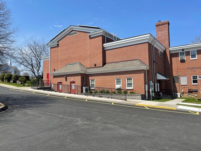

Property Detail
5 Obtuse Hill Rd
BROO-000010F-000000-000013
FAIRFIELD
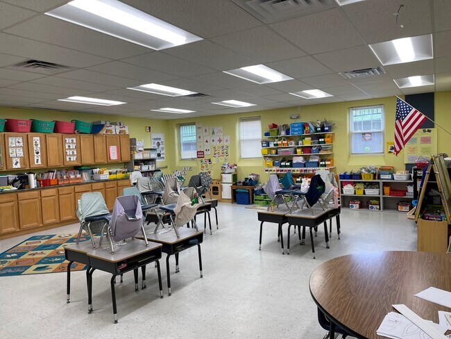
Religious
Connecticut
R-60
13
B and X Area of moderate flood hazard, usually the area between the limits of the 100-year and 500-year floods.
9.29 AC
2025
Brookfield
2025
Westchester/So Connecticut
205200
Bridgeport-Stamford-Danbury, CT
NEARBY LISTINGS FOR SALE OR LEASE
DEMOGRAPHICS near 5 Obtuse Hill Rd
1 mile
3 mile
5 mile
2025 Total Population
2,462
22,603
59,026
2030 Population
2,504
23,354
60,909
Pop Growth 2025-2030
+ 1.71%
+ 3.32%
+ 3.19%
Average Age
44
44
44
2025 Total Households
897
8,723
21,997
HH Growth 2025-2030
+ 1.56%
+ 3.28%
+ 3.19%
Median Household Inc
$149,057
$136,177
$124,971
Avg Household Size
2.70
2.60
2.60
2025 Avg HH Vehicles
2.00
2.00
2.00
Median Home Value
$482,916
$467,633
$457,999
Median Year Built
1971
1978
1975
Nearby Places
Map Layers
Map Styles
 Street
 Aerial
Layers
 Traffic
 Biking
Places
Listings with unknown addresses are not visible on the map
- Restaurants
- Banks
- Shops
- Fitness
- Groceries
PUBLIC TRANSPORTATION
COMMUTER RAIL
Danbury Station (New Haven Line - Metro-North Commuter Railroad Company (Metro-North))
Drive
Walk
Distance
Danbury Station (New Haven Line - Metro-North Commuter Railroad Company (Metro-North))
15 min
6.7 mi
Bethel Station (New Haven Line - Metro-North Commuter Railroad Company (Metro-North))
Drive
Walk
Distance
Bethel Station (New Haven Line - Metro-North Commuter Railroad Company (Metro-North))
19 min
8.0 mi
AIRPORT
Tweed/New Haven
Drive
Walk
Distance
Tweed/New Haven
58 min
36.7 mi
Westchester County
Drive
Walk
Distance
Westchester County
53 min
40.4 mi
SALE & LEASE HISTORY
LISTING DATE
SALE/LEASE

May 17, 2022
For Lease
Nearby Properties
Address
Land Use
TOTAL SIZE
Lot Size
Zoning
Address
Land Use
TOTAL SIZE
Lot Size
Zoning
168,282 SF
22.83 AC
R-60
Address
Land Use
TOTAL SIZE
Lot Size
Zoning
322,970 SF
43.80 AC
IP
Address
Land Use
TOTAL SIZE
Lot Size
Zoning
31.57 AC
C-1
Address
Land Use
TOTAL SIZE
Lot Size
Zoning
79.31 AC
R-80
Address
Land Use
TOTAL SIZE
Lot Size
Zoning
139,231 SF
13.31 AC
CP
Address
Land Use
TOTAL SIZE
Lot Size
Zoning
4.09 AC
C-1
Address
Land Use
TOTAL SIZE
Lot Size
Zoning
9.39 AC
C-2
Address
Land Use
TOTAL SIZE
Lot Size
Zoning
16.31 AC
C-1
Address
Land Use
TOTAL SIZE
Lot Size
Zoning
123,271 SF
16.06 AC
C-1
Address
Land Use
TOTAL SIZE
Lot Size
Zoning
127,863 SF
12.82 AC
R-20
Address
Land Use
TOTAL SIZE
Lot Size
Zoning
45.15 AC
I-1 HO
Address
Land Use
TOTAL SIZE
Lot Size
Zoning
12.42 AC
C-1
Address
Land Use
TOTAL SIZE
Lot Size
Zoning
16.09 AC
R-80
Address
Land Use
TOTAL SIZE
Lot Size
Zoning
6.18 AC
R-60
Address
Land Use
TOTAL SIZE
Lot Size
Zoning
65,027 SF
5.69 AC
C-1
Address
Land Use
TOTAL SIZE
Lot Size
Zoning
2,173 SF
4.76 AC
TCD
Address
Land Use
TOTAL SIZE
Lot Size
Zoning
53,582 SF
7.71 AC
C-2
Address
Land Use
TOTAL SIZE
Lot Size
Zoning
2,295.68 AC
Address
Land Use
TOTAL SIZE
Lot Size
Zoning
6.54 AC
TCD-P
Address
Land Use
TOTAL SIZE
Lot Size
Zoning
151,200 SF
12.48 AC
I-1
Address
Land Use
TOTAL SIZE
Lot Size
Zoning
6.87 AC
C-1
Address
Land Use
TOTAL SIZE
Lot Size
Zoning
110,200 SF
4.96 AC
I-1 HO
Address
Land Use
TOTAL SIZE
Lot Size
Zoning
99,891 SF
7.01 AC
C-1
Address
Land Use
TOTAL SIZE
Lot Size
Zoning
57,782 SF
7.14 AC
R-80
Address
Land Use
TOTAL SIZE
Lot Size
Zoning
54.60 AC
R-80
Address
Land Use
TOTAL SIZE
Lot Size
Zoning
4.65 AC
TCD
Address
Land Use
TOTAL SIZE
Lot Size
Zoning
60,042 SF
7.20 AC
TCD
Address
Land Use
TOTAL SIZE
Lot Size
Zoning
29,862 SF
1.41 AC
TCD
Address
Land Use
TOTAL SIZE
Lot Size
Zoning
58,880 SF
4.08 AC
C-1
The World's #1 Commercial Real Estate Marketplace
Connect with us
© 2026 CoStar Group
The information above has been obtained from sources believed reliable. While we do not doubt its accuracy we have not verified it and make no guarantee, warranty or representation about it. It is your responsibility to independently confirm its accuracy and completeness. Any projections, opinions, assumptions, or estimates used are for example only and do not represent the current or future performance of the property. The value of this transaction to you depends on tax and other factors which should be evaluated by your tax, financial, and legal advisors. You and your advisors should conduct a careful, independent investigation of the property to determine to your satisfaction the suitability of the property for your needs.