Property Record
5 Orchard Dr, Gardiner, NY 12525


NEARBY LISTINGS FOR SALE OR LEASE
Property Detail
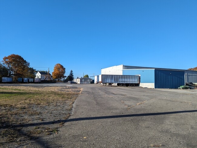
5 Orchard Dr
514200 101.1-6-4.314
Ulster
Warehouse
New York
X
4.314
36111C0765E
6.30 AC
2025
Hudson Valley Area
2024
Other Market Areas
954000
Kingston, NY
15,680 SF
DEMOGRAPHICS near 5 Orchard Dr
1 Mile
3 Mile
5 Mile
2024 Total Population
1,113
7,902
21,212
2029 Population
1,111
7,847
20,988
Pop Growth 2024-2029
(0.18%)
(0.70%)
(1.06%)
Average Age
40
43
42
2024 Total Households
393
2,823
7,704
HH Growth 2024-2029
(0.51%)
(0.96%)
(1.19%)
Median Household Inc
$107,459
$90,709
$96,188
Avg Household Size
2.60
2.50
2.50
2024 Avg HH Vehicles
2.00
2.00
2.00
Median Home Value
$264,934
$294,517
$327,028
Median Year Built
1975
1981
1979
Nearby Places
Map Layers
Map Styles
 Street
 Aerial
- Restaurants
- Banks
- Shops
- Fitness
- Groceries
PUBLIC TRANSPORTATION
AIRPORT
New York Stewart International
DRIVE
WALK
Distance
New York Stewart International
29 min
14.7 mi
Freight Ports
Port Newark Container Terminal
DRIVE
WALK
Distance
Port Newark Container Terminal
107 min
78.2 mi
SALE & LEASE HISTORY
LISTING DATE
SALE/LEASE

Oct 17, 2023
For Lease
Nov 01, 2023
For Lease
Nearby Properties
Address
Land Use
TOTAL SIZE
Lot Size
Zoning
Address
Land Use
TOTAL SIZE
Lot Size
Zoning
1,056 SF
97.30 AC
RR1.5
Address
Land Use
TOTAL SIZE
Lot Size
Zoning
980 SF
94.70 AC
AG1.5
Address
Land Use
TOTAL SIZE
Lot Size
Zoning
34,640 SF
12.40 AC
BD40
Address
Land Use
TOTAL SIZE
Lot Size
Zoning
30,606 SF
62 AC
RR1.5
Address
Land Use
TOTAL SIZE
Lot Size
Zoning
11,182 SF
5.70 AC
HR
Address
Land Use
TOTAL SIZE
Lot Size
Zoning
37,426 SF
5 AC
CLI
Address
Land Use
TOTAL SIZE
Lot Size
Zoning
28,802 SF
108.70 AC
HC
Address
Land Use
TOTAL SIZE
Lot Size
Zoning
5,790 SF
66.60 AC
RR1.5
Address
Land Use
TOTAL SIZE
Lot Size
Zoning
3,360 SF
10.31 AC
BD60
Address
Land Use
TOTAL SIZE
Lot Size
Zoning
23.50 AC
AG1.5
Address
Land Use
TOTAL SIZE
Lot Size
Zoning
780 SF
67.90 AC
BD40
Address
Land Use
TOTAL SIZE
Lot Size
Zoning
2,448 SF
141.50 AC
BD60/AG1.5
Address
Land Use
TOTAL SIZE
Lot Size
Zoning
924 SF
24 AC
RR1.5
Address
Land Use
TOTAL SIZE
Lot Size
Zoning
27,002 SF
2.10 AC
HM
Address
Land Use
TOTAL SIZE
Lot Size
Zoning
4,866 SF
6.90 AC
RA
Address
Land Use
TOTAL SIZE
Lot Size
Zoning
980 SF
11.80 AC
HR-1
Address
Land Use
TOTAL SIZE
Lot Size
Zoning
13,020 SF
1.40 AC
HC
Address
Land Use
TOTAL SIZE
Lot Size
Zoning
4,820 SF
1.96 AC
HM
Address
Land Use
TOTAL SIZE
Lot Size
Zoning
9,100 SF
2.30 AC
BD40
Address
Land Use
TOTAL SIZE
Lot Size
Zoning
7,605 SF
1 AC
AG1.5
Address
Land Use
TOTAL SIZE
Lot Size
Zoning
3,379 SF
194.80 AC
RR1.5
Address
Land Use
TOTAL SIZE
Lot Size
Zoning
8,014 SF
1.12 AC
HM
Address
Land Use
TOTAL SIZE
Lot Size
Zoning
1,950 SF
0.90 AC
BD40
Address
Land Use
TOTAL SIZE
Lot Size
Zoning
5,938 SF
0.30 AC
BD40
Address
Land Use
TOTAL SIZE
Lot Size
Zoning
3,200 SF
10.40 AC
HC
Address
Land Use
TOTAL SIZE
Lot Size
Zoning
9,102 SF
87.50 AC
AG1.5
Address
Land Use
TOTAL SIZE
Lot Size
Zoning
15,000 SF
85 AC
RA
Address
Land Use
TOTAL SIZE
Lot Size
Zoning
9,900 SF
1.30 AC
BD40
Address
Land Use
TOTAL SIZE
Lot Size
Zoning
720 SF
8.10 AC
HR 1
Address
Land Use
TOTAL SIZE
Lot Size
Zoning
3,234 SF
68.80 AC
HC
The World's #1 Commercial Real Estate Marketplace
Connect with us
© 2026 CoStar Group
The information above has been obtained from sources believed reliable. While we do not doubt its accuracy we have not verified it and make no guarantee, warranty or representation about it. It is your responsibility to independently confirm its accuracy and completeness. Any projections, opinions, assumptions, or estimates used are for example only and do not represent the current or future performance of the property. The value of this transaction to you depends on tax and other factors which should be evaluated by your tax, financial, and legal advisors. You and your advisors should conduct a careful, independent investigation of the property to determine to your satisfaction the suitability of the property for your needs.