Property Record
5 Route 45, Salem, NJ 08079
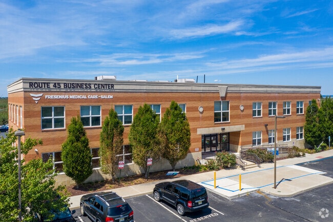

Property Detail
5 Route 45
06-00064-0000-00019
SALEM
Officebuilding
New Jersey
CON
19
AE The base floodplain where base flood elevations are provided. AE Zones are now used on new format FIRMs instead of A1-A30 Zones.
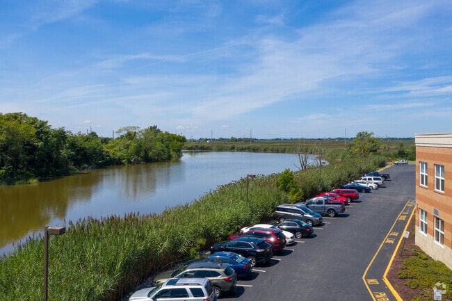
10.33 AC
2024
Salem County
2025
Philadelphia
021300
Philadelphia-Camden-Wilmington, PA-NJ-DE-MD
23,030 SF
NEARBY LISTINGS FOR SALE OR LEASE
DEMOGRAPHICS near 5 Route 45
1 mile
3 mile
5 mile
2024 Total Population
4,861
8,778
12,985
2029 Population
5,098
9,137
13,429
Pop Growth 2024-2029
+ 4.88%
+ 4.09%
+ 3.42%
Average Age
37
38
40
2024 Total Households
1,925
3,516
5,221
HH Growth 2024-2029
+ 4.88%
+ 4.12%
+ 3.43%
Median Household Inc
$46,925
$55,287
$65,568
Avg Household Size
2.50
2.50
2.50
2024 Avg HH Vehicles
1.00
1.00
2.00
Median Home Value
$73,614
$140,235
$212,666
Median Year Built
1948
1952
1957
Nearby Places
Map Layers
Map Styles
 Street
 Aerial
Transit
 Traffic
 Biking
Places
Listings with unknown addresses are not visible on the map
- Restaurants
- Banks
- Shops
- Fitness
- Groceries
PUBLIC TRANSPORTATION
AIRPORT
Philadelphia International
Drive
Walk
Distance
Philadelphia International
49 min
34.6 mi
Freight Ports
Port of Wilmington, RI
Drive
Walk
Distance
Port of Wilmington, RI
26 min
16.3 mi
SALE & LEASE HISTORY
LISTING DATE
SALE/LEASE

Sep 25, 2016
For Lease
Sep 24, 2016
For Sale
Sep 05, 2024
For Sale
Oct 09, 2023
For Lease
May 15, 2018
For Lease
Mar 17, 2017
For Sale
Jun 17, 2019
For Lease
Feb 27, 2017
For Sale
Nearby Properties
Address
Land Use
TOTAL SIZE
Lot Size
Zoning
Address
Land Use
TOTAL SIZE
Lot Size
Zoning
126.30 AC
CN-I
Address
Land Use
TOTAL SIZE
Lot Size
Zoning
22.24 AC
Address
Land Use
TOTAL SIZE
Lot Size
Zoning
19.73 AC
MRLC
Address
Land Use
TOTAL SIZE
Lot Size
Zoning
6,906 SF
0.82 AC
Address
Land Use
TOTAL SIZE
Lot Size
Zoning
16.38 AC
Address
Land Use
TOTAL SIZE
Lot Size
Zoning
6.24 AC
Address
Land Use
TOTAL SIZE
Lot Size
Zoning
6.10 AC
MR
Address
Land Use
TOTAL SIZE
Lot Size
Zoning
6.79 AC
Address
Land Use
TOTAL SIZE
Lot Size
Zoning
0.85 AC
Address
Land Use
TOTAL SIZE
Lot Size
Zoning
14.07 AC
Address
Land Use
TOTAL SIZE
Lot Size
Zoning
8.60 AC
Address
Land Use
TOTAL SIZE
Lot Size
Zoning
2.56 AC
Address
Land Use
TOTAL SIZE
Lot Size
Zoning
2.76 AC
Address
Land Use
TOTAL SIZE
Lot Size
Zoning
3.81 AC
04/0
Address
Land Use
TOTAL SIZE
Lot Size
Zoning
2,507 SF
79.60 AC
04/0
Address
Land Use
TOTAL SIZE
Lot Size
Zoning
75.32 AC
Address
Land Use
TOTAL SIZE
Lot Size
Zoning
Address
Land Use
TOTAL SIZE
Lot Size
Zoning
11.57 AC
A
Address
Land Use
TOTAL SIZE
Lot Size
Zoning
5.14 AC
Address
Land Use
TOTAL SIZE
Lot Size
Zoning
5.14 AC
Address
Land Use
TOTAL SIZE
Lot Size
Zoning
5.23 AC
04/0
Address
Land Use
TOTAL SIZE
Lot Size
Zoning
0.35 AC
Address
Land Use
TOTAL SIZE
Lot Size
Zoning
Address
Land Use
TOTAL SIZE
Lot Size
Zoning
2 AC
CMRA
Address
Land Use
TOTAL SIZE
Lot Size
Zoning
10.31 AC
Address
Land Use
TOTAL SIZE
Lot Size
Zoning
2.02 AC
Address
Land Use
TOTAL SIZE
Lot Size
Zoning
35.15 AC
CN-I
Address
Land Use
TOTAL SIZE
Lot Size
Zoning
3.33 AC
Address
Land Use
TOTAL SIZE
Lot Size
Zoning
9.17 AC
The World's #1 Commercial Real Estate Marketplace
Connect with us
© 2026 CoStar Group
The information above has been obtained from sources believed reliable. While we do not doubt its accuracy we have not verified it and make no guarantee, warranty or representation about it. It is your responsibility to independently confirm its accuracy and completeness. Any projections, opinions, assumptions, or estimates used are for example only and do not represent the current or future performance of the property. The value of this transaction to you depends on tax and other factors which should be evaluated by your tax, financial, and legal advisors. You and your advisors should conduct a careful, independent investigation of the property to determine to your satisfaction the suitability of the property for your needs.