Property Record
5 S Kerr Ave, Wilmington, NC 28403

Property Detail
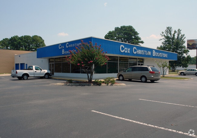
5 S Kerr Ave
R04914-004-002-000
SCATTERGOODS & ADJ RR R/W
Communitycenter
NEW HANOVER
RB,REGIONA
North Carolina
B and X Area of moderate flood hazard, usually the area between the limits of the 100-year and 500-year floods.
2
2025
11.02 AC
2025
Market Street Corridor
010501
Wilmington
14,400 SF
Wilmington, NC
NEARBY LISTINGS FOR SALE OR LEASE
DEMOGRAPHICS near 5 S Kerr Ave
1 mile
3 mile
5 mile
2025 Total Population
12,256
65,115
142,914
2030 Population
12,910
68,464
150,579
Pop Growth 2025-2030
+ 5.34%
+ 5.14%
+ 5.36%
Average Age
32
37
40
2025 Total Households
6,000
28,148
62,429
HH Growth 2025-2030
+ 5.38%
+ 5.40%
+ 5.58%
Median Household Inc
$48,583
$56,946
$70,144
Avg Household Size
2.00
2.10
2.10
2025 Avg HH Vehicles
2.00
2.00
2.00
Median Home Value
$257,142
$342,794
$358,986
Median Year Built
1993
1984
1989
Nearby Places
Map Layers
Map Styles
 Street
 Aerial
Layers
 Traffic
 Biking
Places
Listings with unknown addresses are not visible on the map
- Restaurants
- Banks
- Shops
- Fitness
- Groceries
PUBLIC TRANSPORTATION
AIRPORT
Wilmington International
Drive
Walk
Distance
Wilmington International
16 min
6.7 mi
Freight Ports
Port of Wilmington
Drive
Walk
Distance
Port of Wilmington
15 min
6.7 mi
Nearby Properties
Address
Land Use
TOTAL SIZE
Lot Size
Zoning
Address
Land Use
TOTAL SIZE
Lot Size
Zoning
18,848 SF
649.08 AC
O&I,OFFICE
Address
Land Use
TOTAL SIZE
Lot Size
Zoning
13,398 SF
15.67 AC
O&I,OFFICE
Address
Land Use
TOTAL SIZE
Lot Size
Zoning
35,600 SF
14.86 AC
CB,COMMUNI
Address
Land Use
TOTAL SIZE
Lot Size
Zoning
11,500 SF
1,340.44 AC
AC
Address
Land Use
TOTAL SIZE
Lot Size
Zoning
12,336 SF
67.48 AC
IND
Address
Land Use
TOTAL SIZE
Lot Size
Zoning
35,334 SF
38.86 AC
O&I,OFFICE
Address
Land Use
TOTAL SIZE
Lot Size
Zoning
5,563 SF
13.60 AC
MD-17
Address
Land Use
TOTAL SIZE
Lot Size
Zoning
93,946 SF
AC
Address
Land Use
TOTAL SIZE
Lot Size
Zoning
606,792 SF
44.13 AC
RB,REGIONA
Address
Land Use
TOTAL SIZE
Lot Size
Zoning
191,720 SF
7.82 AC
RB,REGIONA
Address
Land Use
TOTAL SIZE
Lot Size
Zoning
Address
Land Use
TOTAL SIZE
Lot Size
Zoning
308,208 SF
7.80 AC
O&I,OFFICE
Address
Land Use
TOTAL SIZE
Lot Size
Zoning
142,207 SF
9.29 AC
O&I,OFFICE
Address
Land Use
TOTAL SIZE
Lot Size
Zoning
160,284 SF
59.79 AC
O&I,OFFICE
Address
Land Use
TOTAL SIZE
Lot Size
Zoning
413,684 SF
34.95 AC
I-2,INDUST
Address
Land Use
TOTAL SIZE
Lot Size
Zoning
57,077 SF
28.58 AC
O&I,OFFICE
Address
Land Use
TOTAL SIZE
Lot Size
Zoning
150,588 SF
30.57 AC
RB,REGIONA
Address
Land Use
TOTAL SIZE
Lot Size
Zoning
128,015 SF
6.91 AC
RB,REGIONA
Address
Land Use
TOTAL SIZE
Lot Size
Zoning
153,764 SF
22.87 AC
RB,REGIONA
Address
Land Use
TOTAL SIZE
Lot Size
Zoning
6,780 SF
24.11 AC
RB,REGIONA
Address
Land Use
TOTAL SIZE
Lot Size
Zoning
116,691 SF
14.43 AC
RB,REGIONA
Address
Land Use
TOTAL SIZE
Lot Size
Zoning
24,966 SF
5.55 AC
O&I,OFFICE
Address
Land Use
TOTAL SIZE
Lot Size
Zoning
106,320 SF
4.65 AC
O&I,OFFICE
Address
Land Use
TOTAL SIZE
Lot Size
Zoning
290,417 SF
15.78 AC
AI,AIRPORT
Address
Land Use
TOTAL SIZE
Lot Size
Zoning
115,283 SF
4.45 AC
RB,REGIONA
Address
Land Use
TOTAL SIZE
Lot Size
Zoning
70,842 SF
4.91 AC
AI,AIRPORT
Address
Land Use
TOTAL SIZE
Lot Size
Zoning
1,656 SF
74.28 AC
R-15,RESID
Address
Land Use
TOTAL SIZE
Lot Size
Zoning
4,428 SF
4.47 AC
O&I,OFFICE
Address
Land Use
TOTAL SIZE
Lot Size
Zoning
27,108 SF
31.84 AC
AI,AIRPORT
Address
Land Use
TOTAL SIZE
Lot Size
Zoning
212,000 SF
13.18 AC
AI,AIRPORT
The World's #1 Commercial Real Estate Marketplace
Connect with us
© 2026 CoStar Group
The information above has been obtained from sources believed reliable. While we do not doubt its accuracy we have not verified it and make no guarantee, warranty or representation about it. It is your responsibility to independently confirm its accuracy and completeness. Any projections, opinions, assumptions, or estimates used are for example only and do not represent the current or future performance of the property. The value of this transaction to you depends on tax and other factors which should be evaluated by your tax, financial, and legal advisors. You and your advisors should conduct a careful, independent investigation of the property to determine to your satisfaction the suitability of the property for your needs.