Property Record
5 Southwick St, Mendon, MA 01756
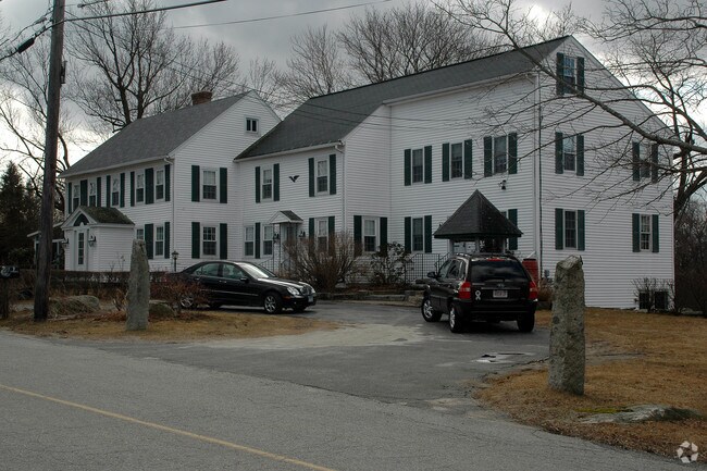

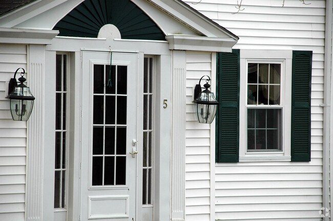
Property Detail
5 Southwick St
MEND-000025-000219-000005
WORCESTER
Timberlandforesttreesagricultural
Massachusetts
RES
56.47 AC
C and X Area of minimal flood hazard, usually depicted on FIRMs as above the 500-year flood level.
Outlying Worcester
2024
Boston
2025
Worcester, MA
746100
NEARBY LISTINGS FOR SALE OR LEASE
-
-
View all Mendon listings for sale on LoopNet.com
DEMOGRAPHICS near 5 Southwick St
1 mile
3 mile
5 mile
2025 Total Population
965
15,205
47,422
2030 Population
996
15,682
48,874
Pop Growth 2025-2030
+ 3.21%
+ 3.14%
+ 3.06%
Average Age
42
42
43
2025 Total Households
344
5,693
18,456
HH Growth 2025-2030
+ 3.49%
+ 3.20%
+ 3.15%
Median Household Inc
$125,980
$125,454
$115,167
Avg Household Size
2.70
2.60
2.50
2025 Avg HH Vehicles
2.00
2.00
2.00
Median Home Value
$494,444
$489,570
$475,836
Median Year Built
1988
1984
1980
Nearby Places
Map Layers
Map Styles
 Street
 Aerial
Layers
 Traffic
 Biking
Places
Listings with unknown addresses are not visible on the map
- Restaurants
- Banks
- Shops
- Fitness
- Groceries
PUBLIC TRANSPORTATION
AIRPORT
Rhode Island Tf Green International
Drive
Walk
Distance
Rhode Island Tf Green International
46 min
29.9 mi
Worcester Regional
Drive
Walk
Distance
Worcester Regional
48 min
32.0 mi
Freight Ports
Port of Davisville, RI
Drive
Walk
Distance
Port of Davisville, RI
59 min
41.8 mi
Nearby Properties
Address
Land Use
TOTAL SIZE
Lot Size
Zoning
Address
Land Use
TOTAL SIZE
Lot Size
Zoning
108.65 AC
RC
Address
Land Use
TOTAL SIZE
Lot Size
Zoning
192,817 SF
36.30 AC
RA
Address
Land Use
TOTAL SIZE
Lot Size
Zoning
48,071 SF
44.42 AC
I
Address
Land Use
TOTAL SIZE
Lot Size
Zoning
28,468 SF
1.24 AC
I
Address
Land Use
TOTAL SIZE
Lot Size
Zoning
25,100 SF
7.40 AC
I
Address
Land Use
TOTAL SIZE
Lot Size
Zoning
25,601 SF
9.26 AC
RB
Address
Land Use
TOTAL SIZE
Lot Size
Zoning
52,041 SF
47.80 AC
VRD
Address
Land Use
TOTAL SIZE
Lot Size
Zoning
28,170 SF
2.02 AC
RC
Address
Land Use
TOTAL SIZE
Lot Size
Zoning
45,960 SF
2.88 AC
RA
Address
Land Use
TOTAL SIZE
Lot Size
Zoning
37,580 SF
14.10 AC
RB
Address
Land Use
TOTAL SIZE
Lot Size
Zoning
34,094 SF
5.22 AC
C/I
Address
Land Use
TOTAL SIZE
Lot Size
Zoning
34,152 SF
4.30 AC
C/I
Address
Land Use
TOTAL SIZE
Lot Size
Zoning
64,110 SF
6 AC
I
Address
Land Use
TOTAL SIZE
Lot Size
Zoning
34,094 SF
4.51 AC
C/I
Address
Land Use
TOTAL SIZE
Lot Size
Zoning
33,552 SF
7.87 AC
I
Address
Land Use
TOTAL SIZE
Lot Size
Zoning
53,875 SF
5.42 AC
C
Address
Land Use
TOTAL SIZE
Lot Size
Zoning
7,176 SF
4.55 AC
I
Address
Land Use
TOTAL SIZE
Lot Size
Zoning
3.19 AC
C/I
Address
Land Use
TOTAL SIZE
Lot Size
Zoning
22,680 SF
29.31 AC
RC
Address
Land Use
TOTAL SIZE
Lot Size
Zoning
13,195 SF
8.80 AC
C/I
Address
Land Use
TOTAL SIZE
Lot Size
Zoning
44,302 SF
7.10 AC
RA
Address
Land Use
TOTAL SIZE
Lot Size
Zoning
17,987 SF
I
Address
Land Use
TOTAL SIZE
Lot Size
Zoning
43,654 SF
5.29 AC
I
Address
Land Use
TOTAL SIZE
Lot Size
Zoning
17,924 SF
5.62 AC
I
Address
Land Use
TOTAL SIZE
Lot Size
Zoning
18,424 SF
4.93 AC
RC
Address
Land Use
TOTAL SIZE
Lot Size
Zoning
2,706 SF
43.74 AC
RC
Address
Land Use
TOTAL SIZE
Lot Size
Zoning
9,404 SF
0.77 AC
B
Address
Land Use
TOTAL SIZE
Lot Size
Zoning
16,507 SF
0.87 AC
B
Address
Land Use
TOTAL SIZE
Lot Size
Zoning
27,673 SF
10.01 AC
B
The World's #1 Commercial Real Estate Marketplace
Connect with us
© 2026 CoStar Group
The information above has been obtained from sources believed reliable. While we do not doubt its accuracy we have not verified it and make no guarantee, warranty or representation about it. It is your responsibility to independently confirm its accuracy and completeness. Any projections, opinions, assumptions, or estimates used are for example only and do not represent the current or future performance of the property. The value of this transaction to you depends on tax and other factors which should be evaluated by your tax, financial, and legal advisors. You and your advisors should conduct a careful, independent investigation of the property to determine to your satisfaction the suitability of the property for your needs.