Property Record
5 Veronica Ave, Somerset, NJ 08873
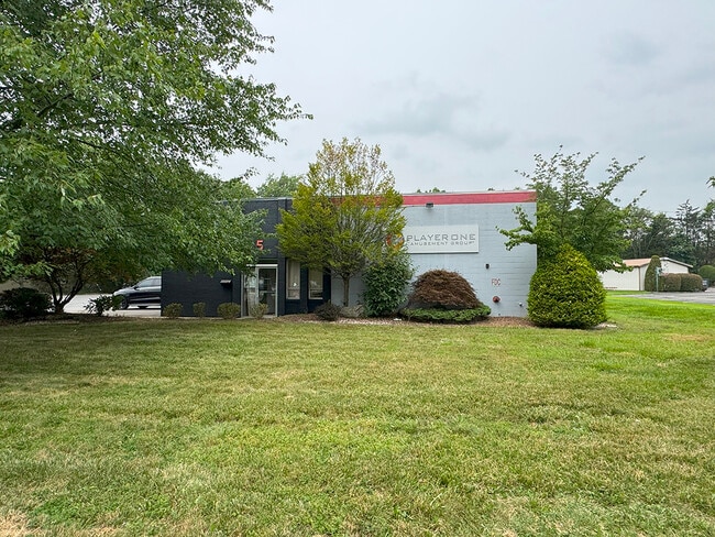
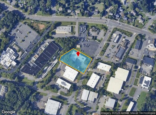
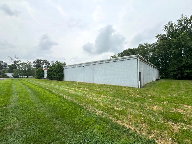
This Property Is For Sale
NEARBY LISTINGS FOR SALE OR LEASE
Property Detail
5 Veronica Ave
08-00089-03-00010-10
Somerset
Industrialgeneral
New Jersey
X
10.10
34035C0260E
1.33 AC
2024
Somerset
2025
Northern New Jersey
053300
Newark, NJ-PA
11,800 SF
DEMOGRAPHICS near 5 Veronica Ave
1 Mile
3 Mile
5 Mile
2024 Total Population
4,686
102,300
230,956
2029 Population
4,678
101,503
230,071
Pop Growth 2024-2029
(0.17%)
(0.78%)
(0.38%)
Average Age
42
38
38
2024 Total Households
1,522
34,173
78,200
HH Growth 2024-2029
(0.26%)
(0.62%)
(0.25%)
Median Household Inc
$115,435
$89,542
$96,028
Avg Household Size
3.00
2.80
2.70
2024 Avg HH Vehicles
2.00
2.00
2.00
Median Home Value
$383,887
$366,946
$396,162
Median Year Built
1967
1977
1979
Nearby Places
- Restaurants
- Banks
- Shops
- Fitness
- Groceries
PUBLIC TRANSPORTATION
COMMUTER RAIL
Jersey Avenue (Northeast Corridor Line - NJ Transit Commuter Rail (NJ Transit))
DRIVE
WALK
Distance
Jersey Avenue (Northeast Corridor Line - NJ Transit Commuter Rail (NJ Transit))
10 min
3.0 mi
New Brunswick (Northeast Corridor Line - NJ Transit Commuter Rail (NJ Transit))
DRIVE
WALK
Distance
New Brunswick (Northeast Corridor Line - NJ Transit Commuter Rail (NJ Transit))
8 min
3.7 mi
AIRPORT
Trenton Mercer
DRIVE
WALK
Distance
Trenton Mercer
42 min
27.4 mi
Newark Liberty International
DRIVE
WALK
Distance
Newark Liberty International
45 min
32.2 mi
Freight Ports
New York Container Terminal
DRIVE
WALK
Distance
New York Container Terminal
39 min
25.0 mi
Nearby Properties
Address
Land Use
TOTAL SIZE
Lot Size
Zoning
Address
Land Use
TOTAL SIZE
Lot Size
Zoning
8.25 AC
D-HI
Address
Land Use
TOTAL SIZE
Lot Size
Zoning
25.77 AC
C-6
Address
Land Use
TOTAL SIZE
Lot Size
Zoning
11.50 AC
HI
Address
Land Use
TOTAL SIZE
Lot Size
Zoning
99.79 AC
B-I
Address
Land Use
TOTAL SIZE
Lot Size
Zoning
78.71 AC
ER
Address
Land Use
TOTAL SIZE
Lot Size
Zoning
48.30 AC
GB
Address
Land Use
TOTAL SIZE
Lot Size
Zoning
16,397 SF
41.98 AC
R20
Address
Land Use
TOTAL SIZE
Lot Size
Zoning
543,945 SF
48.46 AC
B-I
Address
Land Use
TOTAL SIZE
Lot Size
Zoning
18.21 AC
E
Address
Land Use
TOTAL SIZE
Lot Size
Zoning
0.92 AC
D-HI
Address
Land Use
TOTAL SIZE
Lot Size
Zoning
1.81 AC
D-HI
Address
Land Use
TOTAL SIZE
Lot Size
Zoning
11.35 AC
R20
Address
Land Use
TOTAL SIZE
Lot Size
Zoning
111,911 SF
126 AC
E
Address
Land Use
TOTAL SIZE
Lot Size
Zoning
34.75 AC
CR
Address
Land Use
TOTAL SIZE
Lot Size
Zoning
Address
Land Use
TOTAL SIZE
Lot Size
Zoning
1,200 SF
0.01 AC
D-HI
Address
Land Use
TOTAL SIZE
Lot Size
Zoning
27.23 AC
CR
Address
Land Use
TOTAL SIZE
Lot Size
Zoning
Address
Land Use
TOTAL SIZE
Lot Size
Zoning
Address
Land Use
TOTAL SIZE
Lot Size
Zoning
4.89 AC
R-7
Address
Land Use
TOTAL SIZE
Lot Size
Zoning
8,430 SF
10.51 AC
I-2
Address
Land Use
TOTAL SIZE
Lot Size
Zoning
283,080 SF
34.62 AC
CR
Address
Land Use
TOTAL SIZE
Lot Size
Zoning
1.37 AC
HI
Address
Land Use
TOTAL SIZE
Lot Size
Zoning
26,965 SF
2.70 AC
C-3A
Address
Land Use
TOTAL SIZE
Lot Size
Zoning
Address
Land Use
TOTAL SIZE
Lot Size
Zoning
18.50 AC
I-2
Address
Land Use
TOTAL SIZE
Lot Size
Zoning
27.88 AC
C2
Address
Land Use
TOTAL SIZE
Lot Size
Zoning
12,316 SF
17.31 AC
GB
Address
Land Use
TOTAL SIZE
Lot Size
Zoning
298,292 SF
29.58 AC
B-I
Address
Land Use
TOTAL SIZE
Lot Size
Zoning
2.65 AC
R-6
The World's #1 Commercial Real Estate Marketplace
Connect with us
© 2025 CoStar Group
The information above has been obtained from sources believed reliable. While we do not doubt its accuracy we have not verified it and make no guarantee, warranty or representation about it. It is your responsibility to independently confirm its accuracy and completeness. Any projections, opinions, assumptions, or estimates used are for example only and do not represent the current or future performance of the property. The value of this transaction to you depends on tax and other factors which should be evaluated by your tax, financial, and legal advisors. You and your advisors should conduct a careful, independent investigation of the property to determine to your satisfaction the suitability of the property for your needs.