Property Record
5 Washington St, Boxford, MA 01921
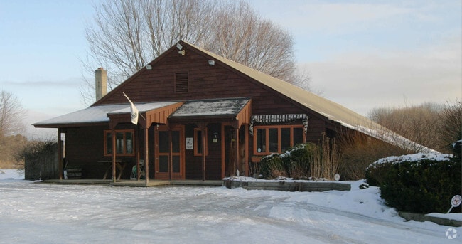


Property Detail
5 Washington St
BOXF-000006-000001-000001
Essex
Commercialofficeresidentialmixeduse
Massachusetts
A Areas with a 1% annual chance of flooding and a 26% chance of flooding over the life of a 30-year mortgage.
1
2025
6.60 AC
2025
Lawrence/Andover
213100
Boston
3,110 SF
Boston-Cambridge-Newton, MA-NH
NEARBY LISTINGS FOR SALE OR LEASE
-
-
View all Boxford listings for sale on LoopNet.com
DEMOGRAPHICS near 5 Washington St
1 mile
3 mile
5 mile
2025 Total Population
707
39,161
206,600
2030 Population
728
40,286
209,266
Pop Growth 2025-2030
+ 2.97%
+ 2.87%
+ 1.29%
Average Age
47
41
39
2025 Total Households
268
14,423
74,044
HH Growth 2025-2030
+ 2.61%
+ 2.95%
+ 1.46%
Median Household Inc
$157,500
$113,795
$80,222
Avg Household Size
2.50
2.60
2.70
2025 Avg HH Vehicles
2.00
2.00
2.00
Median Home Value
$859,503
$607,901
$530,078
Median Year Built
1982
1974
1960
Nearby Places
Map Layers
Map Styles
 Street
 Aerial
Layers
 Traffic
 Biking
Places
Listings with unknown addresses are not visible on the map
- Restaurants
- Banks
- Shops
- Fitness
- Groceries
PUBLIC TRANSPORTATION
COMMUTER RAIL
Bradford (Haverhill Line - Massachusetts Bay Transportation Authority Commuter Rail (Purple Line))
Drive
Walk
Distance
Bradford (Haverhill Line - Massachusetts Bay Transportation Authority Commuter Rail (Purple Line))
10 min
4.6 mi
Haverhill (Haverhill Line - Massachusetts Bay Transportation Authority Commuter Rail (Purple Line))
Drive
Walk
Distance
Haverhill (Haverhill Line - Massachusetts Bay Transportation Authority Commuter Rail (Purple Line))
10 min
4.7 mi
AIRPORT
Portsmouth International at Pease
Drive
Walk
Distance
Portsmouth International at Pease
49 min
31.5 mi
General Edward Lawrence Logan International
Drive
Walk
Distance
General Edward Lawrence Logan International
52 min
31.6 mi
Manchester Boston Regional
Drive
Walk
Distance
Manchester Boston Regional
56 min
35.5 mi
Freight Ports
Port of Boston
Drive
Walk
Distance
Port of Boston
54 min
33.4 mi
Nearby Properties
Address
Land Use
TOTAL SIZE
Lot Size
Zoning
Address
Land Use
TOTAL SIZE
Lot Size
Zoning
9,966 SF
67.03 AC
R2
Address
Land Use
TOTAL SIZE
Lot Size
Zoning
30.72 AC
Address
Land Use
TOTAL SIZE
Lot Size
Zoning
187,600 SF
19.31 AC
Address
Land Use
TOTAL SIZE
Lot Size
Zoning
53.50 AC
C
Address
Land Use
TOTAL SIZE
Lot Size
Zoning
92,931 SF
24.53 AC
RB
Address
Land Use
TOTAL SIZE
Lot Size
Zoning
159,058 SF
7.46 AC
Address
Land Use
TOTAL SIZE
Lot Size
Zoning
4,818 SF
12.90 AC
Address
Land Use
TOTAL SIZE
Lot Size
Zoning
76,842 SF
12.38 AC
Address
Land Use
TOTAL SIZE
Lot Size
Zoning
53,620 SF
14.40 AC
RB
Address
Land Use
TOTAL SIZE
Lot Size
Zoning
6.94 AC
Address
Land Use
TOTAL SIZE
Lot Size
Zoning
8,649 SF
47 AC
Address
Land Use
TOTAL SIZE
Lot Size
Zoning
64,898 SF
1.48 AC
Address
Land Use
TOTAL SIZE
Lot Size
Zoning
57,064 SF
14.90 AC
Address
Land Use
TOTAL SIZE
Lot Size
Zoning
8.23 AC
Address
Land Use
TOTAL SIZE
Lot Size
Zoning
3.16 AC
Address
Land Use
TOTAL SIZE
Lot Size
Zoning
118.81 AC
Address
Land Use
TOTAL SIZE
Lot Size
Zoning
13 AC
RB
Address
Land Use
TOTAL SIZE
Lot Size
Zoning
21,245 SF
1.81 AC
Address
Land Use
TOTAL SIZE
Lot Size
Zoning
55.15 AC
Address
Land Use
TOTAL SIZE
Lot Size
Zoning
25,371 SF
3.54 AC
Address
Land Use
TOTAL SIZE
Lot Size
Zoning
7,921 SF
36.20 AC
R1
Address
Land Use
TOTAL SIZE
Lot Size
Zoning
476.30 AC
RA
Address
Land Use
TOTAL SIZE
Lot Size
Zoning
2.16 AC
Address
Land Use
TOTAL SIZE
Lot Size
Zoning
43,384 SF
3.67 AC
Address
Land Use
TOTAL SIZE
Lot Size
Zoning
93,248 SF
10.37 AC
Address
Land Use
TOTAL SIZE
Lot Size
Zoning
2.80 AC
RB
Address
Land Use
TOTAL SIZE
Lot Size
Zoning
37,615 SF
5.03 AC
Address
Land Use
TOTAL SIZE
Lot Size
Zoning
17,540 SF
7.21 AC
Address
Land Use
TOTAL SIZE
Lot Size
Zoning
1,904 SF
48 AC
Address
Land Use
TOTAL SIZE
Lot Size
Zoning
18,551 SF
0.52 AC
The World's #1 Commercial Real Estate Marketplace
Connect with us
© 2026 CoStar Group
The information above has been obtained from sources believed reliable. While we do not doubt its accuracy we have not verified it and make no guarantee, warranty or representation about it. It is your responsibility to independently confirm its accuracy and completeness. Any projections, opinions, assumptions, or estimates used are for example only and do not represent the current or future performance of the property. The value of this transaction to you depends on tax and other factors which should be evaluated by your tax, financial, and legal advisors. You and your advisors should conduct a careful, independent investigation of the property to determine to your satisfaction the suitability of the property for your needs.