Property Record
50 Altair Ave, Plymouth, CT 06782


NEARBY LISTINGS FOR SALE OR LEASE
Property Detail
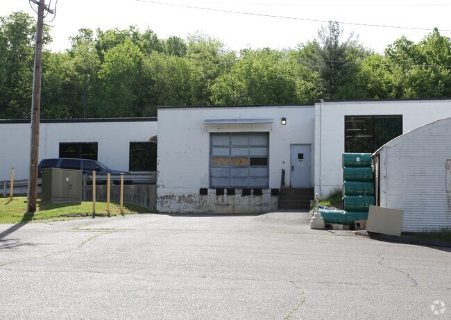
50 Altair Ave
Torrington, CT
Litchfield
PLYM-000025-000041-000013
Connecticut
Industrialgeneral
13
2025
8.80 AC
2025
SE Litchfield County
425300
Hartford
24,186 SF
DEMOGRAPHICS near 50 Altair Ave
1 Mile
3 Mile
5 Mile
2024 Total Population
2,123
15,805
29,023
2029 Population
2,111
15,708
28,926
Pop Growth 2024-2029
(0.57%)
(0.61%)
(0.33%)
Average Age
43
44
43
2024 Total Households
893
6,629
11,880
HH Growth 2024-2029
(0.45%)
(0.62%)
(0.36%)
Median Household Inc
$72,739
$85,222
$89,005
Avg Household Size
2.30
2.30
2.40
2024 Avg HH Vehicles
2.00
2.00
2.00
Median Home Value
$257,283
$256,973
$269,614
Median Year Built
1955
1967
1974
Nearby Places
Map Layers
Map Styles
 Street
 Aerial
- Restaurants
- Banks
- Shops
- Fitness
- Groceries
PUBLIC TRANSPORTATION
AIRPORT
Bradley International
DRIVE
WALK
Distance
Bradley International
67 min
37.3 mi
Tweed/New Haven
DRIVE
WALK
Distance
Tweed/New Haven
60 min
38.2 mi
SALE & LEASE HISTORY
LISTING DATE
SALE/LEASE

Sep 25, 2016
For Lease
Nearby Properties
Address
Land Use
TOTAL SIZE
Lot Size
Zoning
Address
Land Use
TOTAL SIZE
Lot Size
Zoning
65,974 SF
20.70 AC
RA15
Address
Land Use
TOTAL SIZE
Lot Size
Zoning
15 AC
M1
Address
Land Use
TOTAL SIZE
Lot Size
Zoning
3.35 AC
RA2
Address
Land Use
TOTAL SIZE
Lot Size
Zoning
34.36 AC
RA2
Address
Land Use
TOTAL SIZE
Lot Size
Zoning
10 AC
RA1
Address
Land Use
TOTAL SIZE
Lot Size
Zoning
2.77 AC
C
Address
Land Use
TOTAL SIZE
Lot Size
Zoning
18,252 SF
1.56 AC
GC
Address
Land Use
TOTAL SIZE
Lot Size
Zoning
3.99 AC
RA1
Address
Land Use
TOTAL SIZE
Lot Size
Zoning
22,938 SF
1.92 AC
M
Address
Land Use
TOTAL SIZE
Lot Size
Zoning
17,085 SF
3.77 AC
RR
Address
Land Use
TOTAL SIZE
Lot Size
Zoning
12.44 AC
M2
Address
Land Use
TOTAL SIZE
Lot Size
Zoning
4.30 AC
RA2
Address
Land Use
TOTAL SIZE
Lot Size
Zoning
49,954 SF
3.90 AC
M1
Address
Land Use
TOTAL SIZE
Lot Size
Zoning
94,414 SF
6.50 AC
M
Address
Land Use
TOTAL SIZE
Lot Size
Zoning
4.08 AC
RA15
Address
Land Use
TOTAL SIZE
Lot Size
Zoning
11.25 AC
RA2
Address
Land Use
TOTAL SIZE
Lot Size
Zoning
16,867 SF
7.94 AC
RA15GC
Address
Land Use
TOTAL SIZE
Lot Size
Zoning
11,920 SF
4.20 AC
RA15
Address
Land Use
TOTAL SIZE
Lot Size
Zoning
37.72 AC
RA80A
Address
Land Use
TOTAL SIZE
Lot Size
Zoning
49,690 SF
3.59 AC
M
Address
Land Use
TOTAL SIZE
Lot Size
Zoning
129,174 SF
11.92 AC
GC
Address
Land Use
TOTAL SIZE
Lot Size
Zoning
9,594 SF
1.87 AC
GC
Address
Land Use
TOTAL SIZE
Lot Size
Zoning
2.10 AC
C
Address
Land Use
TOTAL SIZE
Lot Size
Zoning
6.10 AC
M
Address
Land Use
TOTAL SIZE
Lot Size
Zoning
2.30 AC
GC
Address
Land Use
TOTAL SIZE
Lot Size
Zoning
130,374 SF
10.50 AC
M2
Address
Land Use
TOTAL SIZE
Lot Size
Zoning
6.55 AC
M1
Address
Land Use
TOTAL SIZE
Lot Size
Zoning
11,067 SF
1.69 AC
M1
Address
Land Use
TOTAL SIZE
Lot Size
Zoning
14.26 AC
RA2
Address
Land Use
TOTAL SIZE
Lot Size
Zoning
7.47 AC
M2
The World's #1 Commercial Real Estate Marketplace
Connect with us
© 2026 CoStar Group
The information above has been obtained from sources believed reliable. While we do not doubt its accuracy we have not verified it and make no guarantee, warranty or representation about it. It is your responsibility to independently confirm its accuracy and completeness. Any projections, opinions, assumptions, or estimates used are for example only and do not represent the current or future performance of the property. The value of this transaction to you depends on tax and other factors which should be evaluated by your tax, financial, and legal advisors. You and your advisors should conduct a careful, independent investigation of the property to determine to your satisfaction the suitability of the property for your needs.