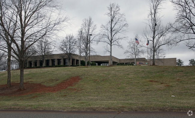
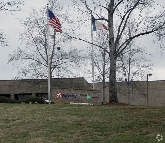
Property Record
50 Beechtree Blvd, Greenville, SC 29605

Save to a Folder
{{folder.Name}}
{{folder.ListingIds.length}} Properties
{{folder.ListingIds.length}} Property
Create a New Folder
Property Detail
50 Beechtree Blvd
Greenville-Anderson-Greer, SC
MAP 0406.00
0406.00-01-004.07
Greenville
Lightindustrial
South Carolina
I1
004.07
B and X Area of moderate flood hazard, usually the area between the limits of the 100-year and 500-year floods.
33.60 AC
2025
I-85 South/Donaldson
2025
Greenville/Spartanburg
002003
NEARBY LISTINGS FOR SALE OR LEASE
DEMOGRAPHICS near 50 Beechtree Blvd
1 mile
3 mile
5 mile
2025 Total Population
2,358
23,631
77,278
2030 Population
2,587
25,669
83,822
Pop Growth 2025-2030
+ 9.71%
+ 8.62%
+ 8.47%
Average Age
35
38
39
2025 Total Households
793
9,039
30,536
HH Growth 2025-2030
+ 9.96%
+ 8.74%
+ 8.60%
Median Household Inc
$42,702
$51,930
$64,042
Avg Household Size
2.80
2.50
2.50
2025 Avg HH Vehicles
2.00
2.00
2.00
Median Home Value
$82,752
$175,307
$275,455
Median Year Built
1987
1979
1985
Nearby Places
Map Layers
Map Styles
 Street
 Aerial
Layers
 Traffic
 Biking
Places
Listings with unknown addresses are not visible on the map
- Restaurants
- Banks
- Shops
- Fitness
- Groceries
PUBLIC TRANSPORTATION
COMMUTER RAIL
Greenville Amtrak Station (Crescent - Amtrak)
Drive
Walk
Distance
Greenville Amtrak Station (Crescent - Amtrak)
21 min
9.9 mi
AIRPORT
Greenville Spartanburg International
Drive
Walk
Distance
Greenville Spartanburg International
28 min
16.3 mi
Freight Ports
North Charleston Terminal
Drive
Walk
Distance
North Charleston Terminal
228 min
201.4 mi
SALE & LEASE HISTORY
LISTING DATE
SALE/LEASE

Jul 07, 2017
For Sale
Nearby Properties
Address
Land Use
TOTAL SIZE
Lot Size
Zoning
Address
Land Use
TOTAL SIZE
Lot Size
Zoning
78.04 AC
C2
Address
Land Use
TOTAL SIZE
Lot Size
Zoning
56.28 AC
Address
Land Use
TOTAL SIZE
Lot Size
Zoning
969.66 AC
I1
Address
Land Use
TOTAL SIZE
Lot Size
Zoning
32.34 AC
Address
Land Use
TOTAL SIZE
Lot Size
Zoning
58.95 AC
Address
Land Use
TOTAL SIZE
Lot Size
Zoning
29.91 AC
Address
Land Use
TOTAL SIZE
Lot Size
Zoning
13.90 AC
I1
Address
Land Use
TOTAL SIZE
Lot Size
Zoning
46.07 AC
I2
Address
Land Use
TOTAL SIZE
Lot Size
Zoning
12.87 AC
I2
Address
Land Use
TOTAL SIZE
Lot Size
Zoning
14.13 AC
Address
Land Use
TOTAL SIZE
Lot Size
Zoning
31.52 AC
I2
Address
Land Use
TOTAL SIZE
Lot Size
Zoning
387.84 AC
S1
Address
Land Use
TOTAL SIZE
Lot Size
Zoning
8.97 AC
Address
Land Use
TOTAL SIZE
Lot Size
Zoning
243.47 AC
R10
Address
Land Use
TOTAL SIZE
Lot Size
Zoning
45.10 AC
I1
Address
Land Use
TOTAL SIZE
Lot Size
Zoning
41.48 AC
I2
Address
Land Use
TOTAL SIZE
Lot Size
Zoning
152.21 AC
I1
Address
Land Use
TOTAL SIZE
Lot Size
Zoning
21.33 AC
Address
Land Use
TOTAL SIZE
Lot Size
Zoning
28.29 AC
I2
Address
Land Use
TOTAL SIZE
Lot Size
Zoning
112.08 AC
S1
Address
Land Use
TOTAL SIZE
Lot Size
Zoning
12.41 AC
RS
Address
Land Use
TOTAL SIZE
Lot Size
Zoning
142.22 AC
Address
Land Use
TOTAL SIZE
Lot Size
Zoning
Address
Land Use
TOTAL SIZE
Lot Size
Zoning
12.80 AC
S1
Address
Land Use
TOTAL SIZE
Lot Size
Zoning
16.09 AC
S1
Address
Land Use
TOTAL SIZE
Lot Size
Zoning
8 AC
I1
Address
Land Use
TOTAL SIZE
Lot Size
Zoning
13.03 AC
S1
Address
Land Use
TOTAL SIZE
Lot Size
Zoning
6.30 AC
S1
Address
Land Use
TOTAL SIZE
Lot Size
Zoning
50 AC
I2
The World's #1 Commercial Real Estate Marketplace
Connect with us
© 2026 CoStar Group
The information above has been obtained from sources believed reliable. While we do not doubt its accuracy we have not verified it and make no guarantee, warranty or representation about it. It is your responsibility to independently confirm its accuracy and completeness. Any projections, opinions, assumptions, or estimates used are for example only and do not represent the current or future performance of the property. The value of this transaction to you depends on tax and other factors which should be evaluated by your tax, financial, and legal advisors. You and your advisors should conduct a careful, independent investigation of the property to determine to your satisfaction the suitability of the property for your needs.