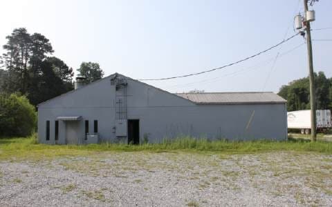
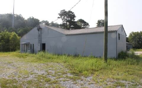
Property Record
50 Candler Rd, Ellijay, GA 30540
NEARBY LISTINGS FOR SALE OR LEASE
Property Detail
50 Candler Rd
3067-095A
Commercial Hwy 5 Acre
Commercialnec
Gilmer
A
Georgia
13123C0165D
1.27 AC
2024
Georgia Northwest
2025
Other Market Areas
080301
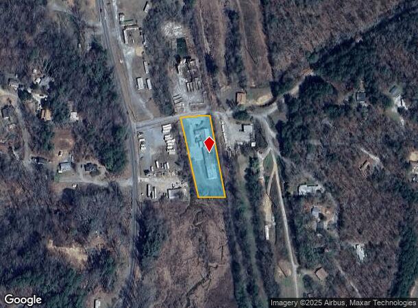
DEMOGRAPHICS near 50 Candler Rd
1 Mile
3 Mile
5 Mile
2024 Total Population
949
9,308
17,983
2029 Population
1,040
10,141
19,424
Pop Growth 2024-2029
+ 9.59%
+ 8.95%
+ 8.01%
Average Age
43
44
44
2024 Total Households
356
3,636
7,069
HH Growth 2024-2029
+ 9.27%
+ 8.86%
+ 7.91%
Median Household Inc
$77,434
$71,757
$65,725
Avg Household Size
2.60
2.50
2.50
2024 Avg HH Vehicles
2.00
2.00
2.00
Median Home Value
$234,765
$231,944
$241,362
Median Year Built
1996
1997
1996
Nearby Places
Map Layers
Map Styles
 Street
 Aerial
- Restaurants
- Banks
- Shops
- Fitness
- Groceries
Nearby Properties
Address
Land Use
TOTAL SIZE
Lot Size
Zoning
Address
Land Use
TOTAL SIZE
Lot Size
Zoning
Address
Land Use
TOTAL SIZE
Lot Size
Zoning
Address
Land Use
TOTAL SIZE
Lot Size
Zoning
81,340 SF
1.60 AC
R1
Address
Land Use
TOTAL SIZE
Lot Size
Zoning
22,257 SF
34.27 AC
GC
Address
Land Use
TOTAL SIZE
Lot Size
Zoning
Address
Land Use
TOTAL SIZE
Lot Size
Zoning
Address
Land Use
TOTAL SIZE
Lot Size
Zoning
78,478 SF
30 AC
GC
Address
Land Use
TOTAL SIZE
Lot Size
Zoning
182,628 SF
21.34 AC
C2
Address
Land Use
TOTAL SIZE
Lot Size
Zoning
77,632 SF
54.94 AC
R1
Address
Land Use
TOTAL SIZE
Lot Size
Zoning
106,978 SF
11.77 AC
I2
Address
Land Use
TOTAL SIZE
Lot Size
Zoning
Address
Land Use
TOTAL SIZE
Lot Size
Zoning
Address
Land Use
TOTAL SIZE
Lot Size
Zoning
2,143.41 AC
TE
Address
Land Use
TOTAL SIZE
Lot Size
Zoning
112,824 SF
15.06 AC
C2
Address
Land Use
TOTAL SIZE
Lot Size
Zoning
155,575 SF
16.60 AC
I2
Address
Land Use
TOTAL SIZE
Lot Size
Zoning
62,687 SF
8.45 AC
C2
Address
Land Use
TOTAL SIZE
Lot Size
Zoning
55,992 SF
5.50 AC
C2
Address
Land Use
TOTAL SIZE
Lot Size
Zoning
35,298 SF
6.56 AC
C2
Address
Land Use
TOTAL SIZE
Lot Size
Zoning
60,101 SF
3.35 AC
C2
Address
Land Use
TOTAL SIZE
Lot Size
Zoning
3,600 SF
7.53 AC
GC
Address
Land Use
TOTAL SIZE
Lot Size
Zoning
30,276 SF
6.66 AC
GC
Address
Land Use
TOTAL SIZE
Lot Size
Zoning
160,379 SF
9.44 AC
GC
Address
Land Use
TOTAL SIZE
Lot Size
Zoning
62,102 SF
6.73 AC
C2
Address
Land Use
TOTAL SIZE
Lot Size
Zoning
20,446 SF
1.54 AC
C1
Address
Land Use
TOTAL SIZE
Lot Size
Zoning
30,086 SF
0.73 AC
CBD
Address
Land Use
TOTAL SIZE
Lot Size
Zoning
18,276 SF
29.10 AC
R1
Address
Land Use
TOTAL SIZE
Lot Size
Zoning
186,280 SF
10.49 AC
I2
Address
Land Use
TOTAL SIZE
Lot Size
Zoning
36,276 SF
3 AC
C2
Address
Land Use
TOTAL SIZE
Lot Size
Zoning
4,814 SF
26.91 AC
C2
Address
Land Use
TOTAL SIZE
Lot Size
Zoning
12,480 SF
2.87 AC
C2
The World's #1 Commercial Real Estate Marketplace
Connect with us
© 2025 CoStar Group
The information above has been obtained from sources believed reliable. While we do not doubt its accuracy we have not verified it and make no guarantee, warranty or representation about it. It is your responsibility to independently confirm its accuracy and completeness. Any projections, opinions, assumptions, or estimates used are for example only and do not represent the current or future performance of the property. The value of this transaction to you depends on tax and other factors which should be evaluated by your tax, financial, and legal advisors. You and your advisors should conduct a careful, independent investigation of the property to determine to your satisfaction the suitability of the property for your needs.