Property Record
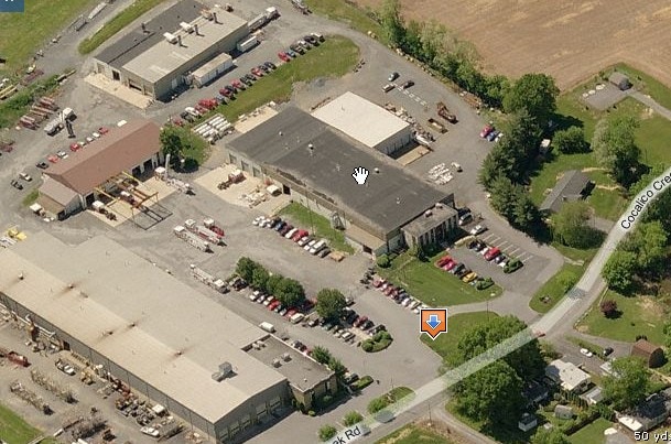
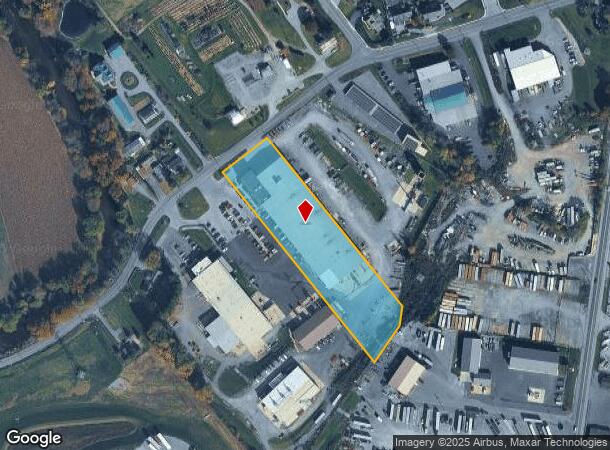
50 Cocalico Creek Rd, Stevens, PA 17578
NEARBY LISTINGS FOR SALE OR LEASE
Property Detail
50 Cocalico Creek Rd
Lancaster, PA
Prepared Mn Zimmerman Co
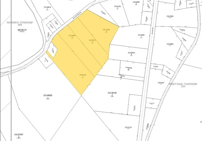
210-05312-0-0000
50 COCALICO CREEK RD
Lightindustrial
Lancaster
AE
Pennsylvania
42071C0189F
2
2024
2.80 AC
2025
Lancaster County
012502
Philadelphia
59,936 SF
DEMOGRAPHICS near 50 Cocalico Creek Rd
1 Mile
3 Mile
5 Mile
2024 Total Population
2,748
23,575
73,587
2029 Population
2,768
23,688
73,960
Pop Growth 2024-2029
+ 0.73%
+ 0.48%
+ 0.51%
Average Age
40
41
41
2024 Total Households
1,022
9,145
27,997
HH Growth 2024-2029
+ 0.88%
+ 0.57%
+ 0.53%
Median Household Inc
$76,727
$73,134
$76,162
Avg Household Size
2.70
2.50
2.50
2024 Avg HH Vehicles
2.00
2.00
2.00
Median Home Value
$210,383
$230,697
$255,930
Median Year Built
1987
1981
1980
Nearby Places
Map Layers
Map Styles
 Street
 Aerial
- Restaurants
- Banks
- Shops
- Fitness
- Groceries
PUBLIC TRANSPORTATION
COMMUTER RAIL
DRIVE
WALK
Distance
16 min
9.7 mi
AIRPORT
Harrisburg International
DRIVE
WALK
Distance
Harrisburg International
50 min
39.0 mi
Freight Ports
Port of Wilmington, RI
DRIVE
WALK
Distance
Port of Wilmington, RI
95 min
53.8 mi
Nearby Properties
Address
Land Use
TOTAL SIZE
Lot Size
Zoning
Address
Land Use
TOTAL SIZE
Lot Size
Zoning
229,049 SF
26.80 AC
RLD
Address
Land Use
TOTAL SIZE
Lot Size
Zoning
166,771 SF
10.76 AC
Address
Land Use
TOTAL SIZE
Lot Size
Zoning
90,600 SF
6.98 AC
Address
Land Use
TOTAL SIZE
Lot Size
Zoning
135,900 SF
11.79 AC
Address
Land Use
TOTAL SIZE
Lot Size
Zoning
103,448 SF
79.90 AC
A
Address
Land Use
TOTAL SIZE
Lot Size
Zoning
122,512 SF
22.36 AC
I
Address
Land Use
TOTAL SIZE
Lot Size
Zoning
88,413 SF
5.30 AC
RMD
Address
Land Use
TOTAL SIZE
Lot Size
Zoning
123,018 SF
14.30 AC
HC
Address
Land Use
TOTAL SIZE
Lot Size
Zoning
75,760 SF
4.85 AC
RMD
Address
Land Use
TOTAL SIZE
Lot Size
Zoning
73,648 SF
10.20 AC
R-1
Address
Land Use
TOTAL SIZE
Lot Size
Zoning
92,217 SF
11.50 AC
C
Address
Land Use
TOTAL SIZE
Lot Size
Zoning
59,996 SF
6 AC
Address
Land Use
TOTAL SIZE
Lot Size
Zoning
51,954 SF
11.80 AC
R-1
Address
Land Use
TOTAL SIZE
Lot Size
Zoning
81,044 SF
4.67 AC
Address
Land Use
TOTAL SIZE
Lot Size
Zoning
104,828 SF
5.94 AC
I
Address
Land Use
TOTAL SIZE
Lot Size
Zoning
64,500 SF
19.60 AC
RLD
Address
Land Use
TOTAL SIZE
Lot Size
Zoning
220,374 SF
20.62 AC
I
Address
Land Use
TOTAL SIZE
Lot Size
Zoning
16,054 SF
4.50 AC
HC
Address
Land Use
TOTAL SIZE
Lot Size
Zoning
14.50 AC
I
Address
Land Use
TOTAL SIZE
Lot Size
Zoning
51,064 SF
1.28 AC
Address
Land Use
TOTAL SIZE
Lot Size
Zoning
20,116 SF
3.50 AC
HC
Address
Land Use
TOTAL SIZE
Lot Size
Zoning
17,176 SF
3.95 AC
CC
Address
Land Use
TOTAL SIZE
Lot Size
Zoning
34,394 SF
1.82 AC
Address
Land Use
TOTAL SIZE
Lot Size
Zoning
44,625 SF
9.61 AC
C-2
Address
Land Use
TOTAL SIZE
Lot Size
Zoning
46,339 SF
39 AC
RMD
Address
Land Use
TOTAL SIZE
Lot Size
Zoning
43,155 SF
2 AC
C-1
Address
Land Use
TOTAL SIZE
Lot Size
Zoning
36,121 SF
2.60 AC
Address
Land Use
TOTAL SIZE
Lot Size
Zoning
16,710 SF
1.57 AC
C-2
Address
Land Use
TOTAL SIZE
Lot Size
Zoning
22,230 SF
7.80 AC
Address
Land Use
TOTAL SIZE
Lot Size
Zoning
34,680 SF
2.10 AC
RHD
The World's #1 Commercial Real Estate Marketplace
Connect with us
© 2025 CoStar Group
The information above has been obtained from sources believed reliable. While we do not doubt its accuracy we have not verified it and make no guarantee, warranty or representation about it. It is your responsibility to independently confirm its accuracy and completeness. Any projections, opinions, assumptions, or estimates used are for example only and do not represent the current or future performance of the property. The value of this transaction to you depends on tax and other factors which should be evaluated by your tax, financial, and legal advisors. You and your advisors should conduct a careful, independent investigation of the property to determine to your satisfaction the suitability of the property for your needs.