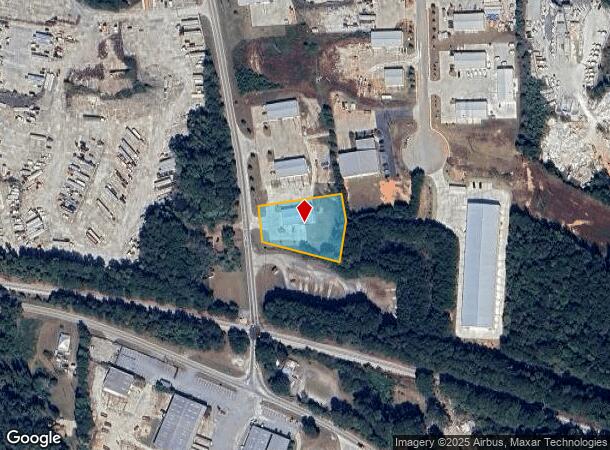
Property Record
50 Cook Rd, Covington, GA 30014

NEARBY LISTINGS FOR SALE OR LEASE
Property Detail
50 Cook Rd
Atlanta-Sandy Springs-Roswell, GA
Moore Street Industrial Parcels
C042000000034D00
LT2A EAST METRO INDUSTRIA
Warehouse
Newton
X
Georgia
13217C0107D
2a
2025
1.07 AC
2025
Rockdale/Newton Cnty
100400
Atlanta
5,000 SF
DEMOGRAPHICS near 50 Cook Rd
1 Mile
3 Mile
5 Mile
2024 Total Population
3,247
25,556
68,752
2029 Population
3,546
28,496
76,045
Pop Growth 2024-2029
+ 9.21%
+ 11.50%
+ 10.61%
Average Age
36
38
38
2024 Total Households
1,171
9,358
24,582
HH Growth 2024-2029
+ 9.22%
+ 11.84%
+ 10.95%
Median Household Inc
$57,179
$70,637
$72,487
Avg Household Size
2.40
2.60
2.70
2024 Avg HH Vehicles
2.00
2.00
2.00
Median Home Value
$97,806
$173,387
$186,199
Median Year Built
1984
1991
1997
Nearby Places
Map Layers
Map Styles
 Street
 Aerial
- Restaurants
- Banks
- Shops
- Fitness
- Groceries
PUBLIC TRANSPORTATION
AIRPORT
Hartsfield - Jackson Atlanta International
DRIVE
WALK
Distance
Hartsfield - Jackson Atlanta International
50 min
36.6 mi
SALE & LEASE HISTORY
LISTING DATE
SALE/LEASE

Mar 24, 2023
For Lease
Nearby Properties
Address
Land Use
TOTAL SIZE
Lot Size
Zoning
Address
Land Use
TOTAL SIZE
Lot Size
Zoning
8,358 SF
24.01 AC
Address
Land Use
TOTAL SIZE
Lot Size
Zoning
4,734 SF
35.19 AC
RMF
Address
Land Use
TOTAL SIZE
Lot Size
Zoning
207,237 SF
10.61 AC
E1
Address
Land Use
TOTAL SIZE
Lot Size
Zoning
306,886 SF
118.50 AC
R2
Address
Land Use
TOTAL SIZE
Lot Size
Zoning
391,932 SF
73.70 AC
R1
Address
Land Use
TOTAL SIZE
Lot Size
Zoning
14,624 SF
26.09 AC
C1
Address
Land Use
TOTAL SIZE
Lot Size
Zoning
7,130 SF
36.78 AC
A1
Address
Land Use
TOTAL SIZE
Lot Size
Zoning
45,900 AC
Address
Land Use
TOTAL SIZE
Lot Size
Zoning
88,944 SF
0.98 AC
E1
Address
Land Use
TOTAL SIZE
Lot Size
Zoning
92,162 SF
11.21 AC
R2
Address
Land Use
TOTAL SIZE
Lot Size
Zoning
5,160 SF
45.17 AC
C1
Address
Land Use
TOTAL SIZE
Lot Size
Zoning
262,782 SF
20.94 AC
Address
Land Use
TOTAL SIZE
Lot Size
Zoning
123,360 SF
109.16 AC
I1
Address
Land Use
TOTAL SIZE
Lot Size
Zoning
150,000 SF
34.05 AC
Address
Land Use
TOTAL SIZE
Lot Size
Zoning
34,384 SF
3.32 AC
Address
Land Use
TOTAL SIZE
Lot Size
Zoning
112,884 SF
2.74 AC
Address
Land Use
TOTAL SIZE
Lot Size
Zoning
50,464 SF
12.11 AC
Address
Land Use
TOTAL SIZE
Lot Size
Zoning
222,056 SF
13.35 AC
Address
Land Use
TOTAL SIZE
Lot Size
Zoning
3,888 SF
7.17 AC
C1
Address
Land Use
TOTAL SIZE
Lot Size
Zoning
28,790 SF
3.70 AC
E1
Address
Land Use
TOTAL SIZE
Lot Size
Zoning
48,144 SF
1.50 AC
E1
Address
Land Use
TOTAL SIZE
Lot Size
Zoning
65,520 SF
35 AC
E6
Address
Land Use
TOTAL SIZE
Lot Size
Zoning
65,008 SF
23.81 AC
R2
Address
Land Use
TOTAL SIZE
Lot Size
Zoning
169,660 SF
35.21 AC
I1
Address
Land Use
TOTAL SIZE
Lot Size
Zoning
4,768 SF
263.26 AC
C1
Address
Land Use
TOTAL SIZE
Lot Size
Zoning
41,772 SF
28.03 AC
E6
Address
Land Use
TOTAL SIZE
Lot Size
Zoning
6,936 SF
8.88 AC
C1
Address
Land Use
TOTAL SIZE
Lot Size
Zoning
28,512 SF
0.52 AC
Address
Land Use
TOTAL SIZE
Lot Size
Zoning
99,686 SF
11.50 AC
C1
Address
Land Use
TOTAL SIZE
Lot Size
Zoning
38,120 SF
155.15 AC
E1
The World's #1 Commercial Real Estate Marketplace
Connect with us
© 2025 CoStar Group
The information above has been obtained from sources believed reliable. While we do not doubt its accuracy we have not verified it and make no guarantee, warranty or representation about it. It is your responsibility to independently confirm its accuracy and completeness. Any projections, opinions, assumptions, or estimates used are for example only and do not represent the current or future performance of the property. The value of this transaction to you depends on tax and other factors which should be evaluated by your tax, financial, and legal advisors. You and your advisors should conduct a careful, independent investigation of the property to determine to your satisfaction the suitability of the property for your needs.