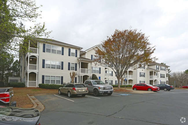
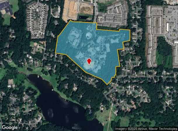
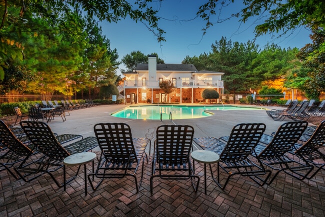
Property Record
50 Downsby Ln, Woodstock, GA 30189
NEARBY LISTINGS FOR SALE OR LEASE
-
-
View all Woodstock listings for sale on LoopNet.com
Property Detail
50 Downsby Ln
Atlanta-Sandy Springs-Roswell, GA
Gould Alan Surv
015N12-00000-007-00A-0000
LL 1229,1230,1291 & 1292 15TH D TR 1
Nightclub
Cherokee
AE
Georgia
13057C0333E
1229
2025
31.92 AC
2025
Cherokee County
091013
Atlanta
235,861 SF
DEMOGRAPHICS near 50 Downsby Ln
1 Mile
3 Mile
5 Mile
2024 Total Population
7,167
78,881
187,858
2029 Population
8,059
86,319
203,159
Pop Growth 2024-2029
+ 12.45%
+ 9.43%
+ 8.14%
Average Age
40
39
39
2024 Total Households
2,749
29,489
68,579
HH Growth 2024-2029
+ 13.10%
+ 9.75%
+ 8.35%
Median Household Inc
$92,288
$85,608
$91,538
Avg Household Size
2.60
2.60
2.60
2024 Avg HH Vehicles
2.00
2.00
2.00
Median Home Value
$281,713
$294,209
$309,493
Median Year Built
1991
1993
1993
Nearby Places
- Restaurants
- Banks
- Shops
- Fitness
- Groceries
Nearby Properties
Address
Land Use
TOTAL SIZE
Lot Size
Zoning
Address
Land Use
TOTAL SIZE
Lot Size
Zoning
523,803 SF
148.37 AC
R-40
Address
Land Use
TOTAL SIZE
Lot Size
Zoning
56,439 SF
13.69 AC
GC
Address
Land Use
TOTAL SIZE
Lot Size
Zoning
189,621 SF
12.16 AC
R-40
Address
Land Use
TOTAL SIZE
Lot Size
Zoning
228,644 SF
7.88 AC
DT-CBD
Address
Land Use
TOTAL SIZE
Lot Size
Zoning
309,011 SF
64.20 AC
PUD
Address
Land Use
TOTAL SIZE
Lot Size
Zoning
175,587 SF
17.71 AC
RTH
Address
Land Use
TOTAL SIZE
Lot Size
Zoning
197,890 SF
14.60 AC
R-4
Address
Land Use
TOTAL SIZE
Lot Size
Zoning
489,796 SF
44.09 AC
RM-12
Address
Land Use
TOTAL SIZE
Lot Size
Zoning
181,704 SF
17.56 AC
DT-MRA
Address
Land Use
TOTAL SIZE
Lot Size
Zoning
188,105 SF
25.86 AC
R-5
Address
Land Use
TOTAL SIZE
Lot Size
Zoning
201,331 SF
15.48 AC
RM16
Address
Land Use
TOTAL SIZE
Lot Size
Zoning
13.46 AC
PVC
Address
Land Use
TOTAL SIZE
Lot Size
Zoning
367,587 SF
26.87 AC
RM-12
Address
Land Use
TOTAL SIZE
Lot Size
Zoning
346,900 SF
104.10 AC
CD
Address
Land Use
TOTAL SIZE
Lot Size
Zoning
360,937 SF
32.56 AC
RM-12
Address
Land Use
TOTAL SIZE
Lot Size
Zoning
280,546 SF
26.91 AC
RM-12
Address
Land Use
TOTAL SIZE
Lot Size
Zoning
238,600 SF
21.10 AC
R-3
Address
Land Use
TOTAL SIZE
Lot Size
Zoning
91,547 SF
18.48 AC
R-3
Address
Land Use
TOTAL SIZE
Lot Size
Zoning
195,033 SF
22.85 AC
RM-8
Address
Land Use
TOTAL SIZE
Lot Size
Zoning
320,248 SF
26.67 AC
RM-12
Address
Land Use
TOTAL SIZE
Lot Size
Zoning
181,526 SF
6.52 AC
RM-12
Address
Land Use
TOTAL SIZE
Lot Size
Zoning
255,460 SF
20.28 AC
RM16
Address
Land Use
TOTAL SIZE
Lot Size
Zoning
232,415 SF
19.23 AC
RM-12
Address
Land Use
TOTAL SIZE
Lot Size
Zoning
131,024 SF
6.32 AC
RM-12
Address
Land Use
TOTAL SIZE
Lot Size
Zoning
229,440 SF
13 AC
OI
Address
Land Use
TOTAL SIZE
Lot Size
Zoning
113,849 SF
7.46 AC
R-5
Address
Land Use
TOTAL SIZE
Lot Size
Zoning
140,120 SF
9.52 AC
OMR
Address
Land Use
TOTAL SIZE
Lot Size
Zoning
85,671 SF
12.25 AC
RM10
Address
Land Use
TOTAL SIZE
Lot Size
Zoning
194,729 SF
29.67 AC
GC
The World's #1 Commercial Real Estate Marketplace
Connect with us
© 2025 CoStar Group
The information above has been obtained from sources believed reliable. While we do not doubt its accuracy we have not verified it and make no guarantee, warranty or representation about it. It is your responsibility to independently confirm its accuracy and completeness. Any projections, opinions, assumptions, or estimates used are for example only and do not represent the current or future performance of the property. The value of this transaction to you depends on tax and other factors which should be evaluated by your tax, financial, and legal advisors. You and your advisors should conduct a careful, independent investigation of the property to determine to your satisfaction the suitability of the property for your needs.