Property Record
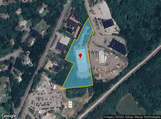
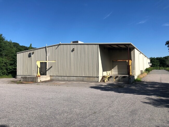
50 Earls Way, Franklin, MA 02038

NEARBY LISTINGS FOR SALE OR LEASE
Property Detail
50 Earls Way
FRAN-000248-000000-000075
Norfolk
Warehouse
Massachusetts
X
75
25021C0321F
3.40 AC
2025
I-95 Corridor South
2025
Boston
442101
Boston-Cambridge-Newton, MA-NH
22,540 SF
DEMOGRAPHICS near 50 Earls Way
1 Mile
3 Mile
5 Mile
2024 Total Population
3,170
36,110
72,059
2029 Population
3,215
36,003
71,835
Pop Growth 2024-2029
+ 1.42%
(0.30%)
(0.31%)
Average Age
41
41
41
2024 Total Households
1,082
12,824
26,006
HH Growth 2024-2029
+ 1.20%
(0.35%)
(0.35%)
Median Household Inc
$156,051
$140,288
$142,255
Avg Household Size
2.80
2.70
2.70
2024 Avg HH Vehicles
2.00
2.00
2.00
Median Home Value
$554,370
$552,204
$548,126
Median Year Built
1986
1981
1980
Nearby Places
Map Layers
Map Styles
 Street
 Aerial
- Restaurants
- Banks
- Shops
- Fitness
- Groceries
PUBLIC TRANSPORTATION
COMMUTER RAIL
Franklin (Franklin Line - Massachusetts Bay Transportation Authority Commuter Rail (Purple Line))
DRIVE
WALK
Distance
Franklin (Franklin Line - Massachusetts Bay Transportation Authority Commuter Rail (Purple Line))
6 min
2.6 mi
Norfolk (Franklin Line - Massachusetts Bay Transportation Authority Commuter Rail (Purple Line))
DRIVE
WALK
Distance
Norfolk (Franklin Line - Massachusetts Bay Transportation Authority Commuter Rail (Purple Line))
6 min
2.9 mi
AIRPORT
Rhode Island Tf Green International
DRIVE
WALK
Distance
Rhode Island Tf Green International
54 min
30.8 mi
General Edward Lawrence Logan International
DRIVE
WALK
Distance
General Edward Lawrence Logan International
56 min
37.3 mi
Worcester Regional
DRIVE
WALK
Distance
Worcester Regional
59 min
37.6 mi
Freight Ports
Port of Boston
DRIVE
WALK
Distance
Port of Boston
54 min
31.9 mi
SALE & LEASE HISTORY
LISTING DATE
SALE/LEASE

Nov 04, 2024
For Lease
Jul 29, 2020
For Lease
Jul 29, 2020
For Sale
Feb 23, 2022
For Lease
Feb 05, 2019
For Lease
Feb 05, 2019
For Sale
Nearby Properties
Address
Land Use
TOTAL SIZE
Lot Size
Zoning
Address
Land Use
TOTAL SIZE
Lot Size
Zoning
85.04 AC
Address
Land Use
TOTAL SIZE
Lot Size
Zoning
23.38 AC
Address
Land Use
TOTAL SIZE
Lot Size
Zoning
Address
Land Use
TOTAL SIZE
Lot Size
Zoning
14,317 SF
411.17 AC
R-43
Address
Land Use
TOTAL SIZE
Lot Size
Zoning
279,174 SF
59.96 AC
Address
Land Use
TOTAL SIZE
Lot Size
Zoning
0.58 AC
Address
Land Use
TOTAL SIZE
Lot Size
Zoning
231,487 SF
33.15 AC
R-30
Address
Land Use
TOTAL SIZE
Lot Size
Zoning
4.14 AC
Address
Land Use
TOTAL SIZE
Lot Size
Zoning
99,952 SF
19.80 AC
Address
Land Use
TOTAL SIZE
Lot Size
Zoning
151,021 SF
14.56 AC
Address
Land Use
TOTAL SIZE
Lot Size
Zoning
16.99 AC
Address
Land Use
TOTAL SIZE
Lot Size
Zoning
125,778 SF
35.60 AC
Address
Land Use
TOTAL SIZE
Lot Size
Zoning
204,365 SF
16.23 AC
Address
Land Use
TOTAL SIZE
Lot Size
Zoning
130,500 SF
9.52 AC
Address
Land Use
TOTAL SIZE
Lot Size
Zoning
57,305 SF
24.84 AC
Address
Land Use
TOTAL SIZE
Lot Size
Zoning
3,024 SF
12.47 AC
C-1 80
Address
Land Use
TOTAL SIZE
Lot Size
Zoning
8.93 AC
Address
Land Use
TOTAL SIZE
Lot Size
Zoning
50,610 SF
20.50 AC
Address
Land Use
TOTAL SIZE
Lot Size
Zoning
12.32 AC
Address
Land Use
TOTAL SIZE
Lot Size
Zoning
43.12 AC
Address
Land Use
TOTAL SIZE
Lot Size
Zoning
51,110 SF
2.11 AC
Address
Land Use
TOTAL SIZE
Lot Size
Zoning
76,123 SF
4.39 AC
Address
Land Use
TOTAL SIZE
Lot Size
Zoning
14.75 AC
Address
Land Use
TOTAL SIZE
Lot Size
Zoning
34,841 SF
1.02 AC
Address
Land Use
TOTAL SIZE
Lot Size
Zoning
61,484 SF
5.84 AC
Address
Land Use
TOTAL SIZE
Lot Size
Zoning
52,229 SF
11.25 AC
Address
Land Use
TOTAL SIZE
Lot Size
Zoning
82,450 SF
7.05 AC
Address
Land Use
TOTAL SIZE
Lot Size
Zoning
36,825 SF
0.99 AC
Address
Land Use
TOTAL SIZE
Lot Size
Zoning
4.91 AC
Address
Land Use
TOTAL SIZE
Lot Size
Zoning
44,833 SF
5 AC
The World's #1 Commercial Real Estate Marketplace
Connect with us
© 2025 CoStar Group
The information above has been obtained from sources believed reliable. While we do not doubt its accuracy we have not verified it and make no guarantee, warranty or representation about it. It is your responsibility to independently confirm its accuracy and completeness. Any projections, opinions, assumptions, or estimates used are for example only and do not represent the current or future performance of the property. The value of this transaction to you depends on tax and other factors which should be evaluated by your tax, financial, and legal advisors. You and your advisors should conduct a careful, independent investigation of the property to determine to your satisfaction the suitability of the property for your needs.