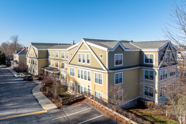
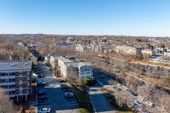
Property Record
50 Eliot St, Milton, MA 02186
NEARBY LISTINGS FOR SALE OR LEASE
Property Detail
50 Eliot St
MILT-000000-E000003-000005
Norfolk
Apartment
Massachusetts
X
5
25021C0064G
1.41 AC
2025
Milton
2025
Boston
416300
Boston-Cambridge-Newton, MA-NH
42,389 SF
DEMOGRAPHICS near 50 Eliot St
1 Mile
3 Mile
5 Mile
2024 Total Population
18,815
215,581
520,871
2029 Population
17,780
206,469
499,371
Pop Growth 2024-2029
(5.50%)
(4.23%)
(4.13%)
Average Age
41
40
39
2024 Total Households
7,191
79,268
202,940
HH Growth 2024-2029
(6.26%)
(4.57%)
(4.48%)
Median Household Inc
$92,832
$78,652
$82,570
Avg Household Size
2.50
2.60
2.40
2024 Avg HH Vehicles
1.00
1.00
1.00
Median Home Value
$667,672
$642,811
$673,408
Median Year Built
1948
1948
1949
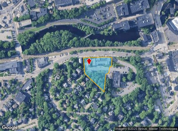
Nearby Places
Map Layers
Map Styles
 Street
 Aerial
- Restaurants
- Banks
- Shops
- Fitness
- Groceries
PUBLIC TRANSPORTATION
TRANSIT/SUBWAY
Milton Station (Ashmont Mattapan High Speed Line - Massachusetts Bay Transportation Authority Subway (The T))
DRIVE
WALK
Distance
Milton Station (Ashmont Mattapan High Speed Line - Massachusetts Bay Transportation Authority Subway (The T))
1 min
6 min
0.3 mi
Central Avenue Station (Ashmont Mattapan High Speed Line - Massachusetts Bay Transportation Authority Subway (The T))
DRIVE
WALK
Distance
Central Avenue Station (Ashmont Mattapan High Speed Line - Massachusetts Bay Transportation Authority Subway (The T))
1 min
7 min
0.3 mi
Butler Station (Ashmont Mattapan High Speed Line - Massachusetts Bay Transportation Authority Subway (The T))
DRIVE
WALK
Distance
Butler Station (Ashmont Mattapan High Speed Line - Massachusetts Bay Transportation Authority Subway (The T))
2 min
11 min
0.6 mi
Valley Road Station (Ashmont Mattapan High Speed Line - Massachusetts Bay Transportation Authority Subway (The T))
DRIVE
WALK
Distance
Valley Road Station (Ashmont Mattapan High Speed Line - Massachusetts Bay Transportation Authority Subway (The T))
2 min
14 min
0.7 mi
COMMUTER RAIL
Morton Street (Fairmount Line - Massachusetts Bay Transportation Authority Commuter Rail (Purple Line))
DRIVE
WALK
Distance
Morton Street (Fairmount Line - Massachusetts Bay Transportation Authority Commuter Rail (Purple Line))
3 min
1.5 mi
Blue Hill Avenue (Fairmount Line - MBTA, Franklin/Foxboro Line - MBTA)
DRIVE
WALK
Distance
Blue Hill Avenue (Fairmount Line - MBTA, Franklin/Foxboro Line - MBTA)
5 min
2.0 mi
AIRPORT
General Edward Lawrence Logan International
DRIVE
WALK
Distance
General Edward Lawrence Logan International
18 min
10.3 mi
Freight Ports
Port of Boston
DRIVE
WALK
Distance
Port of Boston
16 min
8.1 mi
Nearby Properties
Address
Land Use
TOTAL SIZE
Lot Size
Zoning
Address
Land Use
TOTAL SIZE
Lot Size
Zoning
17.33 AC
Address
Land Use
TOTAL SIZE
Lot Size
Zoning
251,272 SF
3.77 AC
BUSC
Address
Land Use
TOTAL SIZE
Lot Size
Zoning
152,495 SF
6.51 AC
Address
Land Use
TOTAL SIZE
Lot Size
Zoning
254,856 SF
4.05 AC
BUSC
Address
Land Use
TOTAL SIZE
Lot Size
Zoning
1,660.52 AC
RA
Address
Land Use
TOTAL SIZE
Lot Size
Zoning
1,940 SF
58.17 AC
E
Address
Land Use
TOTAL SIZE
Lot Size
Zoning
681,518 SF
34.52 AC
Address
Land Use
TOTAL SIZE
Lot Size
Zoning
240.18 AC
E
Address
Land Use
TOTAL SIZE
Lot Size
Zoning
728,348 SF
11.71 AC
C
Address
Land Use
TOTAL SIZE
Lot Size
Zoning
526,040 SF
27.79 AC
E
Address
Land Use
TOTAL SIZE
Lot Size
Zoning
383,811 SF
5.86 AC
RESB
Address
Land Use
TOTAL SIZE
Lot Size
Zoning
132,321 SF
3.94 AC
RC
Address
Land Use
TOTAL SIZE
Lot Size
Zoning
173,630 SF
4.46 AC
E
Address
Land Use
TOTAL SIZE
Lot Size
Zoning
17.85 AC
BUSC
Address
Land Use
TOTAL SIZE
Lot Size
Zoning
150,987 SF
6.90 AC
PUD
Address
Land Use
TOTAL SIZE
Lot Size
Zoning
560,065 SF
28.20 AC
Address
Land Use
TOTAL SIZE
Lot Size
Zoning
217,302 SF
13.47 AC
RA
Address
Land Use
TOTAL SIZE
Lot Size
Zoning
247,316 SF
2.75 AC
E
Address
Land Use
TOTAL SIZE
Lot Size
Zoning
4.81 AC
RESC
Address
Land Use
TOTAL SIZE
Lot Size
Zoning
83,891 SF
3.47 AC
RA
Address
Land Use
TOTAL SIZE
Lot Size
Zoning
108,500 SF
2.38 AC
E
Address
Land Use
TOTAL SIZE
Lot Size
Zoning
14.14 AC
Address
Land Use
TOTAL SIZE
Lot Size
Zoning
20,580 SF
20.51 AC
E
Address
Land Use
TOTAL SIZE
Lot Size
Zoning
153,360 SF
4.94 AC
E
Address
Land Use
TOTAL SIZE
Lot Size
Zoning
154,928 SF
0.77 AC
INDB
Address
Land Use
TOTAL SIZE
Lot Size
Zoning
130,867 SF
15.29 AC
RA
Address
Land Use
TOTAL SIZE
Lot Size
Zoning
138,986 SF
10.07 AC
E
Address
Land Use
TOTAL SIZE
Lot Size
Zoning
296,340 SF
4.58 AC
A
Address
Land Use
TOTAL SIZE
Lot Size
Zoning
99,497 SF
4.12 AC
E
Address
Land Use
TOTAL SIZE
Lot Size
Zoning
159,116 SF
11.37 AC
RC
The World's #1 Commercial Real Estate Marketplace
Connect with us
© 2025 CoStar Group
The information above has been obtained from sources believed reliable. While we do not doubt its accuracy we have not verified it and make no guarantee, warranty or representation about it. It is your responsibility to independently confirm its accuracy and completeness. Any projections, opinions, assumptions, or estimates used are for example only and do not represent the current or future performance of the property. The value of this transaction to you depends on tax and other factors which should be evaluated by your tax, financial, and legal advisors. You and your advisors should conduct a careful, independent investigation of the property to determine to your satisfaction the suitability of the property for your needs.