Property Record
50 Feldspar Rdg, Glastonbury, CT 06033

NEARBY LISTINGS FOR SALE OR LEASE
-
-
No Photo
-
View all Glastonbury listings for sale on LoopNet.com
Property Detail
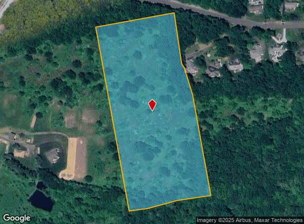
50 Feldspar Rdg
GLAS-000008H-002255-S000001
Hartford
Vacantlandnec
Connecticut
X
s0001
09003C0533F
12.13 AC
2025
Glastonbury
2025
Hartford
520400
Hartford-West Hartford-East Hartford, CT
DEMOGRAPHICS near 50 Feldspar Rdg
1 Mile
3 Mile
5 Mile
2024 Total Population
2,946
26,895
67,031
2029 Population
2,934
26,737
66,761
Pop Growth 2024-2029
(0.41%)
(0.59%)
(0.40%)
Average Age
41
43
43
2024 Total Households
1,108
10,566
26,853
HH Growth 2024-2029
(0.36%)
(0.71%)
(0.43%)
Median Household Inc
$139,469
$130,535
$107,540
Avg Household Size
2.70
2.50
2.40
2024 Avg HH Vehicles
2.00
2.00
2.00
Median Home Value
$411,422
$378,582
$303,710
Median Year Built
1978
1975
1969
Nearby Places
Map Layers
Map Styles
 Street
 Aerial
- Restaurants
- Banks
- Shops
- Fitness
- Groceries
PUBLIC TRANSPORTATION
COMMUTER RAIL
Hartford (Hartford Line - Hartford Line)
DRIVE
WALK
Distance
Hartford (Hartford Line - Hartford Line)
16 min
9.1 mi
Hartford Amtrak Station (Amtrak Hartford Line - Amtrak, Northeast Regional - Amtrak, Valley Flyer - Amtrak, Vermonter - Amtrak)
DRIVE
WALK
Distance
Hartford Amtrak Station (Amtrak Hartford Line - Amtrak, Northeast Regional - Amtrak, Valley Flyer - Amtrak, Vermonter - Amtrak)
16 min
9.2 mi
AIRPORT
Bradley International
DRIVE
WALK
Distance
Bradley International
45 min
25.1 mi
Freight Ports
Port of New Haven
DRIVE
WALK
Distance
Port of New Haven
57 min
41.3 mi
SALE & LEASE HISTORY
LISTING DATE
SALE/LEASE

Mar 09, 2021
For Sale
Nearby Properties
Address
Land Use
TOTAL SIZE
Lot Size
Zoning
Address
Land Use
TOTAL SIZE
Lot Size
Zoning
49,219 SF
31.72 AC
Address
Land Use
TOTAL SIZE
Lot Size
Zoning
55.64 AC
Address
Land Use
TOTAL SIZE
Lot Size
Zoning
188,454 SF
178.60 AC
A
Address
Land Use
TOTAL SIZE
Lot Size
Zoning
7.07 AC
PBD
Address
Land Use
TOTAL SIZE
Lot Size
Zoning
Address
Land Use
TOTAL SIZE
Lot Size
Zoning
8.14 AC
Address
Land Use
TOTAL SIZE
Lot Size
Zoning
7.90 AC
Address
Land Use
TOTAL SIZE
Lot Size
Zoning
3.06 AC
Address
Land Use
TOTAL SIZE
Lot Size
Zoning
71,728 SF
13.65 AC
Address
Land Use
TOTAL SIZE
Lot Size
Zoning
110,628 SF
28.81 AC
RR
Address
Land Use
TOTAL SIZE
Lot Size
Zoning
20,472 SF
10.59 AC
Address
Land Use
TOTAL SIZE
Lot Size
Zoning
61,651 SF
9.98 AC
Address
Land Use
TOTAL SIZE
Lot Size
Zoning
57,457 SF
34.79 AC
Address
Land Use
TOTAL SIZE
Lot Size
Zoning
7.14 AC
Address
Land Use
TOTAL SIZE
Lot Size
Zoning
89,766 SF
11.18 AC
Address
Land Use
TOTAL SIZE
Lot Size
Zoning
55,045 SF
2.88 AC
Address
Land Use
TOTAL SIZE
Lot Size
Zoning
104,775 SF
12.57 AC
PI
Address
Land Use
TOTAL SIZE
Lot Size
Zoning
Address
Land Use
TOTAL SIZE
Lot Size
Zoning
62,224 SF
RR
Address
Land Use
TOTAL SIZE
Lot Size
Zoning
93,484 SF
9.45 AC
PI
Address
Land Use
TOTAL SIZE
Lot Size
Zoning
7.90 AC
PI
Address
Land Use
TOTAL SIZE
Lot Size
Zoning
57,480 SF
27.70 AC
RL
Address
Land Use
TOTAL SIZE
Lot Size
Zoning
Address
Land Use
TOTAL SIZE
Lot Size
Zoning
57,153 SF
14.79 AC
RR
Address
Land Use
TOTAL SIZE
Lot Size
Zoning
Address
Land Use
TOTAL SIZE
Lot Size
Zoning
Address
Land Use
TOTAL SIZE
Lot Size
Zoning
7.42 AC
PI
Address
Land Use
TOTAL SIZE
Lot Size
Zoning
1,772 SF
9.01 AC
Address
Land Use
TOTAL SIZE
Lot Size
Zoning
16,145 SF
4.56 AC
PI
Address
Land Use
TOTAL SIZE
Lot Size
Zoning
55,074 SF
25.80 AC
RL
The World's #1 Commercial Real Estate Marketplace
Connect with us
© 2025 CoStar Group
The information above has been obtained from sources believed reliable. While we do not doubt its accuracy we have not verified it and make no guarantee, warranty or representation about it. It is your responsibility to independently confirm its accuracy and completeness. Any projections, opinions, assumptions, or estimates used are for example only and do not represent the current or future performance of the property. The value of this transaction to you depends on tax and other factors which should be evaluated by your tax, financial, and legal advisors. You and your advisors should conduct a careful, independent investigation of the property to determine to your satisfaction the suitability of the property for your needs.