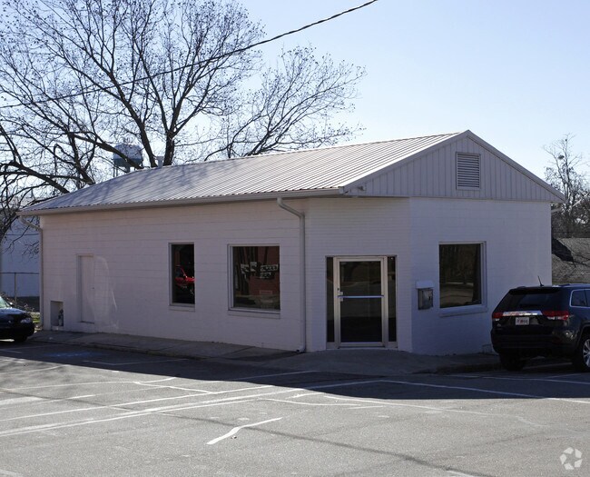
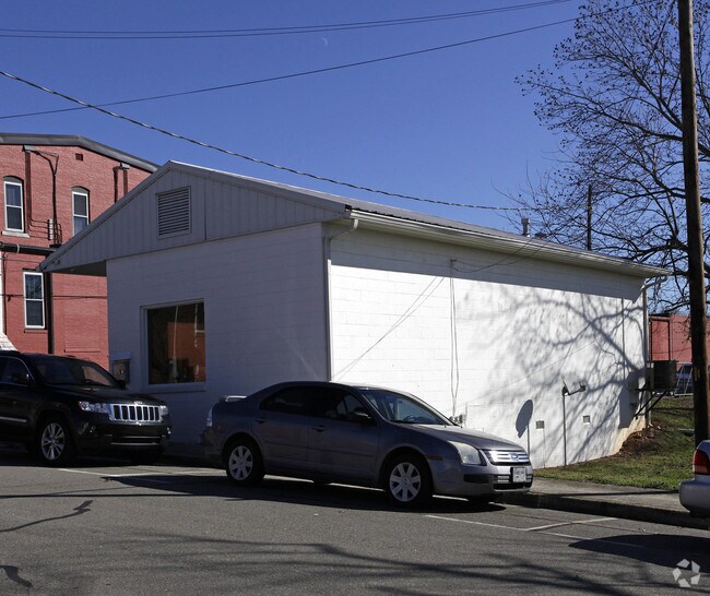
Property Record
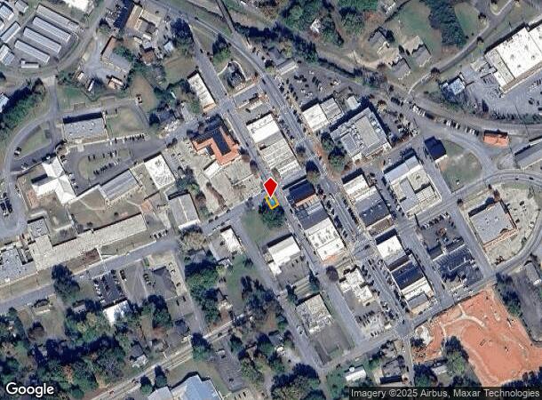
50 Mark Whitfield St, Jasper, GA 30143
NEARBY LISTINGS FOR SALE OR LEASE
Property Detail
50 Mark Whitfield St
Atlanta-Sandy Springs-Roswell, GA
Jasper
JA07-000-071-001
DIST12 LL306 LT1 .03AC
Officebuilding
Pickens
X
Georgia
13057C0075E
1
2024
0.03 AC
2024
Pickens County
050201
Atlanta
1,138 SF
DEMOGRAPHICS near 50 Mark Whitfield St
1 Mile
3 Mile
5 Mile
2024 Total Population
2,818
10,420
19,231
2029 Population
3,126
11,645
21,655
Pop Growth 2024-2029
+ 10.93%
+ 11.76%
+ 12.60%
Average Age
43
42
44
2024 Total Households
1,174
4,056
7,607
HH Growth 2024-2029
+ 10.65%
+ 11.46%
+ 12.48%
Median Household Inc
$62,121
$66,764
$70,853
Avg Household Size
2.30
2.50
2.40
2024 Avg HH Vehicles
2.00
2.00
2.00
Median Home Value
$241,562
$230,193
$264,800
Median Year Built
1990
1991
1992
Nearby Places
Map Layers
Map Styles
 Street
 Aerial
- Restaurants
- Banks
- Shops
- Fitness
- Groceries
SALE & LEASE HISTORY
LISTING DATE
SALE/LEASE

Apr 13, 2017
For Lease
Nearby Properties
Address
Land Use
TOTAL SIZE
Lot Size
Zoning
Address
Land Use
TOTAL SIZE
Lot Size
Zoning
Address
Land Use
TOTAL SIZE
Lot Size
Zoning
83,727 SF
19.27 AC
C-2
Address
Land Use
TOTAL SIZE
Lot Size
Zoning
1,120 SF
136.24 AC
HB
Address
Land Use
TOTAL SIZE
Lot Size
Zoning
149,347 SF
18.16 AC
C-2
Address
Land Use
TOTAL SIZE
Lot Size
Zoning
3,280 SF
140.59 AC
HB
Address
Land Use
TOTAL SIZE
Lot Size
Zoning
40,482 SF
1.84 AC
CBD
Address
Land Use
TOTAL SIZE
Lot Size
Zoning
4,800 SF
31.59 AC
HB
Address
Land Use
TOTAL SIZE
Lot Size
Zoning
4,512 SF
22 AC
R-3
Address
Land Use
TOTAL SIZE
Lot Size
Zoning
66,768 SF
19.43 AC
R-1
Address
Land Use
TOTAL SIZE
Lot Size
Zoning
42,200 SF
16.76 AC
HB
Address
Land Use
TOTAL SIZE
Lot Size
Zoning
10,000 SF
38.60 AC
HB
Address
Land Use
TOTAL SIZE
Lot Size
Zoning
9,120 SF
12.06 AC
R-1
Address
Land Use
TOTAL SIZE
Lot Size
Zoning
104,608 SF
10.12 AC
C-2
Address
Land Use
TOTAL SIZE
Lot Size
Zoning
14.75 AC
C-2
Address
Land Use
TOTAL SIZE
Lot Size
Zoning
70,300 SF
5.06 AC
C-2
Address
Land Use
TOTAL SIZE
Lot Size
Zoning
51,709 SF
6 AC
C-2
Address
Land Use
TOTAL SIZE
Lot Size
Zoning
27,171 SF
7.03 AC
C-2
Address
Land Use
TOTAL SIZE
Lot Size
Zoning
8,992 SF
18.96 AC
C-2
Address
Land Use
TOTAL SIZE
Lot Size
Zoning
82,500 SF
6.34 AC
C-2
Address
Land Use
TOTAL SIZE
Lot Size
Zoning
19,541 SF
3.12 AC
C-1
Address
Land Use
TOTAL SIZE
Lot Size
Zoning
9,670 SF
9.73 AC
C-2
Address
Land Use
TOTAL SIZE
Lot Size
Zoning
20,461 SF
3.71 AC
M-1
Address
Land Use
TOTAL SIZE
Lot Size
Zoning
49,100 SF
4.19 AC
C-2
Address
Land Use
TOTAL SIZE
Lot Size
Zoning
5,928 SF
5 AC
M-1
Address
Land Use
TOTAL SIZE
Lot Size
Zoning
27,440 SF
4.71 AC
C-2
Address
Land Use
TOTAL SIZE
Lot Size
Zoning
21,456 SF
2.36 AC
C-2
Address
Land Use
TOTAL SIZE
Lot Size
Zoning
20,689 SF
7.27 AC
C-2
Address
Land Use
TOTAL SIZE
Lot Size
Zoning
22,360 SF
28.31 AC
M-1
Address
Land Use
TOTAL SIZE
Lot Size
Zoning
21,456 SF
2.36 AC
C-2
Address
Land Use
TOTAL SIZE
Lot Size
Zoning
21,456 SF
2.36 AC
C-2
The World's #1 Commercial Real Estate Marketplace
Connect with us
© 2025 CoStar Group
The information above has been obtained from sources believed reliable. While we do not doubt its accuracy we have not verified it and make no guarantee, warranty or representation about it. It is your responsibility to independently confirm its accuracy and completeness. Any projections, opinions, assumptions, or estimates used are for example only and do not represent the current or future performance of the property. The value of this transaction to you depends on tax and other factors which should be evaluated by your tax, financial, and legal advisors. You and your advisors should conduct a careful, independent investigation of the property to determine to your satisfaction the suitability of the property for your needs.