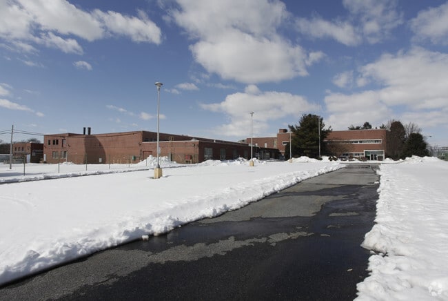
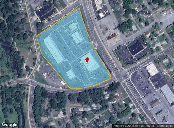
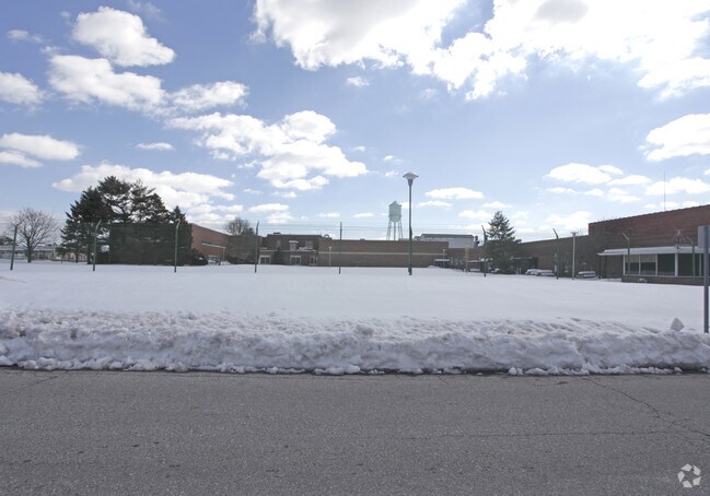
Property Record
10 N Dupont Hwy, Dover, DE 19901
NEARBY LISTINGS FOR SALE OR LEASE
Property Detail
10 N Dupont Hwy
2-05-07706-01-0200-000
W SD RT 13 8.894 A 50 N DUPONT HWY
Commercialnec
Kent
AE
Delaware
10001C0167H
8.90 AC
2025
Kent County
2025
Philadelphia
040900
Dover, DE
23,122 SF
DEMOGRAPHICS near 10 N Dupont Hwy
1 Mile
3 Mile
5 Mile
2024 Total Population
12,361
46,404
75,508
2029 Population
13,246
49,807
81,029
Pop Growth 2024-2029
+ 7.16%
+ 7.33%
+ 7.31%
Average Age
38
38
38
2024 Total Households
5,108
18,060
28,637
HH Growth 2024-2029
+ 7.34%
+ 7.61%
+ 7.59%
Median Household Inc
$48,446
$52,591
$59,752
Avg Household Size
2.30
2.40
2.50
2024 Avg HH Vehicles
1.00
2.00
2.00
Median Home Value
$206,341
$227,978
$255,851
Median Year Built
1976
1982
1987
Nearby Places
Map Layers
Map Styles
 Street
 Aerial
- Restaurants
- Banks
- Shops
- Fitness
- Groceries
SALE & LEASE HISTORY
LISTING DATE
SALE/LEASE

Apr 25, 2017
For Lease
Nearby Properties
Address
Land Use
TOTAL SIZE
Lot Size
Zoning
Address
Land Use
TOTAL SIZE
Lot Size
Zoning
231,470 SF
213.60 AC
IO
Address
Land Use
TOTAL SIZE
Lot Size
Zoning
308,750 SF
102.10 AC
R10
Address
Land Use
TOTAL SIZE
Lot Size
Zoning
Address
Land Use
TOTAL SIZE
Lot Size
Zoning
247,145 SF
43.71 AC
CPO
Address
Land Use
TOTAL SIZE
Lot Size
Zoning
1,120 SF
181.50 AC
RC
Address
Land Use
TOTAL SIZE
Lot Size
Zoning
189,363 SF
123.90 AC
IO
Address
Land Use
TOTAL SIZE
Lot Size
Zoning
172,440 SF
28.86 AC
RM2
Address
Land Use
TOTAL SIZE
Lot Size
Zoning
322,096 SF
18.20 AC
SC2
Address
Land Use
TOTAL SIZE
Lot Size
Zoning
105,846 SF
15.79 AC
SC2
Address
Land Use
TOTAL SIZE
Lot Size
Zoning
567,080 SF
30.22 AC
IPM
Address
Land Use
TOTAL SIZE
Lot Size
Zoning
179,601 SF
42.90 AC
IO
Address
Land Use
TOTAL SIZE
Lot Size
Zoning
93,186 SF
89.27 AC
IPM
Address
Land Use
TOTAL SIZE
Lot Size
Zoning
228,076 SF
15.50 AC
BG
Address
Land Use
TOTAL SIZE
Lot Size
Zoning
129,471 SF
TND
Address
Land Use
TOTAL SIZE
Lot Size
Zoning
379,358 SF
67.30 AC
SC3
Address
Land Use
TOTAL SIZE
Lot Size
Zoning
108,450 SF
11 AC
RM
Address
Land Use
TOTAL SIZE
Lot Size
Zoning
116,604 SF
3.20 AC
IO
Address
Land Use
TOTAL SIZE
Lot Size
Zoning
189,000 SF
13.40 AC
RG2
Address
Land Use
TOTAL SIZE
Lot Size
Zoning
187,104 SF
7.80 AC
RM1
Address
Land Use
TOTAL SIZE
Lot Size
Zoning
72,794 SF
11.57 AC
IO
Address
Land Use
TOTAL SIZE
Lot Size
Zoning
Address
Land Use
TOTAL SIZE
Lot Size
Zoning
60,324 SF
6.70 AC
IO
Address
Land Use
TOTAL SIZE
Lot Size
Zoning
44,560 SF
8.10 AC
IO
Address
Land Use
TOTAL SIZE
Lot Size
Zoning
Address
Land Use
TOTAL SIZE
Lot Size
Zoning
210,400 SF
30 AC
IPM
Address
Land Use
TOTAL SIZE
Lot Size
Zoning
243,410 SF
43.20 AC
IPM
Address
Land Use
TOTAL SIZE
Lot Size
Zoning
421,941 SF
23.70 AC
IPM
Address
Land Use
TOTAL SIZE
Lot Size
Zoning
111,744 SF
11.47 AC
RG2
Address
Land Use
TOTAL SIZE
Lot Size
Zoning
188,100 SF
9.70 AC
RG2
Address
Land Use
TOTAL SIZE
Lot Size
Zoning
69,228 SF
16.90 AC
RG5
The World's #1 Commercial Real Estate Marketplace
Connect with us
© 2026 CoStar Group
The information above has been obtained from sources believed reliable. While we do not doubt its accuracy we have not verified it and make no guarantee, warranty or representation about it. It is your responsibility to independently confirm its accuracy and completeness. Any projections, opinions, assumptions, or estimates used are for example only and do not represent the current or future performance of the property. The value of this transaction to you depends on tax and other factors which should be evaluated by your tax, financial, and legal advisors. You and your advisors should conduct a careful, independent investigation of the property to determine to your satisfaction the suitability of the property for your needs.