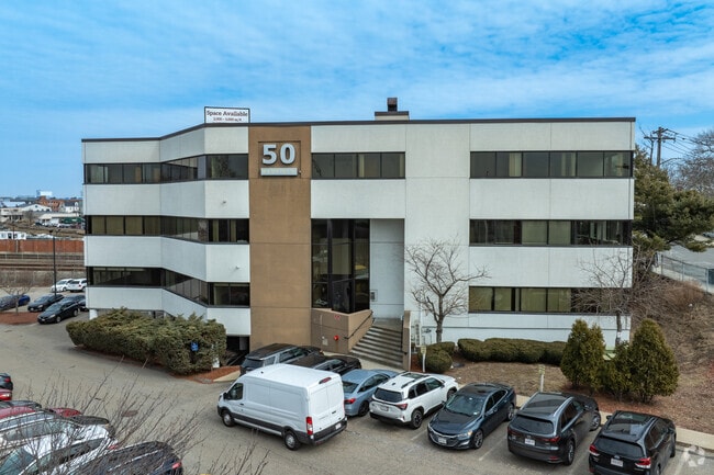
Property Record
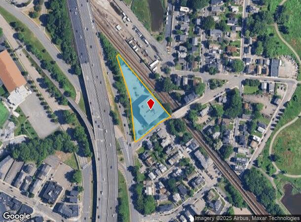
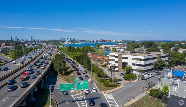
50 Redfield St, Dorchester, MA 02122

Current Lease Availabilities
NEARBY LISTINGS FOR SALE OR LEASE
Property Detail
50 Redfield St
Officebuilding
Suffolk
X
Massachusetts
25025C0091J
1.26 AC
2025
Roxbury/Dorchester
2025
Boston
100603
Boston-Cambridge-Newton, MA-NH
42,669 SF
DORC-000000-000016-002418-000001
DEMOGRAPHICS near 50 Redfield St
1 Mile
3 Mile
5 Mile
2024 Total Population
22,111
213,488
571,872
2029 Population
21,099
203,960
549,999
Pop Growth 2024-2029
(4.58%)
(4.46%)
(3.82%)
Average Age
41
39
39
2024 Total Households
9,548
80,196
234,009
HH Growth 2024-2029
(4.73%)
(4.76%)
(4.08%)
Median Household Inc
$102,789
$73,866
$82,450
Avg Household Size
2.20
2.50
2.20
2024 Avg HH Vehicles
1.00
1.00
1.00
Median Home Value
$645,282
$662,078
$707,465
Median Year Built
1948
1948
1951
Nearby Places
Map Layers
Map Styles
 Street
 Aerial
- Restaurants
- Banks
- Shops
- Fitness
- Groceries
PUBLIC TRANSPORTATION
COMMUTER RAIL
Four Corners/Geneva (Fairmount Line - MBTA, Franklin/Foxboro Line - MBTA)
DRIVE
WALK
Distance
Four Corners/Geneva (Fairmount Line - MBTA, Franklin/Foxboro Line - MBTA)
9 min
2.8 mi
Talbot Avenue (Fairmount Line - MBTA, Franklin/Foxboro Line - MBTA)
DRIVE
WALK
Distance
Talbot Avenue (Fairmount Line - MBTA, Franklin/Foxboro Line - MBTA)
7 min
3.0 mi
AIRPORT
General Edward Lawrence Logan International
DRIVE
WALK
Distance
General Edward Lawrence Logan International
15 min
8.3 mi
Freight Ports
Port of Boston
DRIVE
WALK
Distance
Port of Boston
13 min
6.1 mi
Nearby Properties
Address
Land Use
TOTAL SIZE
Lot Size
Zoning
Address
Land Use
TOTAL SIZE
Lot Size
Zoning
259,990 SF
2.84 AC
E
Address
Land Use
TOTAL SIZE
Lot Size
Zoning
303,055 SF
2.15 AC
RC
Address
Land Use
TOTAL SIZE
Lot Size
Zoning
17.33 AC
Address
Land Use
TOTAL SIZE
Lot Size
Zoning
251,272 SF
3.77 AC
BUSC
Address
Land Use
TOTAL SIZE
Lot Size
Zoning
152,495 SF
6.51 AC
Address
Land Use
TOTAL SIZE
Lot Size
Zoning
254,856 SF
4.05 AC
BUSC
Address
Land Use
TOTAL SIZE
Lot Size
Zoning
255,257 SF
2.34 AC
A
Address
Land Use
TOTAL SIZE
Lot Size
Zoning
1,940 SF
58.17 AC
E
Address
Land Use
TOTAL SIZE
Lot Size
Zoning
681,518 SF
34.52 AC
Address
Land Use
TOTAL SIZE
Lot Size
Zoning
291,918 SF
1.99 AC
RC
Address
Land Use
TOTAL SIZE
Lot Size
Zoning
332,366 SF
4.86 AC
E
Address
Land Use
TOTAL SIZE
Lot Size
Zoning
728,348 SF
11.71 AC
C
Address
Land Use
TOTAL SIZE
Lot Size
Zoning
526,040 SF
27.79 AC
E
Address
Land Use
TOTAL SIZE
Lot Size
Zoning
383,811 SF
5.86 AC
RESB
Address
Land Use
TOTAL SIZE
Lot Size
Zoning
132,321 SF
3.94 AC
RC
Address
Land Use
TOTAL SIZE
Lot Size
Zoning
88.20 AC
E
Address
Land Use
TOTAL SIZE
Lot Size
Zoning
173,630 SF
4.46 AC
E
Address
Land Use
TOTAL SIZE
Lot Size
Zoning
17.85 AC
BUSC
Address
Land Use
TOTAL SIZE
Lot Size
Zoning
150,987 SF
6.90 AC
PUD
Address
Land Use
TOTAL SIZE
Lot Size
Zoning
201,924 SF
2.17 AC
RC
Address
Land Use
TOTAL SIZE
Lot Size
Zoning
560,065 SF
28.20 AC
Address
Land Use
TOTAL SIZE
Lot Size
Zoning
275,752 SF
39.06 AC
E
Address
Land Use
TOTAL SIZE
Lot Size
Zoning
133,254 SF
4.21 AC
Address
Land Use
TOTAL SIZE
Lot Size
Zoning
167,236 SF
13.61 AC
C
Address
Land Use
TOTAL SIZE
Lot Size
Zoning
247,316 SF
2.75 AC
E
Address
Land Use
TOTAL SIZE
Lot Size
Zoning
24,156 SF
7.65 AC
RESB
Address
Land Use
TOTAL SIZE
Lot Size
Zoning
4.81 AC
RESC
Address
Land Use
TOTAL SIZE
Lot Size
Zoning
108,500 SF
2.38 AC
E
Address
Land Use
TOTAL SIZE
Lot Size
Zoning
147,560 SF
1.10 AC
A
Address
Land Use
TOTAL SIZE
Lot Size
Zoning
341,694 SF
3.23 AC
C
The World's #1 Commercial Real Estate Marketplace
Connect with us
© 2026 CoStar Group
The information above has been obtained from sources believed reliable. While we do not doubt its accuracy we have not verified it and make no guarantee, warranty or representation about it. It is your responsibility to independently confirm its accuracy and completeness. Any projections, opinions, assumptions, or estimates used are for example only and do not represent the current or future performance of the property. The value of this transaction to you depends on tax and other factors which should be evaluated by your tax, financial, and legal advisors. You and your advisors should conduct a careful, independent investigation of the property to determine to your satisfaction the suitability of the property for your needs.