Property Record
50 Rogers Ave, Lockport, NY 14094

NEARBY LISTINGS FOR SALE OR LEASE
Property Detail
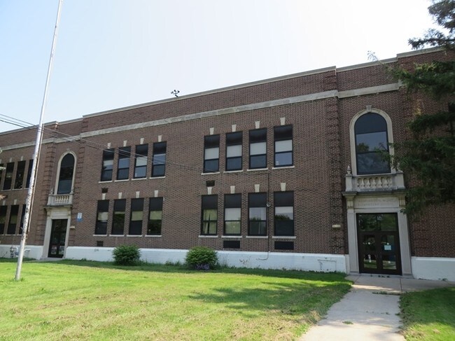
50 Rogers Ave
Buffalo-Cheektowaga-Niagara Falls, NY
Holland Land Company S Survey
290900-109-042-0002-001-000
CORNER EAST UNION ST EXT WASHINGTON HUNT SCHOOL
Recreationalnontaxablecampsboygirlscouts
Niagara
X
New York
36063C0241E
1.000
2023
2.86 AC
2024
Outlying Niagara County
023800
Buffalo/Niagara Falls
32,748 SF
DEMOGRAPHICS near 50 Rogers Ave
1 Mile
3 Mile
5 Mile
2024 Total Population
7,849
29,539
42,429
2029 Population
7,696
29,061
41,811
Pop Growth 2024-2029
(1.95%)
(1.62%)
(1.46%)
Average Age
41
42
42
2024 Total Households
3,544
12,943
18,391
HH Growth 2024-2029
(1.92%)
(1.63%)
(1.46%)
Median Household Inc
$51,855
$62,527
$62,978
Avg Household Size
2.20
2.20
2.20
2024 Avg HH Vehicles
2.00
2.00
2.00
Median Home Value
$131,764
$149,100
$150,562
Median Year Built
1949
1954
1965
Nearby Places
Map Layers
Map Styles
 Street
 Aerial
- Restaurants
- Banks
- Shops
- Fitness
- Groceries
PUBLIC TRANSPORTATION
AIRPORT
Niagara Falls International
DRIVE
WALK
Distance
Niagara Falls International
25 min
17.3 mi
Buffalo Niagara International
DRIVE
WALK
Distance
Buffalo Niagara International
26 min
18.6 mi
Freight Ports
Albany, NY Port
DRIVE
WALK
Distance
Albany, NY Port
338 min
286.2 mi
Nearby Properties
Address
Land Use
TOTAL SIZE
Lot Size
Zoning
Address
Land Use
TOTAL SIZE
Lot Size
Zoning
Address
Land Use
TOTAL SIZE
Lot Size
Zoning
90,347 SF
18.67 AC
B-2
Address
Land Use
TOTAL SIZE
Lot Size
Zoning
65,184 SF
100.76 AC
B-2
Address
Land Use
TOTAL SIZE
Lot Size
Zoning
259,393 SF
33.74 AC
RA
Address
Land Use
TOTAL SIZE
Lot Size
Zoning
90.60 AC
AR
Address
Land Use
TOTAL SIZE
Lot Size
Zoning
206,149 SF
17.86 AC
B-2
Address
Land Use
TOTAL SIZE
Lot Size
Zoning
660 SF
0.99 AC
R3
Address
Land Use
TOTAL SIZE
Lot Size
Zoning
8,604 SF
15 AC
R-2
Address
Land Use
TOTAL SIZE
Lot Size
Zoning
119,070 SF
21.99 AC
RA
Address
Land Use
TOTAL SIZE
Lot Size
Zoning
111,617 SF
16.83 AC
RA
Address
Land Use
TOTAL SIZE
Lot Size
Zoning
130,160 SF
13 AC
B-2
Address
Land Use
TOTAL SIZE
Lot Size
Zoning
108,630 SF
0.77 AC
B2
Address
Land Use
TOTAL SIZE
Lot Size
Zoning
760 SF
7.82 AC
R1
Address
Land Use
TOTAL SIZE
Lot Size
Zoning
67,111 SF
3.22 AC
B2
Address
Land Use
TOTAL SIZE
Lot Size
Zoning
130,946 SF
11.10 AC
B-2
Address
Land Use
TOTAL SIZE
Lot Size
Zoning
115,228 SF
10.90 AC
Address
Land Use
TOTAL SIZE
Lot Size
Zoning
Address
Land Use
TOTAL SIZE
Lot Size
Zoning
24,103 SF
74.12 AC
Address
Land Use
TOTAL SIZE
Lot Size
Zoning
16,282 SF
4.90 AC
R3
Address
Land Use
TOTAL SIZE
Lot Size
Zoning
62,310 SF
6.39 AC
R3
Address
Land Use
TOTAL SIZE
Lot Size
Zoning
7,692 SF
3.82 AC
R3
Address
Land Use
TOTAL SIZE
Lot Size
Zoning
27.12 AC
Address
Land Use
TOTAL SIZE
Lot Size
Zoning
23,904 SF
2 AC
Address
Land Use
TOTAL SIZE
Lot Size
Zoning
157,785 SF
7.32 AC
I3
Address
Land Use
TOTAL SIZE
Lot Size
Zoning
14,832 SF
1.64 AC
B2
Address
Land Use
TOTAL SIZE
Lot Size
Zoning
52,000 SF
30.40 AC
R-1
Address
Land Use
TOTAL SIZE
Lot Size
Zoning
8,160 SF
4.22 AC
R3
Address
Land Use
TOTAL SIZE
Lot Size
Zoning
81,875 SF
8.67 AC
RA
Address
Land Use
TOTAL SIZE
Lot Size
Zoning
67,960 SF
8.51 AC
B3
Address
Land Use
TOTAL SIZE
Lot Size
Zoning
66,581 SF
5.86 AC
B2
The World's #1 Commercial Real Estate Marketplace
Connect with us
© 2025 CoStar Group
The information above has been obtained from sources believed reliable. While we do not doubt its accuracy we have not verified it and make no guarantee, warranty or representation about it. It is your responsibility to independently confirm its accuracy and completeness. Any projections, opinions, assumptions, or estimates used are for example only and do not represent the current or future performance of the property. The value of this transaction to you depends on tax and other factors which should be evaluated by your tax, financial, and legal advisors. You and your advisors should conduct a careful, independent investigation of the property to determine to your satisfaction the suitability of the property for your needs.