Property Record
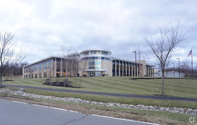
50 Stone Clay Rd, Troy, NY 12180


NEARBY LISTINGS FOR SALE OR LEASE
Property Detail
50 Stone Clay Rd
3200-133-1-1.3
Rensselaer
Industrialacreage
New York
ARE
1.003
36083C0237D
12.79 AC
2025
Outer Rensselaer County
2024
Albany/Schenectady/Troy
041300
Albany-Schenectady-Troy, NY
DEMOGRAPHICS near 50 Stone Clay Rd
1 Mile
3 Mile
5 Mile
2024 Total Population
3,531
43,246
173,713
2029 Population
3,566
43,009
171,641
Pop Growth 2024-2029
+ 0.99%
(0.55%)
(1.19%)
Average Age
42
40
38
2024 Total Households
1,685
18,759
74,108
HH Growth 2024-2029
+ 0.89%
(0.54%)
(1.23%)
Median Household Inc
$111,359
$69,209
$59,331
Avg Household Size
2.10
2.20
2.10
2024 Avg HH Vehicles
2.00
1.00
1.00
Median Home Value
$256,567
$220,250
$217,367
Median Year Built
1999
1970
1955
Nearby Places
Map Layers
Map Styles
 Street
 Aerial
- Restaurants
- Banks
- Shops
- Fitness
- Groceries
PUBLIC TRANSPORTATION
COMMUTER RAIL
Albany-Rensselaer Amtrak Station (Adirondack - Amtrak, Empire Service - Amtrak, Ethan Allen Express - Amtrak, Lake Shore Limited - Amtrak, Maple Leaf - Amtrak, Toronto - New York - Amtrak)
DRIVE
WALK
Distance
Albany-Rensselaer Amtrak Station (Adirondack - Amtrak, Empire Service - Amtrak, Ethan Allen Express - Amtrak, Lake Shore Limited - Amtrak, Maple Leaf - Amtrak, Toronto - New York - Amtrak)
12 min
5.7 mi
AIRPORT
Albany International
DRIVE
WALK
Distance
Albany International
22 min
13.0 mi
Freight Ports
Albany, NY Port
DRIVE
WALK
Distance
Albany, NY Port
15 min
8.3 mi
Nearby Properties
Address
Land Use
TOTAL SIZE
Lot Size
Zoning
Address
Land Use
TOTAL SIZE
Lot Size
Zoning
120,579 SF
49.20 AC
CI
Address
Land Use
TOTAL SIZE
Lot Size
Zoning
207.50 AC
CM
Address
Land Use
TOTAL SIZE
Lot Size
Zoning
326,350 SF
11.11 AC
I
Address
Land Use
TOTAL SIZE
Lot Size
Zoning
199,495 SF
5.40 AC
CO
Address
Land Use
TOTAL SIZE
Lot Size
Zoning
296,914 SF
68.73 AC
PDD
Address
Land Use
TOTAL SIZE
Lot Size
Zoning
11,900 SF
28.60 AC
86
Address
Land Use
TOTAL SIZE
Lot Size
Zoning
179,713 SF
126.43 AC
OC
Address
Land Use
TOTAL SIZE
Lot Size
Zoning
3,214 SF
412.83 AC
18
Address
Land Use
TOTAL SIZE
Lot Size
Zoning
470,768 SF
2.20 AC
C3
Address
Land Use
TOTAL SIZE
Lot Size
Zoning
220,480 SF
8.40 AC
M1
Address
Land Use
TOTAL SIZE
Lot Size
Zoning
170,387 SF
0.54 AC
C3
Address
Land Use
TOTAL SIZE
Lot Size
Zoning
11,264 SF
34.83 AC
MF
Address
Land Use
TOTAL SIZE
Lot Size
Zoning
7.10 AC
CO
Address
Land Use
TOTAL SIZE
Lot Size
Zoning
45,782 SF
0.84 AC
C3
Address
Land Use
TOTAL SIZE
Lot Size
Zoning
85.40 AC
M1
Address
Land Use
TOTAL SIZE
Lot Size
Zoning
19,274 SF
24.80 AC
84
Address
Land Use
TOTAL SIZE
Lot Size
Zoning
204,692 SF
30.97 AC
OC
Address
Land Use
TOTAL SIZE
Lot Size
Zoning
64,600 SF
13.16 AC
Address
Land Use
TOTAL SIZE
Lot Size
Zoning
90,174 SF
3.06 AC
R4
Address
Land Use
TOTAL SIZE
Lot Size
Zoning
131,937 SF
17.50 AC
R3A
Address
Land Use
TOTAL SIZE
Lot Size
Zoning
2,428 SF
23.10 AC
R3A
Address
Land Use
TOTAL SIZE
Lot Size
Zoning
63,992 SF
20 AC
CM
Address
Land Use
TOTAL SIZE
Lot Size
Zoning
43,020 SF
4.50 AC
R2A
Address
Land Use
TOTAL SIZE
Lot Size
Zoning
34.12 AC
Address
Land Use
TOTAL SIZE
Lot Size
Zoning
1,465 SF
49.86 AC
OS
Address
Land Use
TOTAL SIZE
Lot Size
Zoning
7,240 SF
18.70 AC
M1
Address
Land Use
TOTAL SIZE
Lot Size
Zoning
1,536 SF
11.20 AC
M1
Address
Land Use
TOTAL SIZE
Lot Size
Zoning
8,528 SF
9.30 AC
R3A
Address
Land Use
TOTAL SIZE
Lot Size
Zoning
120,000 SF
11.77 AC
OC
The World's #1 Commercial Real Estate Marketplace
Connect with us
© 2026 CoStar Group
The information above has been obtained from sources believed reliable. While we do not doubt its accuracy we have not verified it and make no guarantee, warranty or representation about it. It is your responsibility to independently confirm its accuracy and completeness. Any projections, opinions, assumptions, or estimates used are for example only and do not represent the current or future performance of the property. The value of this transaction to you depends on tax and other factors which should be evaluated by your tax, financial, and legal advisors. You and your advisors should conduct a careful, independent investigation of the property to determine to your satisfaction the suitability of the property for your needs.