Property Record
50 Teledyne Pl, La Vergne, TN 37086


Current Lease Availabilities
NEARBY LISTINGS FOR SALE OR LEASE
Property Detail
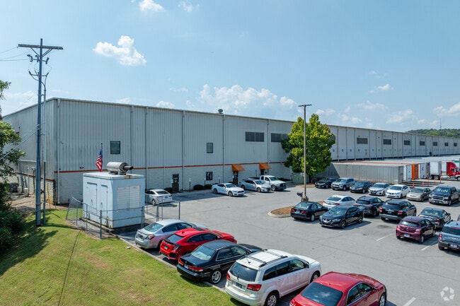
50 Teledyne Pl
175-00-0-203
Industrail Park
Publicstorage
W END OF TELEDYNE PL E OF OLD HICKORY BV
X
Davidson
47149C0015J
Tennessee
2025
13.97 AC
2025
Southeast
015630
Nashville
316,094 SF
Nashville-Davidson--Murfreesboro--Franklin, TN
DEMOGRAPHICS near 50 Teledyne Pl
1 Mile
3 Mile
5 Mile
2024 Total Population
624
46,041
153,179
2029 Population
616
47,704
159,346
Pop Growth 2024-2029
(1.28%)
+ 3.61%
+ 4.03%
Average Age
33
34
35
2024 Total Households
234
16,394
54,104
HH Growth 2024-2029
(1.71%)
+ 3.08%
+ 3.30%
Median Household Inc
$53,182
$64,528
$70,533
Avg Household Size
2.60
2.70
2.70
2024 Avg HH Vehicles
2.00
2.00
2.00
Median Home Value
$240,000
$258,130
$270,183
Median Year Built
2009
2003
1997
Nearby Places
Map Layers
Map Styles
 Street
 Aerial
- Restaurants
- Banks
- Shops
- Fitness
- Groceries
PUBLIC TRANSPORTATION
AIRPORT
Nashville International
DRIVE
WALK
Distance
Nashville International
21 min
12.0 mi
Freight Ports
Port of Mobile
DRIVE
WALK
Distance
Port of Mobile
495 min
448.7 mi
Nearby Properties
Address
Land Use
TOTAL SIZE
Lot Size
Zoning
Address
Land Use
TOTAL SIZE
Lot Size
Zoning
272,894 SF
36.45 AC
MULTI-ZONE
Address
Land Use
TOTAL SIZE
Lot Size
Zoning
28,908 SF
21.55 AC
MULTIZONE
Address
Land Use
TOTAL SIZE
Lot Size
Zoning
367,058 SF
112 AC
Address
Land Use
TOTAL SIZE
Lot Size
Zoning
129,800 SF
73.44 AC
MULTIZONE
Address
Land Use
TOTAL SIZE
Lot Size
Zoning
48,247 SF
Address
Land Use
TOTAL SIZE
Lot Size
Zoning
39,816 SF
39.02 AC
MULTIZONE
Address
Land Use
TOTAL SIZE
Lot Size
Zoning
57,362 SF
31.96 AC
MULTIZONE
Address
Land Use
TOTAL SIZE
Lot Size
Zoning
77,752 SF
13.44 AC
AR2A
Address
Land Use
TOTAL SIZE
Lot Size
Zoning
107,214 SF
13.78 AC
R10
Address
Land Use
TOTAL SIZE
Lot Size
Zoning
17,304 SF
41.35 AC
R8
Address
Land Use
TOTAL SIZE
Lot Size
Zoning
12,156 SF
122.05 AC
IR
Address
Land Use
TOTAL SIZE
Lot Size
Zoning
27,734 SF
18.24 AC
RM20
Address
Land Use
TOTAL SIZE
Lot Size
Zoning
42,711 SF
18.42 AC
MULTIZONE
Address
Land Use
TOTAL SIZE
Lot Size
Zoning
18,707 SF
27.42 AC
RM15
Address
Land Use
TOTAL SIZE
Lot Size
Zoning
323,961 SF
27.38 AC
I-2
Address
Land Use
TOTAL SIZE
Lot Size
Zoning
23,184 SF
24.15 AC
R15
Address
Land Use
TOTAL SIZE
Lot Size
Zoning
30,388 SF
29.41 AC
RM9
Address
Land Use
TOTAL SIZE
Lot Size
Zoning
23,718 SF
15 AC
MULTI-ZONE
Address
Land Use
TOTAL SIZE
Lot Size
Zoning
15,388 SF
25.28 AC
R8
Address
Land Use
TOTAL SIZE
Lot Size
Zoning
27,189 SF
13.81 AC
MULTIZONE
Address
Land Use
TOTAL SIZE
Lot Size
Zoning
23,580 SF
34.80 AC
RM9
Address
Land Use
TOTAL SIZE
Lot Size
Zoning
28,187 SF
14 AC
SP
Address
Land Use
TOTAL SIZE
Lot Size
Zoning
516,516 SF
28.39 AC
MULTIZONE
Address
Land Use
TOTAL SIZE
Lot Size
Zoning
627,900 SF
55.57 AC
IWD
Address
Land Use
TOTAL SIZE
Lot Size
Zoning
200,101 SF
6.04 AC
MULTIZONE
Address
Land Use
TOTAL SIZE
Lot Size
Zoning
526,143 SF
25.75 AC
IR
Address
Land Use
TOTAL SIZE
Lot Size
Zoning
570,000 SF
36.49 AC
IR
Address
Land Use
TOTAL SIZE
Lot Size
Zoning
25,021 SF
14.46 AC
MULTIZONE
Address
Land Use
TOTAL SIZE
Lot Size
Zoning
512,464 SF
42.43 AC
IR
Address
Land Use
TOTAL SIZE
Lot Size
Zoning
20,240 SF
30.85 AC
RM15
The World's #1 Commercial Real Estate Marketplace
Connect with us
© 2026 CoStar Group
The information above has been obtained from sources believed reliable. While we do not doubt its accuracy we have not verified it and make no guarantee, warranty or representation about it. It is your responsibility to independently confirm its accuracy and completeness. Any projections, opinions, assumptions, or estimates used are for example only and do not represent the current or future performance of the property. The value of this transaction to you depends on tax and other factors which should be evaluated by your tax, financial, and legal advisors. You and your advisors should conduct a careful, independent investigation of the property to determine to your satisfaction the suitability of the property for your needs.