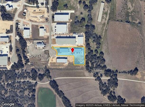
Property Record
50 Worth Dr, Boerne, TX 78006


Current Lease Availabilities
Property Detail
50 Worth Dr
San Antonio-New Braunfels, TX
PLEASANT VALLEY BUSINESS PARK PHASE 2 LOT 25A-1 (REPLAT), 1.67 ACRES PHASE 2
304518
KENDALL
Commercialbuilding
Texas
B and X Area of moderate flood hazard, usually the area between the limits of the 100-year and 500-year floods.
25a-1
2024
1.67 AC
2025
Kendall County
970406
San Antonio
NEARBY LISTINGS FOR SALE OR LEASE
DEMOGRAPHICS near 50 Worth Dr
1 mile
3 mile
5 mile
2025 Total Population
475
3,457
15,879
2030 Population
534
3,896
17,966
Pop Growth 2025-2030
+ 12.42%
+ 12.70%
+ 13.14%
Average Age
47
45
43
2025 Total Households
176
1,234
5,612
HH Growth 2025-2030
+ 12.50%
+ 12.80%
+ 13.24%
Median Household Inc
$199,999
$175,172
$155,573
Avg Household Size
2.70
2.80
2.80
2025 Avg HH Vehicles
3.00
3.00
2.00
Median Home Value
$848,684
$826,446
$724,246
Median Year Built
2003
2006
2007
Nearby Places
Map Layers
Map Styles
 Street
 Aerial
Transit
 Traffic
 Biking
Places
Listings with unknown addresses are not visible on the map
- Restaurants
- Banks
- Shops
- Fitness
- Groceries
PUBLIC TRANSPORTATION
AIRPORT
San Antonio International
Drive
Walk
Distance
San Antonio International
42 min
33.9 mi
Freight Ports
Calhoun Port
Drive
Walk
Distance
Calhoun Port
220 min
179.9 mi
Nearby Properties
Address
Land Use
TOTAL SIZE
Lot Size
Zoning
Address
Land Use
TOTAL SIZE
Lot Size
Zoning
166,650 SF
14.62 AC
Address
Land Use
TOTAL SIZE
Lot Size
Zoning
43,173 SF
91.99 AC
Address
Land Use
TOTAL SIZE
Lot Size
Zoning
46,506 SF
11.40 AC
Address
Land Use
TOTAL SIZE
Lot Size
Zoning
10,800 SF
13.12 AC
Address
Land Use
TOTAL SIZE
Lot Size
Zoning
47,002 SF
6.01 AC
Address
Land Use
TOTAL SIZE
Lot Size
Zoning
16,700 SF
1.71 AC
Address
Land Use
TOTAL SIZE
Lot Size
Zoning
13,041 SF
10.44 AC
Address
Land Use
TOTAL SIZE
Lot Size
Zoning
47,590 SF
5.80 AC
Address
Land Use
TOTAL SIZE
Lot Size
Zoning
8,932 SF
1.15 AC
Address
Land Use
TOTAL SIZE
Lot Size
Zoning
18,338 SF
4.50 AC
Address
Land Use
TOTAL SIZE
Lot Size
Zoning
7,050 SF
1.01 AC
Address
Land Use
TOTAL SIZE
Lot Size
Zoning
10,500 SF
1.23 AC
Address
Land Use
TOTAL SIZE
Lot Size
Zoning
11,460 SF
3.01 AC
Address
Land Use
TOTAL SIZE
Lot Size
Zoning
32.21 AC
Address
Land Use
TOTAL SIZE
Lot Size
Zoning
8,952 SF
6.49 AC
Address
Land Use
TOTAL SIZE
Lot Size
Zoning
31,504 SF
2.10 AC
Address
Land Use
TOTAL SIZE
Lot Size
Zoning
28,705 SF
1.51 AC
Address
Land Use
TOTAL SIZE
Lot Size
Zoning
13,857 SF
2.49 AC
Address
Land Use
TOTAL SIZE
Lot Size
Zoning
12,128 SF
3.88 AC
Address
Land Use
TOTAL SIZE
Lot Size
Zoning
9,076 SF
2.94 AC
Address
Land Use
TOTAL SIZE
Lot Size
Zoning
5,508 SF
1.53 AC
Address
Land Use
TOTAL SIZE
Lot Size
Zoning
6,570 SF
63.12 AC
Address
Land Use
TOTAL SIZE
Lot Size
Zoning
5,448 SF
0.39 AC
Address
Land Use
TOTAL SIZE
Lot Size
Zoning
Address
Land Use
TOTAL SIZE
Lot Size
Zoning
7,490 SF
1.03 AC
Address
Land Use
TOTAL SIZE
Lot Size
Zoning
7,278 SF
3.79 AC
Address
Land Use
TOTAL SIZE
Lot Size
Zoning
16,000 SF
1.11 AC
Address
Land Use
TOTAL SIZE
Lot Size
Zoning
7,950 SF
74.80 AC
Address
Land Use
TOTAL SIZE
Lot Size
Zoning
6,429 SF
5.84 AC
The World's #1 Commercial Real Estate Marketplace
Connect with us
© 2026 CoStar Group
The information above has been obtained from sources believed reliable. While we do not doubt its accuracy we have not verified it and make no guarantee, warranty or representation about it. It is your responsibility to independently confirm its accuracy and completeness. Any projections, opinions, assumptions, or estimates used are for example only and do not represent the current or future performance of the property. The value of this transaction to you depends on tax and other factors which should be evaluated by your tax, financial, and legal advisors. You and your advisors should conduct a careful, independent investigation of the property to determine to your satisfaction the suitability of the property for your needs.