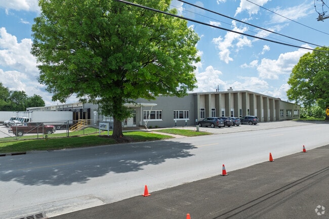
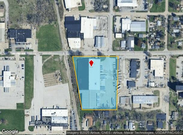
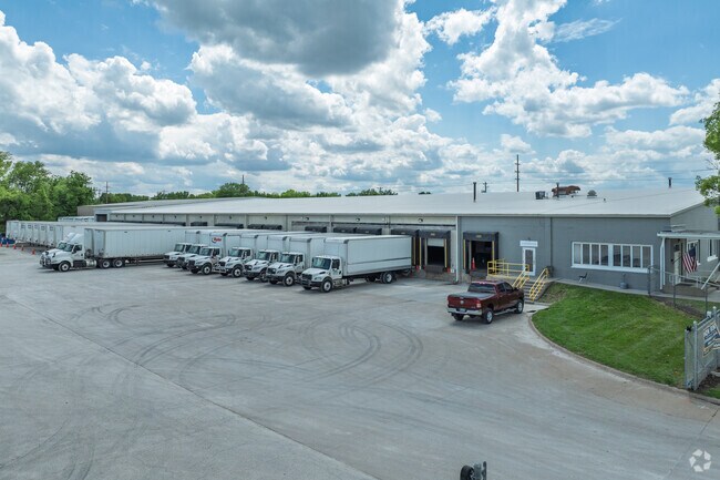
Property Record
500 31St Ave, Rock Island, IL 61201
Current Lease Availabilities
NEARBY LISTINGS FOR SALE OR LEASE
Property Detail
500 31St Ave
16-10-400-006
SUPVR ASST MAP LOT 404 SHEET 17
Industrialgeneral
Rock Island
X
Illinois
19163C0500F
404
2024
5 AC
2024
Greater Rock Island
024400
Davenport/Moline/Rock Island
90,380 SF
Davenport-Moline-Rock Island, IA-IL
DEMOGRAPHICS near 500 31St Ave
1 Mile
3 Mile
5 Mile
2024 Total Population
4,897
42,429
117,777
2029 Population
4,786
41,680
116,141
Pop Growth 2024-2029
(2.27%)
(1.77%)
(1.39%)
Average Age
41
40
39
2024 Total Households
2,182
17,625
49,454
HH Growth 2024-2029
(2.29%)
(1.91%)
(1.40%)
Median Household Inc
$39,910
$50,539
$51,237
Avg Household Size
2.20
2.20
2.20
2024 Avg HH Vehicles
1.00
2.00
2.00
Median Home Value
$90,045
$96,596
$120,656
Median Year Built
1951
1949
1949
Nearby Places
- Restaurants
- Banks
- Shops
- Fitness
- Groceries
PUBLIC TRANSPORTATION
AIRPORT
Quad Cities International
DRIVE
WALK
Distance
Quad Cities International
14 min
7.4 mi
Freight Ports
Port Milwaukee
DRIVE
WALK
Distance
Port Milwaukee
245 min
211.4 mi
Nearby Properties
Address
Land Use
TOTAL SIZE
Lot Size
Zoning
Address
Land Use
TOTAL SIZE
Lot Size
Zoning
3,500 SF
1.54 AC
Address
Land Use
TOTAL SIZE
Lot Size
Zoning
227,249 SF
38.78 AC
RI
Address
Land Use
TOTAL SIZE
Lot Size
Zoning
104,415 SF
5.89 AC
Address
Land Use
TOTAL SIZE
Lot Size
Zoning
3,283 SF
20 AC
Address
Land Use
TOTAL SIZE
Lot Size
Zoning
4.30 AC
RI
Address
Land Use
TOTAL SIZE
Lot Size
Zoning
7,200 SF
Address
Land Use
TOTAL SIZE
Lot Size
Zoning
329,938 SF
Address
Land Use
TOTAL SIZE
Lot Size
Zoning
14,947 SF
26.21 AC
Address
Land Use
TOTAL SIZE
Lot Size
Zoning
109,871 SF
7.89 AC
Address
Land Use
TOTAL SIZE
Lot Size
Zoning
11,566 SF
0.56 AC
Address
Land Use
TOTAL SIZE
Lot Size
Zoning
37,121 SF
2.35 AC
Address
Land Use
TOTAL SIZE
Lot Size
Zoning
152,176 SF
1.10 AC
Address
Land Use
TOTAL SIZE
Lot Size
Zoning
30,522 SF
1.25 AC
Address
Land Use
TOTAL SIZE
Lot Size
Zoning
73,703 SF
4.37 AC
Address
Land Use
TOTAL SIZE
Lot Size
Zoning
186,713 SF
2.89 AC
Address
Land Use
TOTAL SIZE
Lot Size
Zoning
44,839 SF
10.86 AC
RI
Address
Land Use
TOTAL SIZE
Lot Size
Zoning
17,329 SF
1.10 AC
Address
Land Use
TOTAL SIZE
Lot Size
Zoning
17.43 AC
RI
Address
Land Use
TOTAL SIZE
Lot Size
Zoning
70,148 SF
6.96 AC
Address
Land Use
TOTAL SIZE
Lot Size
Zoning
11.25 AC
RI
Address
Land Use
TOTAL SIZE
Lot Size
Zoning
20.35 AC
MIL
Address
Land Use
TOTAL SIZE
Lot Size
Zoning
1,008 SF
7.56 AC
Address
Land Use
TOTAL SIZE
Lot Size
Zoning
935,332 SF
41.69 AC
MIL
Address
Land Use
TOTAL SIZE
Lot Size
Zoning
1,031 SF
14.10 AC
Address
Land Use
TOTAL SIZE
Lot Size
Zoning
65,402 SF
0.19 AC
Address
Land Use
TOTAL SIZE
Lot Size
Zoning
84,000 SF
10 AC
Address
Land Use
TOTAL SIZE
Lot Size
Zoning
6.76 AC
Address
Land Use
TOTAL SIZE
Lot Size
Zoning
62,938 SF
Address
Land Use
TOTAL SIZE
Lot Size
Zoning
1,800 SF
10 AC
RI
Address
Land Use
TOTAL SIZE
Lot Size
Zoning
1,660 SF
8.90 AC
The World's #1 Commercial Real Estate Marketplace
Connect with us
© 2025 CoStar Group
The information above has been obtained from sources believed reliable. While we do not doubt its accuracy we have not verified it and make no guarantee, warranty or representation about it. It is your responsibility to independently confirm its accuracy and completeness. Any projections, opinions, assumptions, or estimates used are for example only and do not represent the current or future performance of the property. The value of this transaction to you depends on tax and other factors which should be evaluated by your tax, financial, and legal advisors. You and your advisors should conduct a careful, independent investigation of the property to determine to your satisfaction the suitability of the property for your needs.