Property Record
500 Dunmore Pl, Capitol Heights, MD 20743
NEARBY LISTINGS FOR SALE OR LEASE
Property Detail
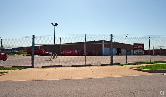
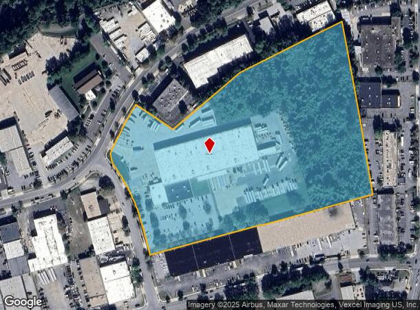
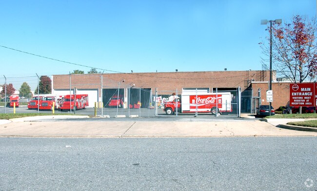
500 Dunmore Pl
Washington-Arlington-Alexandria, DC-VA-MD-WV
Hampton Park
13-1562669
HAMPTON PARK
Warehouse
Prince George's
X
Maryland
24033C0165E
1
2024
16.06 AC
2025
Capitol Heights
802204
Washington, DC
90,349 SF
DEMOGRAPHICS near 500 Dunmore Pl
1 Mile
3 Mile
5 Mile
2024 Total Population
3,669
98,466
274,290
2029 Population
3,615
96,460
265,954
Pop Growth 2024-2029
(1.47%)
(2.04%)
(3.04%)
Average Age
40
41
40
2024 Total Households
1,377
37,683
103,209
HH Growth 2024-2029
(1.02%)
(2.09%)
(3.28%)
Median Household Inc
$91,585
$84,670
$80,337
Avg Household Size
2.60
2.60
2.60
2024 Avg HH Vehicles
2.00
2.00
2.00
Median Home Value
$350,495
$329,866
$353,889
Median Year Built
1983
1982
1976
Nearby Places
Map Layers
Map Styles
 Street
 Aerial
- Restaurants
- Banks
- Shops
- Fitness
- Groceries
PUBLIC TRANSPORTATION
COMMUTER RAIL
New Carrollton (Penn Line - Maryland Area Regional Commuter Trains (The MARC))
DRIVE
WALK
Distance
New Carrollton (Penn Line - Maryland Area Regional Commuter Trains (The MARC))
13 min
7.5 mi
DRIVE
WALK
Distance
13 min
7.5 mi
AIRPORT
Ronald Reagan Washington Ntl
DRIVE
WALK
Distance
Ronald Reagan Washington Ntl
28 min
15.1 mi
Baltimore/Washington International Thurgood Marshall
DRIVE
WALK
Distance
Baltimore/Washington International Thurgood Marshall
43 min
28.7 mi
Washington Dulles International
DRIVE
WALK
Distance
Washington Dulles International
62 min
37.8 mi
Freight Ports
Port of Baltimore
DRIVE
WALK
Distance
Port of Baltimore
52 min
35.0 mi
Nearby Properties
Address
Land Use
TOTAL SIZE
Lot Size
Zoning
Address
Land Use
TOTAL SIZE
Lot Size
Zoning
35.03 AC
LTOE
Address
Land Use
TOTAL SIZE
Lot Size
Zoning
177,081 SF
23.22 AC
LCD
Address
Land Use
TOTAL SIZE
Lot Size
Zoning
5.10 AC
RTOHC
Address
Land Use
TOTAL SIZE
Lot Size
Zoning
12.60 AC
LTOC
Address
Land Use
TOTAL SIZE
Lot Size
Zoning
129,712 SF
150.08 AC
RR
Address
Land Use
TOTAL SIZE
Lot Size
Zoning
7.72 AC
CGO
Address
Land Use
TOTAL SIZE
Lot Size
Zoning
100 SF
4.78 AC
RTOHC
Address
Land Use
TOTAL SIZE
Lot Size
Zoning
315 SF
6.62 AC
RTOHE
Address
Land Use
TOTAL SIZE
Lot Size
Zoning
386,775 SF
45.40 AC
RMF20
Address
Land Use
TOTAL SIZE
Lot Size
Zoning
456,950 SF
52.92 AC
CGO
Address
Land Use
TOTAL SIZE
Lot Size
Zoning
344 SF
23.70 AC
RMF12
Address
Land Use
TOTAL SIZE
Lot Size
Zoning
491,397 SF
6.20 AC
RTOHE
Address
Land Use
TOTAL SIZE
Lot Size
Zoning
386,326 SF
62.74 AC
IE
Address
Land Use
TOTAL SIZE
Lot Size
Zoning
9.67 AC
RMF48
Address
Land Use
TOTAL SIZE
Lot Size
Zoning
4,704 SF
7.20 AC
RMF48
Address
Land Use
TOTAL SIZE
Lot Size
Zoning
217,500 SF
12.95 AC
RTOHE
Address
Land Use
TOTAL SIZE
Lot Size
Zoning
34.38 AC
RMF12
Address
Land Use
TOTAL SIZE
Lot Size
Zoning
14.36 AC
RMF48
Address
Land Use
TOTAL SIZE
Lot Size
Zoning
5.58 AC
CGO
Address
Land Use
TOTAL SIZE
Lot Size
Zoning
259,911 SF
24.14 AC
RTOHE
Address
Land Use
TOTAL SIZE
Lot Size
Zoning
57,288 SF
6.94 AC
TACE
Address
Land Use
TOTAL SIZE
Lot Size
Zoning
26 SF
9.44 AC
RTOHE
Address
Land Use
TOTAL SIZE
Lot Size
Zoning
219,287 SF
24.46 AC
CGO
Address
Land Use
TOTAL SIZE
Lot Size
Zoning
7.16 AC
RMF48
Address
Land Use
TOTAL SIZE
Lot Size
Zoning
182,000 SF
3.69 AC
RTOHE
Address
Land Use
TOTAL SIZE
Lot Size
Zoning
238,785 SF
12.79 AC
CGO
Address
Land Use
TOTAL SIZE
Lot Size
Zoning
125,000 SF
1.03 AC
RTOHC
Address
Land Use
TOTAL SIZE
Lot Size
Zoning
159,120 SF
10.25 AC
IE
Address
Land Use
TOTAL SIZE
Lot Size
Zoning
346 SF
17.37 AC
TACE
Address
Land Use
TOTAL SIZE
Lot Size
Zoning
9.57 AC
RMF48
The World's #1 Commercial Real Estate Marketplace
Connect with us
© 2025 CoStar Group
The information above has been obtained from sources believed reliable. While we do not doubt its accuracy we have not verified it and make no guarantee, warranty or representation about it. It is your responsibility to independently confirm its accuracy and completeness. Any projections, opinions, assumptions, or estimates used are for example only and do not represent the current or future performance of the property. The value of this transaction to you depends on tax and other factors which should be evaluated by your tax, financial, and legal advisors. You and your advisors should conduct a careful, independent investigation of the property to determine to your satisfaction the suitability of the property for your needs.