Property Record
500 E 500 E E, Markle, IN 46770

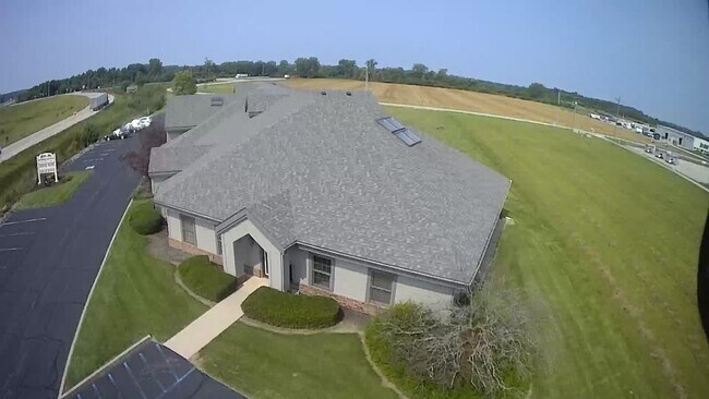
Property Detail
500 E 500 E E
Huntington, IN
015-00226-00 PT W NW SEC 1 2.21A
35-07-14-400-026.100-014
HUNTINGTON
Agriculturalland
Indiana
A Areas with a 1% annual chance of flooding and a 26% chance of flooding over the life of a 30-year mortgage.
42.70 AC
2025
Fort Wayne
2025
Other Market Areas
961700
NEARBY LISTINGS FOR SALE OR LEASE
-
-
View all Markle listings for lease on LoopNet.com
DEMOGRAPHICS near 500 E 500 E E
1 mile
3 mile
5 mile
2025 Total Population
590
1,608
2,896
2030 Population
587
1,612
2,898
Pop Growth 2025-2030
(0.51%)
+ 0.25%
+ 0.07%
Average Age
42
43
43
2025 Total Households
257
666
1,175
HH Growth 2025-2030
(0.39%)
+ 0.30%
+ 0.09%
Median Household Inc
$68,785
$81,830
$90,511
Avg Household Size
2.30
2.40
2.40
2025 Avg HH Vehicles
2.00
2.00
2.00
Median Home Value
$159,340
$201,124
$218,885
Median Year Built
1947
1949
1955
Nearby Places
Map Layers
Map Styles
 Street
 Aerial
Layers
 Traffic
 Biking
Places
Listings with unknown addresses are not visible on the map
- Restaurants
- Banks
- Shops
- Fitness
- Groceries
PUBLIC TRANSPORTATION
AIRPORT
Fort Wayne International
Drive
Walk
Distance
Fort Wayne International
30 min
19.9 mi
Freight Ports
Port of Toledo
Drive
Walk
Distance
Port of Toledo
164 min
130.9 mi
SALE & LEASE HISTORY
LISTING DATE
SALE/LEASE

Aug 05, 2021
For Lease
Nearby Properties
Address
Land Use
TOTAL SIZE
Lot Size
Zoning
Address
Land Use
TOTAL SIZE
Lot Size
Zoning
2,420 SF
18.14 AC
Address
Land Use
TOTAL SIZE
Lot Size
Zoning
73,376 SF
20 AC
Address
Land Use
TOTAL SIZE
Lot Size
Zoning
80 AC
Address
Land Use
TOTAL SIZE
Lot Size
Zoning
32,481 SF
8.88 AC
Address
Land Use
TOTAL SIZE
Lot Size
Zoning
60,540 SF
20.06 AC
Address
Land Use
TOTAL SIZE
Lot Size
Zoning
34,407 SF
8.03 AC
Address
Land Use
TOTAL SIZE
Lot Size
Zoning
39,090 SF
7.98 AC
Address
Land Use
TOTAL SIZE
Lot Size
Zoning
6,014 SF
1.35 AC
Address
Land Use
TOTAL SIZE
Lot Size
Zoning
19,200 SF
5.83 AC
Address
Land Use
TOTAL SIZE
Lot Size
Zoning
22,901 SF
4.65 AC
Address
Land Use
TOTAL SIZE
Lot Size
Zoning
5,940 SF
2.11 AC
Address
Land Use
TOTAL SIZE
Lot Size
Zoning
11,587 SF
2.21 AC
Address
Land Use
TOTAL SIZE
Lot Size
Zoning
58,671 SF
1.67 AC
Address
Land Use
TOTAL SIZE
Lot Size
Zoning
816 SF
3.55 AC
Address
Land Use
TOTAL SIZE
Lot Size
Zoning
14,580 SF
1.29 AC
Address
Land Use
TOTAL SIZE
Lot Size
Zoning
4,940 SF
3.27 AC
Address
Land Use
TOTAL SIZE
Lot Size
Zoning
12,000 SF
8.84 AC
Address
Land Use
TOTAL SIZE
Lot Size
Zoning
26,240 SF
0.71 AC
Address
Land Use
TOTAL SIZE
Lot Size
Zoning
3,015 SF
0.81 AC
Address
Land Use
TOTAL SIZE
Lot Size
Zoning
6,280 SF
1.96 AC
Address
Land Use
TOTAL SIZE
Lot Size
Zoning
163.41 AC
Address
Land Use
TOTAL SIZE
Lot Size
Zoning
2,052 SF
89.58 AC
Address
Land Use
TOTAL SIZE
Lot Size
Zoning
136.56 AC
Address
Land Use
TOTAL SIZE
Lot Size
Zoning
14,400 SF
1.58 AC
Address
Land Use
TOTAL SIZE
Lot Size
Zoning
4,904 SF
1.07 AC
Address
Land Use
TOTAL SIZE
Lot Size
Zoning
1,627 SF
0.31 AC
Address
Land Use
TOTAL SIZE
Lot Size
Zoning
25,321 SF
3.87 AC
Address
Land Use
TOTAL SIZE
Lot Size
Zoning
163.92 AC
Address
Land Use
TOTAL SIZE
Lot Size
Zoning
36,812 SF
4.58 AC
Address
Land Use
TOTAL SIZE
Lot Size
Zoning
160 AC
The World's #1 Commercial Real Estate Marketplace
Connect with us
© 2026 CoStar Group
The information above has been obtained from sources believed reliable. While we do not doubt its accuracy we have not verified it and make no guarantee, warranty or representation about it. It is your responsibility to independently confirm its accuracy and completeness. Any projections, opinions, assumptions, or estimates used are for example only and do not represent the current or future performance of the property. The value of this transaction to you depends on tax and other factors which should be evaluated by your tax, financial, and legal advisors. You and your advisors should conduct a careful, independent investigation of the property to determine to your satisfaction the suitability of the property for your needs.