Property Record
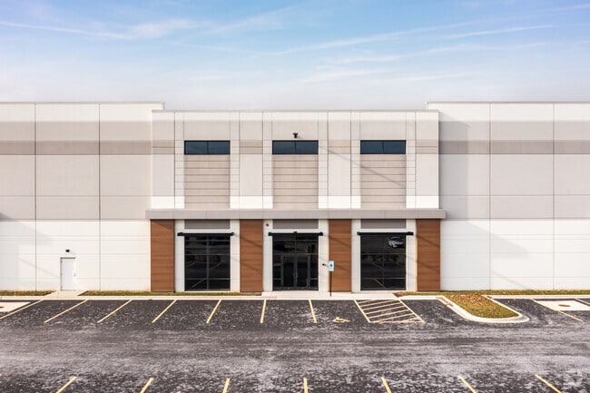
500 E Devon Ave, Elk Grove Village, IL 60007


Current Lease Availabilities
Property Detail
500 E Devon Ave
08-33-401-050-0000
Cook
Industrialgeneral
Illinois
2023
O'Hare
2025
Chicago
770300
Chicago-Naperville-Elgin, IL-IN
146,800 SF
NEARBY LISTINGS FOR SALE OR LEASE
DEMOGRAPHICS near 500 E Devon Ave
1 mile
3 mile
5 mile
2025 Total Population
5,513
61,994
213,641
2030 Population
5,500
62,141
214,822
Pop Growth 2025-2030
(0.24%)
+ 0.24%
+ 0.55%
Average Age
43
42
42
2025 Total Households
2,237
23,798
80,456
HH Growth 2025-2030
(0.45%)
+ 0.13%
+ 0.40%
Median Household Inc
$75,627
$88,114
$89,855
Avg Household Size
2.40
2.50
2.60
2025 Avg HH Vehicles
2.00
2.00
2.00
Median Home Value
$297,606
$314,562
$336,213
Median Year Built
1965
1973
1973
Nearby Places
Map Layers
Map Styles
 Street
 Aerial
Layers
 Traffic
 Biking
Places
Listings with unknown addresses are not visible on the map
- Restaurants
- Banks
- Shops
- Fitness
- Groceries
PUBLIC TRANSPORTATION
COMMUTER RAIL
Wood Dale Station (Milwaukee District West Line - Northeast Illinois Regional Commuter Railroad (Metra))
Drive
Walk
Distance
Wood Dale Station (Milwaukee District West Line - Northeast Illinois Regional Commuter Railroad (Metra))
5 min
2.6 mi
Itasca Station (Milwaukee District West Line - Northeast Illinois Regional Commuter Railroad (Metra))
Drive
Walk
Distance
Itasca Station (Milwaukee District West Line - Northeast Illinois Regional Commuter Railroad (Metra))
6 min
3.0 mi
AIRPORT
Chicago O'Hare International
Drive
Walk
Distance
Chicago O'Hare International
17 min
9.6 mi
Chicago Midway International
Drive
Walk
Distance
Chicago Midway International
38 min
24.1 mi
Freight Ports
Port Milwaukee
Drive
Walk
Distance
Port Milwaukee
99 min
80.3 mi
Nearby Properties
Address
Land Use
TOTAL SIZE
Lot Size
Zoning
Address
Land Use
TOTAL SIZE
Lot Size
Zoning
Address
Land Use
TOTAL SIZE
Lot Size
Zoning
310,751 SF
15.04 AC
Address
Land Use
TOTAL SIZE
Lot Size
Zoning
333,258 SF
9.48 AC
Address
Land Use
TOTAL SIZE
Lot Size
Zoning
108,216 SF
7.87 AC
Address
Land Use
TOTAL SIZE
Lot Size
Zoning
53,760 SF
5.36 AC
Address
Land Use
TOTAL SIZE
Lot Size
Zoning
189,290 SF
9.51 AC
Address
Land Use
TOTAL SIZE
Lot Size
Zoning
410,822 SF
14.26 AC
Address
Land Use
TOTAL SIZE
Lot Size
Zoning
208,000 SF
10.35 AC
Address
Land Use
TOTAL SIZE
Lot Size
Zoning
18.91 AC
Address
Land Use
TOTAL SIZE
Lot Size
Zoning
Address
Land Use
TOTAL SIZE
Lot Size
Zoning
132,699 SF
6.74 AC
Address
Land Use
TOTAL SIZE
Lot Size
Zoning
179,780 SF
8.12 AC
I
Address
Land Use
TOTAL SIZE
Lot Size
Zoning
58,373 SF
11.22 AC
Address
Land Use
TOTAL SIZE
Lot Size
Zoning
17.67 AC
Address
Land Use
TOTAL SIZE
Lot Size
Zoning
74,664 SF
3.19 AC
Address
Land Use
TOTAL SIZE
Lot Size
Zoning
Address
Land Use
TOTAL SIZE
Lot Size
Zoning
17.73 AC
Address
Land Use
TOTAL SIZE
Lot Size
Zoning
14.76 AC
Address
Land Use
TOTAL SIZE
Lot Size
Zoning
165,128 SF
Address
Land Use
TOTAL SIZE
Lot Size
Zoning
525,422 SF
8.45 AC
C
Address
Land Use
TOTAL SIZE
Lot Size
Zoning
15.32 AC
Address
Land Use
TOTAL SIZE
Lot Size
Zoning
487,027 SF
8.36 AC
C
Address
Land Use
TOTAL SIZE
Lot Size
Zoning
15.29 AC
Address
Land Use
TOTAL SIZE
Lot Size
Zoning
132,574 SF
5.91 AC
Address
Land Use
TOTAL SIZE
Lot Size
Zoning
14.35 AC
Address
Land Use
TOTAL SIZE
Lot Size
Zoning
Address
Land Use
TOTAL SIZE
Lot Size
Zoning
112,000 SF
Address
Land Use
TOTAL SIZE
Lot Size
Zoning
450,614 SF
17.97 AC
C
Address
Land Use
TOTAL SIZE
Lot Size
Zoning
469,492 SF
14.87 AC
I
Address
Land Use
TOTAL SIZE
Lot Size
Zoning
24.82 AC
The World's #1 Commercial Real Estate Marketplace
Connect with us
© 2026 CoStar Group
The information above has been obtained from sources believed reliable. While we do not doubt its accuracy we have not verified it and make no guarantee, warranty or representation about it. It is your responsibility to independently confirm its accuracy and completeness. Any projections, opinions, assumptions, or estimates used are for example only and do not represent the current or future performance of the property. The value of this transaction to you depends on tax and other factors which should be evaluated by your tax, financial, and legal advisors. You and your advisors should conduct a careful, independent investigation of the property to determine to your satisfaction the suitability of the property for your needs.