Property Record
500 E Ford St, Valley Center, KS 67147

Property Detail
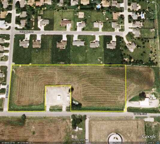
500 E Ford St
Wichita, KS
LOT 1 EXC BEG 31 FT W SE COR TH W 205 FT N 154 FT E 205 FT S TO BEG BLOCK 4 RIVERDELL VALLEY 1ST ADDITION
029-31-0-33-07-001.00
SEDGWICK
Apartment
Kansas
AE The base floodplain where base flood elevations are provided. AE Zones are now used on new format FIRMs instead of A1-A30 Zones.
1
2024
2.89 AC
2025
Park City/North
010201
Wichita
9,883 SF
NEARBY LISTINGS FOR SALE OR LEASE
DEMOGRAPHICS near 500 E Ford St
1 mile
3 mile
5 mile
2025 Total Population
3,761
12,540
27,210
2030 Population
3,859
12,878
28,021
Pop Growth 2025-2030
+ 2.61%
+ 2.70%
+ 2.98%
Average Age
38
39
39
2025 Total Households
1,338
4,582
10,067
HH Growth 2025-2030
+ 2.77%
+ 2.82%
+ 3.07%
Median Household Inc
$82,538
$83,198
$84,937
Avg Household Size
2.70
2.70
2.70
2025 Avg HH Vehicles
2.00
2.00
2.00
Median Home Value
$235,628
$258,095
$245,256
Median Year Built
1978
1981
1986
Nearby Places
Map Layers
Map Styles
 Street
 Aerial
Layers
 Traffic
 Biking
Places
Listings with unknown addresses are not visible on the map
- Restaurants
- Banks
- Shops
- Fitness
- Groceries
PUBLIC TRANSPORTATION
AIRPORT
Wichita Dwight D Eisenhower Ntl
Drive
Walk
Distance
Wichita Dwight D Eisenhower Ntl
24 min
14.0 mi
Nearby Properties
Address
Land Use
TOTAL SIZE
Lot Size
Zoning
Address
Land Use
TOTAL SIZE
Lot Size
Zoning
219,646 SF
94.73 AC
RR
Address
Land Use
TOTAL SIZE
Lot Size
Zoning
183,341 SF
37.09 AC
R2
Address
Land Use
TOTAL SIZE
Lot Size
Zoning
1,079,902 SF
68.86 AC
Address
Land Use
TOTAL SIZE
Lot Size
Zoning
252,450 SF
17.48 AC
Address
Land Use
TOTAL SIZE
Lot Size
Zoning
112,354 SF
29.13 AC
R2
Address
Land Use
TOTAL SIZE
Lot Size
Zoning
292,500 SF
12.15 AC
LI
Address
Land Use
TOTAL SIZE
Lot Size
Zoning
71,511 SF
24.10 AC
R2
Address
Land Use
TOTAL SIZE
Lot Size
Zoning
34,050 SF
10.23 AC
Address
Land Use
TOTAL SIZE
Lot Size
Zoning
54,164 SF
9.57 AC
R2
Address
Land Use
TOTAL SIZE
Lot Size
Zoning
45,868 SF
9.07 AC
R2
Address
Land Use
TOTAL SIZE
Lot Size
Zoning
99,564 SF
31.31 AC
I1
Address
Land Use
TOTAL SIZE
Lot Size
Zoning
61,349 SF
6.91 AC
I1
Address
Land Use
TOTAL SIZE
Lot Size
Zoning
451,477 SF
58.44 AC
I1
Address
Land Use
TOTAL SIZE
Lot Size
Zoning
18,905 SF
1.96 AC
Address
Land Use
TOTAL SIZE
Lot Size
Zoning
26,119 SF
3.63 AC
AA
Address
Land Use
TOTAL SIZE
Lot Size
Zoning
15,370 SF
4.34 AC
R2
Address
Land Use
TOTAL SIZE
Lot Size
Zoning
35,000 SF
16.26 AC
Address
Land Use
TOTAL SIZE
Lot Size
Zoning
349,549 SF
19.11 AC
I1
Address
Land Use
TOTAL SIZE
Lot Size
Zoning
46,968 SF
2.05 AC
R2
Address
Land Use
TOTAL SIZE
Lot Size
Zoning
17,346 SF
16.47 AC
Address
Land Use
TOTAL SIZE
Lot Size
Zoning
198,498 SF
15.50 AC
LC
Address
Land Use
TOTAL SIZE
Lot Size
Zoning
82,879 SF
35.73 AC
GC
Address
Land Use
TOTAL SIZE
Lot Size
Zoning
26,000 SF
6.07 AC
SF-20
Address
Land Use
TOTAL SIZE
Lot Size
Zoning
272,864 SF
5.40 AC
I1
Address
Land Use
TOTAL SIZE
Lot Size
Zoning
79,672 SF
16.30 AC
CZ
Address
Land Use
TOTAL SIZE
Lot Size
Zoning
13,603 SF
13.98 AC
LI
Address
Land Use
TOTAL SIZE
Lot Size
Zoning
41,421 SF
10.28 AC
RR
Address
Land Use
TOTAL SIZE
Lot Size
Zoning
192,281 SF
3.51 AC
I1
Address
Land Use
TOTAL SIZE
Lot Size
Zoning
21,144 SF
2.46 AC
R2
Address
Land Use
TOTAL SIZE
Lot Size
Zoning
14,064 SF
2.75 AC
C2
The World's #1 Commercial Real Estate Marketplace
Connect with us
© 2026 CoStar Group
The information above has been obtained from sources believed reliable. While we do not doubt its accuracy we have not verified it and make no guarantee, warranty or representation about it. It is your responsibility to independently confirm its accuracy and completeness. Any projections, opinions, assumptions, or estimates used are for example only and do not represent the current or future performance of the property. The value of this transaction to you depends on tax and other factors which should be evaluated by your tax, financial, and legal advisors. You and your advisors should conduct a careful, independent investigation of the property to determine to your satisfaction the suitability of the property for your needs.