Property Record
500 E Gowan Rd, North Las Vegas, NV 89030
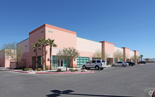


Property Detail
500 E Gowan Rd
Las Vegas-Henderson-North Las Vegas, NV
PARCEL MAP FILE 122 PAGE 35 LOT 1
139-11-201-005
CLARK
Shipyard
Nevada
B and X Area of moderate flood hazard, usually the area between the limits of the 100-year and 500-year floods.
1
2026
17.60 AC
2026
North Las Vegas
004401
Las Vegas
283,552 SF
NEARBY LISTINGS FOR SALE OR LEASE
-
-
-
-
-
-
-
-
Price reduced for fast Sale by $600,000. $183.00 a sq. ft.
North Las Vegas, NV 89081
$6,800,000
37,000 SF
Industrial
-
-
-
-
-
View all North Las Vegas listings for lease on LoopNet.com
DEMOGRAPHICS near 500 E Gowan Rd
1 mile
3 mile
5 mile
2025 Total Population
7,671
177,995
475,018
2030 Population
7,971
186,625
498,700
Pop Growth 2025-2030
+ 3.91%
+ 4.85%
+ 4.99%
Average Age
35
35
36
2025 Total Households
2,374
52,984
153,926
HH Growth 2025-2030
+ 3.88%
+ 4.92%
+ 5.06%
Median Household Inc
$63,594
$61,554
$62,119
Avg Household Size
3.20
3.20
3.00
2025 Avg HH Vehicles
2.00
2.00
2.00
Median Home Value
$399,266
$352,112
$367,676
Median Year Built
1997
1994
1995
Nearby Places
Map Layers
Map Styles
 Street
 Aerial
Layers
 Traffic
 Biking
Places
Listings with unknown addresses are not visible on the map
- Restaurants
- Banks
- Shops
- Fitness
- Groceries
PUBLIC TRANSPORTATION
AIRPORT
Harry Reid International
Drive
Walk
Distance
Harry Reid International
21 min
12.8 mi
Boulder City Municipal
Drive
Walk
Distance
Boulder City Municipal
40 min
29.5 mi
Freight Ports
Port of Long Beach
Drive
Walk
Distance
Port of Long Beach
322 min
288.3 mi
SALE & LEASE HISTORY
LISTING DATE
SALE/LEASE

Sep 25, 2016
For Lease
Mar 12, 2018
For Lease
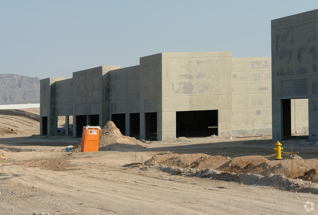
Nearby Properties
Address
Land Use
TOTAL SIZE
Lot Size
Zoning
Address
Land Use
TOTAL SIZE
Lot Size
Zoning
1,767,948 SF
142.04 AC
Address
Land Use
TOTAL SIZE
Lot Size
Zoning
252,005 SF
27.94 AC
C3
Address
Land Use
TOTAL SIZE
Lot Size
Zoning
724,845 SF
37.33 AC
M2
Address
Land Use
TOTAL SIZE
Lot Size
Zoning
9,738 SF
20.40 AC
Address
Land Use
TOTAL SIZE
Lot Size
Zoning
51.45 AC
R1
Address
Land Use
TOTAL SIZE
Lot Size
Zoning
681,792 SF
29.65 AC
Address
Land Use
TOTAL SIZE
Lot Size
Zoning
696,064 SF
29.08 AC
Address
Land Use
TOTAL SIZE
Lot Size
Zoning
602,609 SF
27.33 AC
M2
Address
Land Use
TOTAL SIZE
Lot Size
Zoning
324 SF
8.74 AC
R1
Address
Land Use
TOTAL SIZE
Lot Size
Zoning
7,724 SF
108.84 AC
R1
Address
Land Use
TOTAL SIZE
Lot Size
Zoning
617,670 SF
27.90 AC
M2
Address
Land Use
TOTAL SIZE
Lot Size
Zoning
33.32 AC
R1
Address
Land Use
TOTAL SIZE
Lot Size
Zoning
3,735 SF
17.69 AC
R3
Address
Land Use
TOTAL SIZE
Lot Size
Zoning
1,608 SF
30.32 AC
RAPSP
Address
Land Use
TOTAL SIZE
Lot Size
Zoning
35.49 AC
RE
Address
Land Use
TOTAL SIZE
Lot Size
Zoning
546,249 SF
28.58 AC
Address
Land Use
TOTAL SIZE
Lot Size
Zoning
191,879 SF
12 AC
RACHE
Address
Land Use
TOTAL SIZE
Lot Size
Zoning
35.49 AC
R1
Address
Land Use
TOTAL SIZE
Lot Size
Zoning
18.08 AC
PSP
Address
Land Use
TOTAL SIZE
Lot Size
Zoning
390,851 SF
48.43 AC
PUD
Address
Land Use
TOTAL SIZE
Lot Size
Zoning
504,501 SF
23.08 AC
M2
Address
Land Use
TOTAL SIZE
Lot Size
Zoning
36.24 AC
M2
Address
Land Use
TOTAL SIZE
Lot Size
Zoning
17.69 AC
RE
Address
Land Use
TOTAL SIZE
Lot Size
Zoning
513,240 SF
24.86 AC
M2
Address
Land Use
TOTAL SIZE
Lot Size
Zoning
355,910 SF
18.87 AC
M2
Address
Land Use
TOTAL SIZE
Lot Size
Zoning
612,680 SF
25.48 AC
M2
Address
Land Use
TOTAL SIZE
Lot Size
Zoning
371,648 SF
17.30 AC
Address
Land Use
TOTAL SIZE
Lot Size
Zoning
407,991 SF
26.52 AC
M2
The World's #1 Commercial Real Estate Marketplace
Connect with us
© 2026 CoStar Group
The information above has been obtained from sources believed reliable. While we do not doubt its accuracy we have not verified it and make no guarantee, warranty or representation about it. It is your responsibility to independently confirm its accuracy and completeness. Any projections, opinions, assumptions, or estimates used are for example only and do not represent the current or future performance of the property. The value of this transaction to you depends on tax and other factors which should be evaluated by your tax, financial, and legal advisors. You and your advisors should conduct a careful, independent investigation of the property to determine to your satisfaction the suitability of the property for your needs.