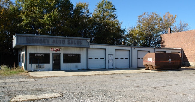
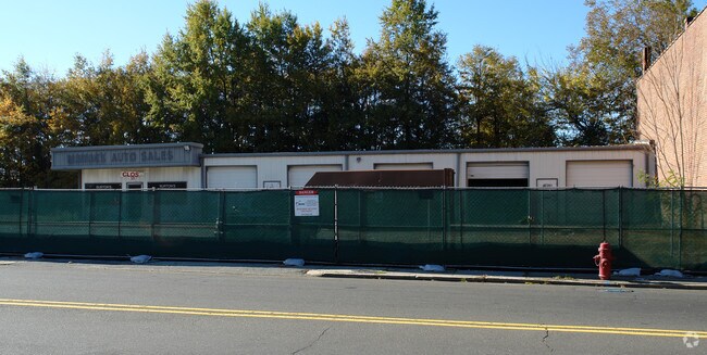
Property Record
500 E Main St, Durham, NC 27701


Property Detail
500 E Main St
102897
PROP-500 EAST MAIN ST/LT#01 PL:000206-000212
Parkinglot
DURHAM
DD-S1
North Carolina
B and X Area of moderate flood hazard, usually the area between the limits of the 100-year and 500-year floods.
1
2025
0.98 AC
2025
Downtown Durham
001100
Raleigh/Durham
303,996 SF
Durham-Chapel Hill, NC
NEARBY LISTINGS FOR SALE OR LEASE
DEMOGRAPHICS near 500 E Main St
1 mile
3 mile
5 mile
2025 Total Population
20,759
99,498
208,275
2030 Population
22,494
106,060
221,145
Pop Growth 2025-2030
+ 8.36%
+ 6.60%
+ 6.18%
Average Age
37
36
37
2025 Total Households
9,248
38,836
84,717
HH Growth 2025-2030
+ 9.18%
+ 7.18%
+ 6.56%
Median Household Inc
$67,542
$65,430
$71,623
Avg Household Size
2.00
2.30
2.30
2025 Avg HH Vehicles
1.00
1.00
2.00
Median Home Value
$533,019
$423,828
$392,906
Median Year Built
1992
1975
1988
Nearby Places
Map Layers
Map Styles
 Street
 Aerial
Layers
 Traffic
 Biking
Places
Listings with unknown addresses are not visible on the map
- Restaurants
- Banks
- Shops
- Fitness
- Groceries
PUBLIC TRANSPORTATION
COMMUTER RAIL
Drive
Walk
Distance
3 min
15 min
0.8 mi
AIRPORT
Raleigh-Durham International
Drive
Walk
Distance
Raleigh-Durham International
21 min
14.0 mi
Nearby Properties
Address
Land Use
TOTAL SIZE
Lot Size
Zoning
Address
Land Use
TOTAL SIZE
Lot Size
Zoning
8,478 SF
676.09 AC
UC
Address
Land Use
TOTAL SIZE
Lot Size
Zoning
839,237 SF
9.84 AC
DD-C
Address
Land Use
TOTAL SIZE
Lot Size
Zoning
310,825 SF
3.20 AC
DD-C
Address
Land Use
TOTAL SIZE
Lot Size
Zoning
3.38 AC
DD-C
Address
Land Use
TOTAL SIZE
Lot Size
Zoning
26,512 SF
6.40 AC
CD-C
Address
Land Use
TOTAL SIZE
Lot Size
Zoning
24,741 SF
5.67 AC
CD-S1
Address
Land Use
TOTAL SIZE
Lot Size
Zoning
63,921 SF
3.76 AC
DD-C
Address
Land Use
TOTAL SIZE
Lot Size
Zoning
171,375 SF
3.80 AC
DD-C
Address
Land Use
TOTAL SIZE
Lot Size
Zoning
416,469 SF
3.85 AC
MU(D)
Address
Land Use
TOTAL SIZE
Lot Size
Zoning
3.20 AC
CD-S1
Address
Land Use
TOTAL SIZE
Lot Size
Zoning
812,903 SF
9.31 AC
UC
Address
Land Use
TOTAL SIZE
Lot Size
Zoning
294,862 SF
2.37 AC
DD-C
Address
Land Use
TOTAL SIZE
Lot Size
Zoning
90,416 SF
3.87 AC
CD-S1
Address
Land Use
TOTAL SIZE
Lot Size
Zoning
478,037 SF
4.51 AC
DD-C
Address
Land Use
TOTAL SIZE
Lot Size
Zoning
69,430 SF
2.61 AC
DD-C
Address
Land Use
TOTAL SIZE
Lot Size
Zoning
125,552 SF
3.23 AC
UC(D)
Address
Land Use
TOTAL SIZE
Lot Size
Zoning
230,275 SF
2.12 AC
DD-C
Address
Land Use
TOTAL SIZE
Lot Size
Zoning
218,882 SF
3.10 AC
DD-S1
Address
Land Use
TOTAL SIZE
Lot Size
Zoning
265,592 SF
2.04 AC
DD-C
Address
Land Use
TOTAL SIZE
Lot Size
Zoning
218,946 SF
1.91 AC
DD-S1
Address
Land Use
TOTAL SIZE
Lot Size
Zoning
234,754 SF
4.85 AC
UC
Address
Land Use
TOTAL SIZE
Lot Size
Zoning
368,569 SF
2.77 AC
Address
Land Use
TOTAL SIZE
Lot Size
Zoning
358,462 SF
1.48 AC
DD-C
Address
Land Use
TOTAL SIZE
Lot Size
Zoning
262,593 SF
2.73 AC
DD-C
Address
Land Use
TOTAL SIZE
Lot Size
Zoning
410,000 SF
31.41 AC
IL
Address
Land Use
TOTAL SIZE
Lot Size
Zoning
250,392 SF
16.67 AC
DD-S2
Address
Land Use
TOTAL SIZE
Lot Size
Zoning
144,812 SF
1.44 AC
DD-C
Address
Land Use
TOTAL SIZE
Lot Size
Zoning
485,295 SF
27.35 AC
RS-8
Address
Land Use
TOTAL SIZE
Lot Size
Zoning
296,580 SF
2.53 AC
MU(D)
Address
Land Use
TOTAL SIZE
Lot Size
Zoning
137,472 SF
1.04 AC
DD-C
The World's #1 Commercial Real Estate Marketplace
Connect with us
© 2026 CoStar Group
The information above has been obtained from sources believed reliable. While we do not doubt its accuracy we have not verified it and make no guarantee, warranty or representation about it. It is your responsibility to independently confirm its accuracy and completeness. Any projections, opinions, assumptions, or estimates used are for example only and do not represent the current or future performance of the property. The value of this transaction to you depends on tax and other factors which should be evaluated by your tax, financial, and legal advisors. You and your advisors should conduct a careful, independent investigation of the property to determine to your satisfaction the suitability of the property for your needs.