Property Record
2000 Day Hill Rd, Windsor, CT 06095

NEARBY LISTINGS FOR SALE OR LEASE
Property Detail
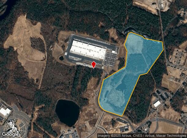
2000 Day Hill Rd
WIND-000012-000142-000012
Hartford
Timberlandforesttreesagricultural
Connecticut
X
12
09003C0213F
79.24 AC
2024
Windsor
2025
Hartford
473501
Hartford-West Hartford-East Hartford, CT
DEMOGRAPHICS near 2000 Day Hill Rd
1 Mile
3 Mile
5 Mile
2024 Total Population
124
14,646
64,008
2029 Population
124
14,586
63,792
Pop Growth 2024-2029
0.00%
(0.41%)
(0.34%)
Average Age
46
46
44
2024 Total Households
48
5,973
26,014
HH Growth 2024-2029
(2.08%)
(0.52%)
(0.43%)
Median Household Inc
$106,944
$99,040
$93,032
Avg Household Size
2.60
2.40
2.40
2024 Avg HH Vehicles
2.00
2.00
2.00
Median Home Value
$280,555
$276,786
$259,525
Median Year Built
1984
1979
1969
Nearby Places
Map Layers
Map Styles
 Street
 Aerial
- Restaurants
- Banks
- Shops
- Fitness
- Groceries
PUBLIC TRANSPORTATION
COMMUTER RAIL
Windsor (Amtrak Hartford Line - Amtrak, Hartford Line - Amtrak, Northeast Regional - Amtrak, Valley Flyer - Amtrak)
DRIVE
WALK
Distance
Windsor (Amtrak Hartford Line - Amtrak, Hartford Line - Amtrak, Northeast Regional - Amtrak, Valley Flyer - Amtrak)
11 min
5.0 mi
Windsor Locks (Hartford Line - CT Rail (CTRail))
DRIVE
WALK
Distance
Windsor Locks (Hartford Line - CT Rail (CTRail))
11 min
6.8 mi
AIRPORT
Bradley International
DRIVE
WALK
Distance
Bradley International
24 min
10.1 mi
Freight Ports
Port of New Haven
DRIVE
WALK
Distance
Port of New Haven
66 min
49.6 mi
Nearby Properties
Address
Land Use
TOTAL SIZE
Lot Size
Zoning
Address
Land Use
TOTAL SIZE
Lot Size
Zoning
105,796 SF
89.51 AC
Address
Land Use
TOTAL SIZE
Lot Size
Zoning
221,054 SF
28.85 AC
R-40
Address
Land Use
TOTAL SIZE
Lot Size
Zoning
66.60 AC
I-2
Address
Land Use
TOTAL SIZE
Lot Size
Zoning
802,150 SF
96.24 AC
I-2
Address
Land Use
TOTAL SIZE
Lot Size
Zoning
100,414 SF
93.10 AC
Address
Land Use
TOTAL SIZE
Lot Size
Zoning
433,356 SF
45.53 AC
I-2
Address
Land Use
TOTAL SIZE
Lot Size
Zoning
93.79 AC
Address
Land Use
TOTAL SIZE
Lot Size
Zoning
130.99 AC
Address
Land Use
TOTAL SIZE
Lot Size
Zoning
65,042 SF
36.76 AC
I-2
Address
Land Use
TOTAL SIZE
Lot Size
Zoning
8.89 AC
Address
Land Use
TOTAL SIZE
Lot Size
Zoning
14.02 AC
PLR
Address
Land Use
TOTAL SIZE
Lot Size
Zoning
203,071 SF
17.46 AC
Address
Land Use
TOTAL SIZE
Lot Size
Zoning
451,806 SF
37.82 AC
I-2
Address
Land Use
TOTAL SIZE
Lot Size
Zoning
215,269 SF
41 AC
I-2
Address
Land Use
TOTAL SIZE
Lot Size
Zoning
304,200 SF
58.46 AC
Address
Land Use
TOTAL SIZE
Lot Size
Zoning
488,812 SF
77.31 AC
Address
Land Use
TOTAL SIZE
Lot Size
Zoning
152,382 SF
10.46 AC
Address
Land Use
TOTAL SIZE
Lot Size
Zoning
234,000 SF
16.50 AC
Address
Land Use
TOTAL SIZE
Lot Size
Zoning
183,263 SF
21.69 AC
Address
Land Use
TOTAL SIZE
Lot Size
Zoning
457,396 SF
72.99 AC
Address
Land Use
TOTAL SIZE
Lot Size
Zoning
25,622 SF
19.80 AC
PLR
Address
Land Use
TOTAL SIZE
Lot Size
Zoning
11,172 SF
16.04 AC
MFER
Address
Land Use
TOTAL SIZE
Lot Size
Zoning
242,000 SF
20.30 AC
Address
Land Use
TOTAL SIZE
Lot Size
Zoning
156,950 SF
27.53 AC
I-2
Address
Land Use
TOTAL SIZE
Lot Size
Zoning
65,592 SF
6.66 AC
Address
Land Use
TOTAL SIZE
Lot Size
Zoning
239,516 SF
31.50 AC
I-2
Address
Land Use
TOTAL SIZE
Lot Size
Zoning
236,977 SF
16.99 AC
Address
Land Use
TOTAL SIZE
Lot Size
Zoning
170,076 SF
24.02 AC
Address
Land Use
TOTAL SIZE
Lot Size
Zoning
143,952 SF
15.97 AC
Address
Land Use
TOTAL SIZE
Lot Size
Zoning
39,366 SF
45.95 AC
I-2
The World's #1 Commercial Real Estate Marketplace
Connect with us
© 2026 CoStar Group
The information above has been obtained from sources believed reliable. While we do not doubt its accuracy we have not verified it and make no guarantee, warranty or representation about it. It is your responsibility to independently confirm its accuracy and completeness. Any projections, opinions, assumptions, or estimates used are for example only and do not represent the current or future performance of the property. The value of this transaction to you depends on tax and other factors which should be evaluated by your tax, financial, and legal advisors. You and your advisors should conduct a careful, independent investigation of the property to determine to your satisfaction the suitability of the property for your needs.