Property Record
500 Island Dr, Fort Pierre, SD 57532
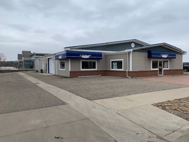

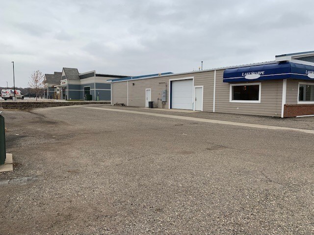
Property Detail
500 Island Dr
Pierre, SD
RIVERWALK LANDING ADDITION, LOT 4RON LOTS 15-17,REPLAT TETON ISLAND ADDITION;CITY OF FORT PIERRE
009646
STANLEY
Commercialnec
South Dakota
B and X Area of moderate flood hazard, usually the area between the limits of the 100-year and 500-year floods.
15-17
2021
2.08 AC
2025
South Dakota Area
960100
Other Market Areas
NEARBY LISTINGS FOR SALE OR LEASE
-
-
View all Fort Pierre listings for lease on LoopNet.com
DEMOGRAPHICS near 500 Island Dr
1 mile
3 mile
5 mile
2025 Total Population
2,812
14,583
16,770
2030 Population
2,768
14,336
16,524
Pop Growth 2025-2030
(1.56%)
(1.69%)
(1.47%)
Average Age
42
41
40
2025 Total Households
1,260
6,269
6,991
HH Growth 2025-2030
(1.35%)
(1.67%)
(1.50%)
Median Household Inc
$76,163
$74,461
$76,247
Avg Household Size
2.20
2.30
2.30
2025 Avg HH Vehicles
2.00
2.00
2.00
Median Home Value
$318,905
$251,393
$249,775
Median Year Built
1978
1975
1977
Nearby Places
Map Layers
Map Styles
 Street
 Aerial
Layers
 Traffic
 Biking
Places
Listings with unknown addresses are not visible on the map
- Restaurants
- Banks
- Shops
- Fitness
- Groceries
SALE & LEASE HISTORY
LISTING DATE
SALE/LEASE

Jan 07, 2020
For Lease
Nearby Properties
Address
Land Use
TOTAL SIZE
Lot Size
Zoning
Address
Land Use
TOTAL SIZE
Lot Size
Zoning
61,699 SF
Address
Land Use
TOTAL SIZE
Lot Size
Zoning
8.73 AC
Address
Land Use
TOTAL SIZE
Lot Size
Zoning
Address
Land Use
TOTAL SIZE
Lot Size
Zoning
56,000 SF
9.72 AC
Address
Land Use
TOTAL SIZE
Lot Size
Zoning
2.93 AC
Address
Land Use
TOTAL SIZE
Lot Size
Zoning
48,390 SF
3.46 AC
Address
Land Use
TOTAL SIZE
Lot Size
Zoning
13.18 AC
Address
Land Use
TOTAL SIZE
Lot Size
Zoning
2.95 AC
Address
Land Use
TOTAL SIZE
Lot Size
Zoning
21,300 SF
0.57 AC
Address
Land Use
TOTAL SIZE
Lot Size
Zoning
Address
Land Use
TOTAL SIZE
Lot Size
Zoning
11,256 SF
4.72 AC
Address
Land Use
TOTAL SIZE
Lot Size
Zoning
38,716 SF
3.04 AC
Address
Land Use
TOTAL SIZE
Lot Size
Zoning
13,786 SF
0.85 AC
Address
Land Use
TOTAL SIZE
Lot Size
Zoning
15.23 AC
Address
Land Use
TOTAL SIZE
Lot Size
Zoning
2.65 AC
Address
Land Use
TOTAL SIZE
Lot Size
Zoning
780 SF
6.39 AC
Address
Land Use
TOTAL SIZE
Lot Size
Zoning
26,950 SF
3.17 AC
Address
Land Use
TOTAL SIZE
Lot Size
Zoning
9,343 SF
1.53 AC
Address
Land Use
TOTAL SIZE
Lot Size
Zoning
14,671 SF
584.32 AC
Address
Land Use
TOTAL SIZE
Lot Size
Zoning
45,192 SF
Address
Land Use
TOTAL SIZE
Lot Size
Zoning
9,682 SF
2.19 AC
Address
Land Use
TOTAL SIZE
Lot Size
Zoning
21,870 SF
1.68 AC
Address
Land Use
TOTAL SIZE
Lot Size
Zoning
Address
Land Use
TOTAL SIZE
Lot Size
Zoning
3.35 AC
Address
Land Use
TOTAL SIZE
Lot Size
Zoning
14,478 SF
2.32 AC
Address
Land Use
TOTAL SIZE
Lot Size
Zoning
8,108 SF
0.89 AC
Address
Land Use
TOTAL SIZE
Lot Size
Zoning
3.70 AC
Address
Land Use
TOTAL SIZE
Lot Size
Zoning
Address
Land Use
TOTAL SIZE
Lot Size
Zoning
6,662 SF
1.39 AC
Address
Land Use
TOTAL SIZE
Lot Size
Zoning
26,168 SF
0.93 AC
The World's #1 Commercial Real Estate Marketplace
Connect with us
© 2026 CoStar Group
The information above has been obtained from sources believed reliable. While we do not doubt its accuracy we have not verified it and make no guarantee, warranty or representation about it. It is your responsibility to independently confirm its accuracy and completeness. Any projections, opinions, assumptions, or estimates used are for example only and do not represent the current or future performance of the property. The value of this transaction to you depends on tax and other factors which should be evaluated by your tax, financial, and legal advisors. You and your advisors should conduct a careful, independent investigation of the property to determine to your satisfaction the suitability of the property for your needs.