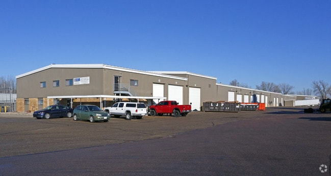
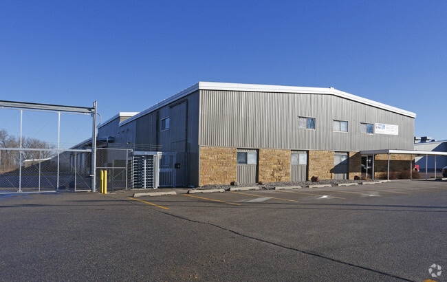
Property Record
500 N Industrial Rd, Mankato, MN 56001

Property Detail
500 N Industrial Rd
R01-04-32-100-027
KAYOT SUB NO 3 01 001 00 6.92A
Industrialgeneral
Blue Earth
B and X Area of moderate flood hazard, usually the area between the limits of the 100-year and 500-year floods.
Minnesota
2024
6.92 AC
2025
North Industrial Mankato
170200
Other Market Areas
72,400 SF
Mankato, MN
NEARBY LISTINGS FOR SALE OR LEASE
DEMOGRAPHICS near 500 N Industrial Rd
1 mile
3 mile
5 mile
2025 Total Population
488
22,108
62,949
2030 Population
500
22,304
63,600
Pop Growth 2025-2030
+ 2.46%
+ 0.89%
+ 1.03%
Average Age
39
38
36
2025 Total Households
189
9,499
24,924
HH Growth 2025-2030
+ 2.65%
+ 1.01%
+ 1.07%
Median Household Inc
$82,237
$68,987
$66,767
Avg Household Size
2.40
2.20
2.30
2025 Avg HH Vehicles
2.00
2.00
2.00
Median Home Value
$295,160
$259,014
$273,848
Median Year Built
1989
1975
1982
Nearby Places
Map Layers
Map Styles
 Street
 Aerial
Transit
 Traffic
 Biking
Places
Listings with unknown addresses are not visible on the map
- Restaurants
- Banks
- Shops
- Fitness
- Groceries
SALE & LEASE HISTORY
LISTING DATE
SALE/LEASE

Sep 25, 2016
For Lease
Apr 21, 2025
For Lease
Apr 12, 2022
For Lease
Nearby Properties
Address
Land Use
TOTAL SIZE
Lot Size
Zoning
Address
Land Use
TOTAL SIZE
Lot Size
Zoning
666,816 SF
6.31 AC
Address
Land Use
TOTAL SIZE
Lot Size
Zoning
616,099 SF
4.06 AC
Address
Land Use
TOTAL SIZE
Lot Size
Zoning
481,569 SF
31.57 AC
Address
Land Use
TOTAL SIZE
Lot Size
Zoning
331,604 SF
35.88 AC
Address
Land Use
TOTAL SIZE
Lot Size
Zoning
47,274 SF
17.47 AC
Address
Land Use
TOTAL SIZE
Lot Size
Zoning
3.73 AC
Address
Land Use
TOTAL SIZE
Lot Size
Zoning
83,917 SF
10.08 AC
Address
Land Use
TOTAL SIZE
Lot Size
Zoning
12,400 SF
60.45 AC
Address
Land Use
TOTAL SIZE
Lot Size
Zoning
168,908 SF
5.71 AC
Address
Land Use
TOTAL SIZE
Lot Size
Zoning
97,508 SF
44.54 AC
Address
Land Use
TOTAL SIZE
Lot Size
Zoning
6.91 AC
Address
Land Use
TOTAL SIZE
Lot Size
Zoning
94,135 SF
23.74 AC
Address
Land Use
TOTAL SIZE
Lot Size
Zoning
24,568 SF
3.48 AC
Address
Land Use
TOTAL SIZE
Lot Size
Zoning
22,522 SF
2.49 AC
Address
Land Use
TOTAL SIZE
Lot Size
Zoning
0.75 AC
Address
Land Use
TOTAL SIZE
Lot Size
Zoning
2.57 AC
Address
Land Use
TOTAL SIZE
Lot Size
Zoning
3.14 AC
Address
Land Use
TOTAL SIZE
Lot Size
Zoning
182,498 SF
23.67 AC
Address
Land Use
TOTAL SIZE
Lot Size
Zoning
279,442 SF
24.04 AC
Address
Land Use
TOTAL SIZE
Lot Size
Zoning
110,608 SF
8.55 AC
Address
Land Use
TOTAL SIZE
Lot Size
Zoning
107,485 SF
11.13 AC
Address
Land Use
TOTAL SIZE
Lot Size
Zoning
43,476 SF
6.37 AC
Address
Land Use
TOTAL SIZE
Lot Size
Zoning
73,143 SF
0.24 AC
Address
Land Use
TOTAL SIZE
Lot Size
Zoning
2.69 AC
Address
Land Use
TOTAL SIZE
Lot Size
Zoning
3.33 AC
Address
Land Use
TOTAL SIZE
Lot Size
Zoning
126,842 SF
8.31 AC
Address
Land Use
TOTAL SIZE
Lot Size
Zoning
90,180 SF
14.40 AC
Address
Land Use
TOTAL SIZE
Lot Size
Zoning
2.13 AC
Address
Land Use
TOTAL SIZE
Lot Size
Zoning
2.45 AC
The World's #1 Commercial Real Estate Marketplace
Connect with us
© 2026 CoStar Group
The information above has been obtained from sources believed reliable. While we do not doubt its accuracy we have not verified it and make no guarantee, warranty or representation about it. It is your responsibility to independently confirm its accuracy and completeness. Any projections, opinions, assumptions, or estimates used are for example only and do not represent the current or future performance of the property. The value of this transaction to you depends on tax and other factors which should be evaluated by your tax, financial, and legal advisors. You and your advisors should conduct a careful, independent investigation of the property to determine to your satisfaction the suitability of the property for your needs.