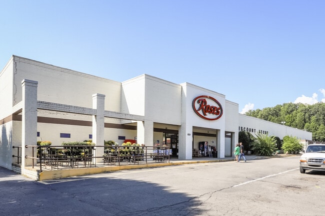
Property Record
500 N Main St, Marion, NC 28752


Save to a Folder
{{folder.Name}}
{{folder.ListingIds.length}} Properties
{{folder.ListingIds.length}} Property
Create a New Folder
Property Detail
500 N Main St
1701-06-49-5592
17.85 AC N MAIN ST SHOPPING CTR
Stripcommercialcenter
MCDOWELL
B and X Area of moderate flood hazard, usually the area between the limits of the 100-year and 500-year floods.
North Carolina
2025
17.85 AC
2025
North Carolina West/Cherokee Area
970300
Other Market Areas
39,795 SF
Marion, NC
NEARBY LISTINGS FOR SALE OR LEASE
DEMOGRAPHICS near 500 N Main St
1 mile
3 mile
5 mile
2025 Total Population
3,349
14,163
22,348
2030 Population
3,422
14,522
22,775
Pop Growth 2025-2030
+ 2.18%
+ 2.53%
+ 1.91%
Average Age
43
42
43
2025 Total Households
1,371
5,856
9,115
HH Growth 2025-2030
+ 2.41%
+ 2.63%
+ 2.01%
Median Household Inc
$65,493
$54,622
$55,145
Avg Household Size
2.30
2.30
2.30
2025 Avg HH Vehicles
2.00
2.00
2.00
Median Home Value
$184,748
$181,566
$183,670
Median Year Built
1973
1982
1983
Nearby Places
Map Layers
Map Styles
 Street
 Aerial
Layers
 Traffic
 Biking
Places
Listings with unknown addresses are not visible on the map
- Restaurants
- Banks
- Shops
- Fitness
- Groceries
PUBLIC TRANSPORTATION
AIRPORT
Asheville Regional
Drive
Walk
Distance
Asheville Regional
61 min
43.0 mi
SALE & LEASE HISTORY
LISTING DATE
SALE/LEASE

Sep 11, 2020
For Lease
Jan 29, 2021
For Lease
Nearby Properties
Address
Land Use
TOTAL SIZE
Lot Size
Zoning
Address
Land Use
TOTAL SIZE
Lot Size
Zoning
80,070 SF
Address
Land Use
TOTAL SIZE
Lot Size
Zoning
71,498 SF
12.67 AC
C-2
Address
Land Use
TOTAL SIZE
Lot Size
Zoning
123,039 SF
29.04 AC
Address
Land Use
TOTAL SIZE
Lot Size
Zoning
35,898 SF
Address
Land Use
TOTAL SIZE
Lot Size
Zoning
32,118 SF
0.63 AC
Address
Land Use
TOTAL SIZE
Lot Size
Zoning
204,136 SF
33.59 AC
Address
Land Use
TOTAL SIZE
Lot Size
Zoning
10,920 SF
10.97 AC
Address
Land Use
TOTAL SIZE
Lot Size
Zoning
130,268 SF
14 AC
Address
Land Use
TOTAL SIZE
Lot Size
Zoning
42,966 SF
7.62 AC
Address
Land Use
TOTAL SIZE
Lot Size
Zoning
23,694 SF
416.07 AC
Address
Land Use
TOTAL SIZE
Lot Size
Zoning
41,525 SF
7.02 AC
C-2
Address
Land Use
TOTAL SIZE
Lot Size
Zoning
89,868 SF
31.55 AC
Address
Land Use
TOTAL SIZE
Lot Size
Zoning
12,506 SF
16.19 AC
Address
Land Use
TOTAL SIZE
Lot Size
Zoning
48,105 SF
5.02 AC
Address
Land Use
TOTAL SIZE
Lot Size
Zoning
8,402 SF
100.02 AC
Address
Land Use
TOTAL SIZE
Lot Size
Zoning
911.26 AC
Address
Land Use
TOTAL SIZE
Lot Size
Zoning
18,426 SF
20.18 AC
Address
Land Use
TOTAL SIZE
Lot Size
Zoning
28,184 SF
5 AC
Address
Land Use
TOTAL SIZE
Lot Size
Zoning
33,698 SF
8.99 AC
Address
Land Use
TOTAL SIZE
Lot Size
Zoning
12,650 SF
119.12 AC
Address
Land Use
TOTAL SIZE
Lot Size
Zoning
77,467 SF
10.35 AC
Address
Land Use
TOTAL SIZE
Lot Size
Zoning
6,124 SF
3.99 AC
C-2
Address
Land Use
TOTAL SIZE
Lot Size
Zoning
22,206 SF
8.05 AC
Address
Land Use
TOTAL SIZE
Lot Size
Zoning
33,376 SF
8.98 AC
Address
Land Use
TOTAL SIZE
Lot Size
Zoning
3,088 SF
3.29 AC
Address
Land Use
TOTAL SIZE
Lot Size
Zoning
11,644 SF
2.55 AC
Address
Land Use
TOTAL SIZE
Lot Size
Zoning
14,868 SF
8 AC
Address
Land Use
TOTAL SIZE
Lot Size
Zoning
10,660 SF
8.40 AC
Address
Land Use
TOTAL SIZE
Lot Size
Zoning
2,019 SF
8.86 AC
The World's #1 Commercial Real Estate Marketplace
Connect with us
© 2026 CoStar Group
The information above has been obtained from sources believed reliable. While we do not doubt its accuracy we have not verified it and make no guarantee, warranty or representation about it. It is your responsibility to independently confirm its accuracy and completeness. Any projections, opinions, assumptions, or estimates used are for example only and do not represent the current or future performance of the property. The value of this transaction to you depends on tax and other factors which should be evaluated by your tax, financial, and legal advisors. You and your advisors should conduct a careful, independent investigation of the property to determine to your satisfaction the suitability of the property for your needs.