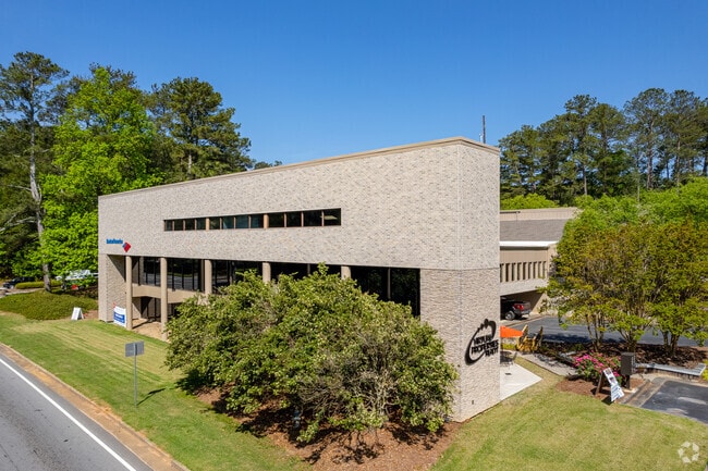
Property Record
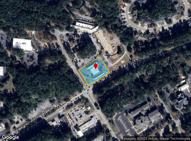
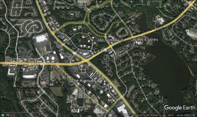
500 Northlake Dr, Peachtree City, GA 30269

Current Lease Availabilities
NEARBY LISTINGS FOR SALE OR LEASE
Property Detail
500 Northlake Dr
07-32-00-054
Fsb Assoc Ltd
Officebuilding
1.0 ACRE NORTHLAKE DRIVE
X
Fayette
13077C0190D
Georgia
2024
1.17 AC
2024
Fayette/Coweta County
140209
Atlanta
22,355 SF
Atlanta-Sandy Springs-Roswell, GA
DEMOGRAPHICS near 500 Northlake Dr
1 Mile
3 Mile
5 Mile
2024 Total Population
5,204
32,941
62,412
2029 Population
5,503
34,829
66,751
Pop Growth 2024-2029
+ 5.75%
+ 5.73%
+ 6.95%
Average Age
42
43
42
2024 Total Households
2,010
12,683
22,803
HH Growth 2024-2029
+ 5.82%
+ 5.77%
+ 6.96%
Median Household Inc
$92,310
$94,351
$102,595
Avg Household Size
2.50
2.60
2.70
2024 Avg HH Vehicles
2.00
2.00
2.00
Median Home Value
$370,850
$387,178
$386,941
Median Year Built
1985
1991
1993
Nearby Places
Map Layers
Map Styles
 Street
 Aerial
- Restaurants
- Banks
- Shops
- Fitness
- Groceries
PUBLIC TRANSPORTATION
AIRPORT
Hartsfield - Jackson Atlanta International
DRIVE
WALK
Distance
Hartsfield - Jackson Atlanta International
38 min
25.6 mi
Nearby Properties
Address
Land Use
TOTAL SIZE
Lot Size
Zoning
Address
Land Use
TOTAL SIZE
Lot Size
Zoning
353,300 SF
38 AC
Address
Land Use
TOTAL SIZE
Lot Size
Zoning
171,535 SF
27.60 AC
C GC
Address
Land Use
TOTAL SIZE
Lot Size
Zoning
194,839 SF
25.40 AC
C GC
Address
Land Use
TOTAL SIZE
Lot Size
Zoning
274,599 SF
28.10 AC
C GR12
Address
Land Use
TOTAL SIZE
Lot Size
Zoning
118,729 SF
21.25 AC
C GR10
Address
Land Use
TOTAL SIZE
Lot Size
Zoning
70,241 SF
11.09 AC
C GR14
Address
Land Use
TOTAL SIZE
Lot Size
Zoning
214,866 SF
10.96 AC
I GI
Address
Land Use
TOTAL SIZE
Lot Size
Zoning
163,447 SF
18.70 AC
C LUC
Address
Land Use
TOTAL SIZE
Lot Size
Zoning
156,113 SF
25.37 AC
001
Address
Land Use
TOTAL SIZE
Lot Size
Zoning
218,763 SF
38.40 AC
C GC
Address
Land Use
TOTAL SIZE
Lot Size
Zoning
123,051 SF
20.80 AC
C GR12
Address
Land Use
TOTAL SIZE
Lot Size
Zoning
262,058 SF
44.79 AC
C GC
Address
Land Use
TOTAL SIZE
Lot Size
Zoning
102,516 SF
19.60 AC
Address
Land Use
TOTAL SIZE
Lot Size
Zoning
89,736 SF
11.56 AC
C GC
Address
Land Use
TOTAL SIZE
Lot Size
Zoning
75,217 SF
15 AC
CS
Address
Land Use
TOTAL SIZE
Lot Size
Zoning
39,195 SF
14.06 AC
C GC
Address
Land Use
TOTAL SIZE
Lot Size
Zoning
151,533 SF
17.78 AC
C GC
Address
Land Use
TOTAL SIZE
Lot Size
Zoning
202,691 SF
24.65 AC
C GC
Address
Land Use
TOTAL SIZE
Lot Size
Zoning
309,402 SF
32.02 AC
I GI
Address
Land Use
TOTAL SIZE
Lot Size
Zoning
261,976 SF
43.41 AC
I GI
Address
Land Use
TOTAL SIZE
Lot Size
Zoning
106,142 SF
13.93 AC
C GR14
Address
Land Use
TOTAL SIZE
Lot Size
Zoning
93,072 SF
28.10 AC
C LUC
Address
Land Use
TOTAL SIZE
Lot Size
Zoning
96,409 SF
12.74 AC
C GC
Address
Land Use
TOTAL SIZE
Lot Size
Zoning
75,052 SF
18.90 AC
Address
Land Use
TOTAL SIZE
Lot Size
Zoning
32,126 SF
8.41 AC
C LUC
Address
Land Use
TOTAL SIZE
Lot Size
Zoning
72,703 SF
8 AC
C GC
Address
Land Use
TOTAL SIZE
Lot Size
Zoning
377,939 SF
14.42 AC
I GI
Address
Land Use
TOTAL SIZE
Lot Size
Zoning
153,191 SF
20.95 AC
R1
Address
Land Use
TOTAL SIZE
Lot Size
Zoning
55,360 SF
4.80 AC
C LUC
Address
Land Use
TOTAL SIZE
Lot Size
Zoning
230.80 AC
The World's #1 Commercial Real Estate Marketplace
Connect with us
© 2025 CoStar Group
The information above has been obtained from sources believed reliable. While we do not doubt its accuracy we have not verified it and make no guarantee, warranty or representation about it. It is your responsibility to independently confirm its accuracy and completeness. Any projections, opinions, assumptions, or estimates used are for example only and do not represent the current or future performance of the property. The value of this transaction to you depends on tax and other factors which should be evaluated by your tax, financial, and legal advisors. You and your advisors should conduct a careful, independent investigation of the property to determine to your satisfaction the suitability of the property for your needs.