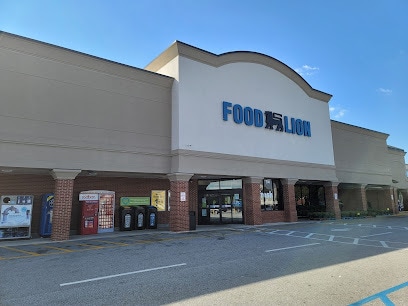
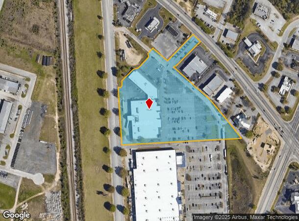
Property Record
500 Pamplico Hwy, Florence, SC 29505
NEARBY LISTINGS FOR SALE OR LEASE
Property Detail
500 Pamplico Hwy
00150-01-099
ST HWY 51 LOT #1A
Supermarket
Florence
AE
South Carolina
45041C0142E
1a
2024
5.65 AC
2024
Florence/Dillon
000600
Other Market Areas
60,575 SF
Florence, SC
DEMOGRAPHICS near 500 Pamplico Hwy
1 Mile
3 Mile
5 Mile
2024 Total Population
3,859
36,980
66,024
2029 Population
3,798
36,668
65,587
Pop Growth 2024-2029
(1.58%)
(0.84%)
(0.66%)
Average Age
41
40
40
2024 Total Households
1,604
15,386
27,391
HH Growth 2024-2029
(1.56%)
(0.76%)
(0.66%)
Median Household Inc
$65,839
$51,702
$50,602
Avg Household Size
2.40
2.30
2.30
2024 Avg HH Vehicles
2.00
2.00
2.00
Median Home Value
$165,680
$164,740
$160,529
Median Year Built
1980
1982
1982
Nearby Places
Map Layers
Map Styles
 Street
 Aerial
- Restaurants
- Banks
- Shops
- Fitness
- Groceries
PUBLIC TRANSPORTATION
COMMUTER RAIL
Florence Amtrak Station (Palmetto - Amtrak, Silver Meteor - Amtrak)
DRIVE
WALK
Distance
Florence Amtrak Station (Palmetto - Amtrak, Silver Meteor - Amtrak)
7 min
3.0 mi
Freight Ports
North Charleston Terminal
DRIVE
WALK
Distance
North Charleston Terminal
137 min
100.6 mi
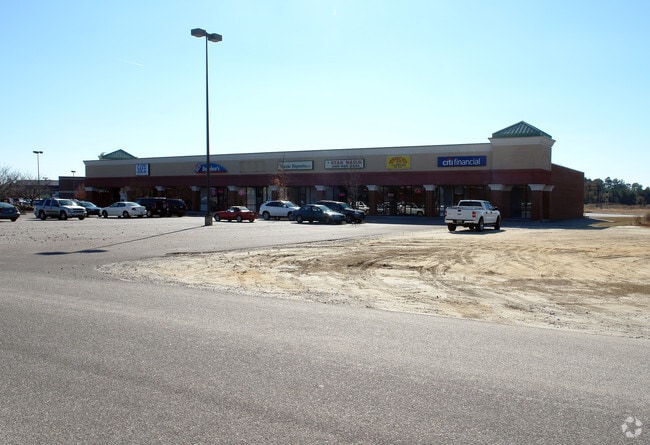
SALE & LEASE HISTORY
LISTING DATE
SALE/LEASE

Sep 24, 2016
For Sale
Nearby Properties
Address
Land Use
TOTAL SIZE
Lot Size
Zoning
Address
Land Use
TOTAL SIZE
Lot Size
Zoning
218,850 SF
7.54 AC
B3
Address
Land Use
TOTAL SIZE
Lot Size
Zoning
2,418 SF
23.31 AC
Address
Land Use
TOTAL SIZE
Lot Size
Zoning
8,416 SF
2.10 AC
B4
Address
Land Use
TOTAL SIZE
Lot Size
Zoning
125,000 SF
6.84 AC
B1
Address
Land Use
TOTAL SIZE
Lot Size
Zoning
1,347.68 AC
Address
Land Use
TOTAL SIZE
Lot Size
Zoning
86,950 SF
6.82 AC
B2
Address
Land Use
TOTAL SIZE
Lot Size
Zoning
55,536 SF
0.02 AC
Address
Land Use
TOTAL SIZE
Lot Size
Zoning
55,536 SF
0.02 AC
Address
Land Use
TOTAL SIZE
Lot Size
Zoning
26.36 AC
B1
Address
Land Use
TOTAL SIZE
Lot Size
Zoning
79,263 SF
1.34 AC
B4
Address
Land Use
TOTAL SIZE
Lot Size
Zoning
4,000 SF
6.22 AC
Address
Land Use
TOTAL SIZE
Lot Size
Zoning
134,869 SF
20.08 AC
Address
Land Use
TOTAL SIZE
Lot Size
Zoning
60,000 SF
0.02 AC
Address
Land Use
TOTAL SIZE
Lot Size
Zoning
71,400 SF
3.71 AC
B3
Address
Land Use
TOTAL SIZE
Lot Size
Zoning
14,820 SF
0.88 AC
B3
Address
Land Use
TOTAL SIZE
Lot Size
Zoning
47,600 SF
4.57 AC
R4
Address
Land Use
TOTAL SIZE
Lot Size
Zoning
112,056 SF
18.96 AC
Address
Land Use
TOTAL SIZE
Lot Size
Zoning
24,549 SF
5.21 AC
Address
Land Use
TOTAL SIZE
Lot Size
Zoning
25,334 SF
146 AC
R1
Address
Land Use
TOTAL SIZE
Lot Size
Zoning
30.32 AC
Address
Land Use
TOTAL SIZE
Lot Size
Zoning
21,092 SF
1.46 AC
Address
Land Use
TOTAL SIZE
Lot Size
Zoning
2.39 AC
B1
Address
Land Use
TOTAL SIZE
Lot Size
Zoning
64,416 SF
3.29 AC
B4
Address
Land Use
TOTAL SIZE
Lot Size
Zoning
59,361 SF
9.14 AC
Address
Land Use
TOTAL SIZE
Lot Size
Zoning
47,905 SF
7.02 AC
Address
Land Use
TOTAL SIZE
Lot Size
Zoning
14,950 SF
1.41 AC
B3
Address
Land Use
TOTAL SIZE
Lot Size
Zoning
18,908 SF
0.47 AC
B3
The World's #1 Commercial Real Estate Marketplace
Connect with us
© 2026 CoStar Group
The information above has been obtained from sources believed reliable. While we do not doubt its accuracy we have not verified it and make no guarantee, warranty or representation about it. It is your responsibility to independently confirm its accuracy and completeness. Any projections, opinions, assumptions, or estimates used are for example only and do not represent the current or future performance of the property. The value of this transaction to you depends on tax and other factors which should be evaluated by your tax, financial, and legal advisors. You and your advisors should conduct a careful, independent investigation of the property to determine to your satisfaction the suitability of the property for your needs.