Property Record
500 Pope Rd, Saint Augustine, FL 32080
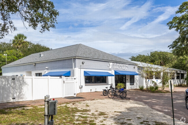


Property Detail
500 Pope Rd
161060-0000
1 ALL FRACTIONAL ANASTASIA PARK & CAMPGROUNDS OR129/60 & 701/1636 (Q/C) & 1127/1021 (C/D)
Stateproperty
Saint Johns
OR
Florida
AE The base floodplain where base flood elevations are provided. AE Zones are now used on new format FIRMs instead of A1-A30 Zones.
10-1
0
322.02 AC
2025
St Johns County
021409
Jacksonville (Florida)
25,453 SF
Jacksonville, FL
NEARBY LISTINGS FOR SALE OR LEASE
DEMOGRAPHICS near 500 Pope Rd
1 mile
3 mile
5 mile
2025 Total Population
6,288
25,387
69,087
2030 Population
7,415
29,777
80,809
Pop Growth 2025-2030
+ 17.92%
+ 17.29%
+ 16.97%
Average Age
48
50
48
2025 Total Households
2,959
11,906
31,631
HH Growth 2025-2030
+ 18.25%
+ 17.73%
+ 17.51%
Median Household Inc
$102,220
$92,082
$77,755
Avg Household Size
2.10
2.10
2.10
2025 Avg HH Vehicles
2.00
2.00
2.00
Median Home Value
$671,812
$646,862
$481,070
Median Year Built
1994
1992
1992
Nearby Places
Map Layers
Map Styles
 Street
 Aerial
Transit
 Traffic
 Biking
Places
Listings with unknown addresses are not visible on the map
- Restaurants
- Banks
- Shops
- Fitness
- Groceries
Nearby Properties
Address
Land Use
TOTAL SIZE
Lot Size
Zoning
Address
Land Use
TOTAL SIZE
Lot Size
Zoning
279,494 SF
6.06 AC
Address
Land Use
TOTAL SIZE
Lot Size
Zoning
532,530 SF
25.80 AC
CG
Address
Land Use
TOTAL SIZE
Lot Size
Zoning
209,356 SF
12.88 AC
RG-O
Address
Land Use
TOTAL SIZE
Lot Size
Zoning
130,186 SF
21.74 AC
CG
Address
Land Use
TOTAL SIZE
Lot Size
Zoning
127,090 SF
4.06 AC
R2
Address
Land Use
TOTAL SIZE
Lot Size
Zoning
7,133 SF
18.57 AC
RS3
Address
Land Use
TOTAL SIZE
Lot Size
Zoning
1,240 SF
29.76 AC
OR
Address
Land Use
TOTAL SIZE
Lot Size
Zoning
90,744 SF
5.47 AC
Address
Land Use
TOTAL SIZE
Lot Size
Zoning
65,037 SF
3.89 AC
Address
Land Use
TOTAL SIZE
Lot Size
Zoning
9,375 SF
30.15 AC
IW
Address
Land Use
TOTAL SIZE
Lot Size
Zoning
126,267 SF
14.28 AC
IW/CG
Address
Land Use
TOTAL SIZE
Lot Size
Zoning
7,021 SF
6.29 AC
OR
Address
Land Use
TOTAL SIZE
Lot Size
Zoning
73,318 SF
9.77 AC
RS3
Address
Land Use
TOTAL SIZE
Lot Size
Zoning
85,384 SF
5.42 AC
R2
Address
Land Use
TOTAL SIZE
Lot Size
Zoning
104,688 SF
10.80 AC
Address
Land Use
TOTAL SIZE
Lot Size
Zoning
46,787 SF
3.04 AC
BU1A
Address
Land Use
TOTAL SIZE
Lot Size
Zoning
15,872 SF
124.49 AC
OR
Address
Land Use
TOTAL SIZE
Lot Size
Zoning
3,703 SF
8.39 AC
CHT
Address
Land Use
TOTAL SIZE
Lot Size
Zoning
110,400 SF
12.60 AC
CG
Address
Land Use
TOTAL SIZE
Lot Size
Zoning
27,823 SF
1.95 AC
OR
Address
Land Use
TOTAL SIZE
Lot Size
Zoning
46,796 SF
1.36 AC
R2
Address
Land Use
TOTAL SIZE
Lot Size
Zoning
36.64 AC
RG-O
Address
Land Use
TOTAL SIZE
Lot Size
Zoning
54,119 SF
2.03 AC
BU-1
Address
Land Use
TOTAL SIZE
Lot Size
Zoning
27,185 SF
206.55 AC
PUD
Address
Land Use
TOTAL SIZE
Lot Size
Zoning
76,239 SF
1.07 AC
CM1
Address
Land Use
TOTAL SIZE
Lot Size
Zoning
27,461 SF
7.24 AC
Address
Land Use
TOTAL SIZE
Lot Size
Zoning
52,011 SF
11.51 AC
CG-B
Address
Land Use
TOTAL SIZE
Lot Size
Zoning
75,356 SF
7.49 AC
CG
Address
Land Use
TOTAL SIZE
Lot Size
Zoning
52,176 SF
7.86 AC
The World's #1 Commercial Real Estate Marketplace
Connect with us
© 2026 CoStar Group
The information above has been obtained from sources believed reliable. While we do not doubt its accuracy we have not verified it and make no guarantee, warranty or representation about it. It is your responsibility to independently confirm its accuracy and completeness. Any projections, opinions, assumptions, or estimates used are for example only and do not represent the current or future performance of the property. The value of this transaction to you depends on tax and other factors which should be evaluated by your tax, financial, and legal advisors. You and your advisors should conduct a careful, independent investigation of the property to determine to your satisfaction the suitability of the property for your needs.