Property Record
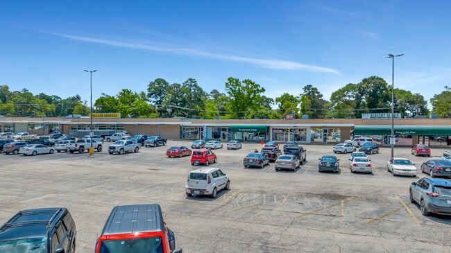
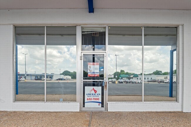
500 S Chestnut St, Lufkin, TX 75901

Property Detail
500 S Chestnut St
20714
ABS 0040 QUINALTY J. L.,TRACT 10 - 11,ACRES 11.790,& 3800 DENMAN W C, BLK 55, LOT 2.2, 5.2 - 6.2 & 3800 DENMAN W C, BLK 55, LOT 2.2, 5.2 - 6.2
Stripcommercialcenter
ANGELINA
C
Texas
AE The base floodplain where base flood elevations are provided. AE Zones are now used on new format FIRMs instead of A1-A30 Zones.
2
2025
11.79 AC
2025
Texas East Area
000800
Other Market Areas
57,883 SF
Lufkin, TX
NEARBY LISTINGS FOR SALE OR LEASE
DEMOGRAPHICS near 500 S Chestnut St
1 mile
3 mile
5 mile
2025 Total Population
6,179
30,135
46,484
2030 Population
6,189
30,286
46,830
Pop Growth 2025-2030
+ 0.16%
+ 0.50%
+ 0.74%
Average Age
36
38
38
2025 Total Households
2,161
11,280
17,693
HH Growth 2025-2030
+ 0.14%
+ 0.51%
+ 0.77%
Median Household Inc
$46,950
$49,022
$51,581
Avg Household Size
2.70
2.50
2.50
2025 Avg HH Vehicles
2.00
2.00
2.00
Median Home Value
$115,720
$152,469
$167,004
Median Year Built
1968
1975
1980
Nearby Places
Map Layers
Map Styles
 Street
 Aerial
Transit
 Traffic
 Biking
Places
Listings with unknown addresses are not visible on the map
- Restaurants
- Banks
- Shops
- Fitness
- Groceries
SALE & LEASE HISTORY
LISTING DATE
SALE/LEASE

Nov 08, 2018
For Sale
Jun 12, 2025
For Lease
Jun 06, 2024
For Sale
Jul 19, 2017
For Lease
Nearby Properties
Address
Land Use
TOTAL SIZE
Lot Size
Zoning
Address
Land Use
TOTAL SIZE
Lot Size
Zoning
379,938 SF
32.47 AC
CSU
Address
Land Use
TOTAL SIZE
Lot Size
Zoning
9,222 SF
10.69 AC
Address
Land Use
TOTAL SIZE
Lot Size
Zoning
34,528 SF
1.86 AC
CBD
Address
Land Use
TOTAL SIZE
Lot Size
Zoning
104,432 SF
10.06 AC
LM
Address
Land Use
TOTAL SIZE
Lot Size
Zoning
13,632 SF
28.08 AC
Address
Land Use
TOTAL SIZE
Lot Size
Zoning
194,526 SF
14.99 AC
LBSU
Address
Land Use
TOTAL SIZE
Lot Size
Zoning
108,460 SF
11.39 AC
Address
Land Use
TOTAL SIZE
Lot Size
Zoning
67,014 SF
23.42 AC
Address
Land Use
TOTAL SIZE
Lot Size
Zoning
60,189 SF
46.10 AC
Address
Land Use
TOTAL SIZE
Lot Size
Zoning
2,319 SF
19.10 AC
Address
Land Use
TOTAL SIZE
Lot Size
Zoning
232,026 SF
27.14 AC
Address
Land Use
TOTAL SIZE
Lot Size
Zoning
31,467 SF
41.44 AC
RL
Address
Land Use
TOTAL SIZE
Lot Size
Zoning
Address
Land Use
TOTAL SIZE
Lot Size
Zoning
14,514 SF
12.90 AC
RL
Address
Land Use
TOTAL SIZE
Lot Size
Zoning
50,378 SF
19.90 AC
RL
Address
Land Use
TOTAL SIZE
Lot Size
Zoning
68,340 SF
3.52 AC
Address
Land Use
TOTAL SIZE
Lot Size
Zoning
1,540 SF
7.82 AC
Address
Land Use
TOTAL SIZE
Lot Size
Zoning
423,495 SF
87.05 AC
LM
Address
Land Use
TOTAL SIZE
Lot Size
Zoning
107,432 SF
11.25 AC
A
Address
Land Use
TOTAL SIZE
Lot Size
Zoning
54,239 SF
7.51 AC
Address
Land Use
TOTAL SIZE
Lot Size
Zoning
Address
Land Use
TOTAL SIZE
Lot Size
Zoning
71,140 SF
9.22 AC
Address
Land Use
TOTAL SIZE
Lot Size
Zoning
39,207 SF
1.92 AC
Address
Land Use
TOTAL SIZE
Lot Size
Zoning
70,046 SF
9 AC
LM
Address
Land Use
TOTAL SIZE
Lot Size
Zoning
34,536 SF
5.56 AC
Address
Land Use
TOTAL SIZE
Lot Size
Zoning
34,696 SF
2.76 AC
LBSU
Address
Land Use
TOTAL SIZE
Lot Size
Zoning
57,588 SF
5.07 AC
Address
Land Use
TOTAL SIZE
Lot Size
Zoning
10,521 SF
22.92 AC
RL
Address
Land Use
TOTAL SIZE
Lot Size
Zoning
134,748 SF
16.08 AC
CSU
Address
Land Use
TOTAL SIZE
Lot Size
Zoning
126,715 SF
10.93 AC
LB
The World's #1 Commercial Real Estate Marketplace
Connect with us
© 2026 CoStar Group
The information above has been obtained from sources believed reliable. While we do not doubt its accuracy we have not verified it and make no guarantee, warranty or representation about it. It is your responsibility to independently confirm its accuracy and completeness. Any projections, opinions, assumptions, or estimates used are for example only and do not represent the current or future performance of the property. The value of this transaction to you depends on tax and other factors which should be evaluated by your tax, financial, and legal advisors. You and your advisors should conduct a careful, independent investigation of the property to determine to your satisfaction the suitability of the property for your needs.