Property Record
500 S Pointe Dr, Miami Beach, FL 33139


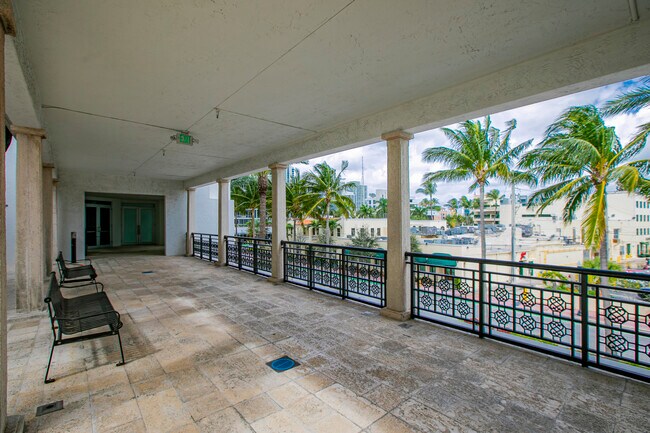

Property Detail
500 S Pointe Dr
02-4210-000-0060
10 54 42 BEG 6.16FT SLY OF SE COR OF WASHINGTON AVE & BISCAYNE ST TH N 87 DEG E 291.65FT S 10 DEG W 63.11FT N 79 DEG W 6.4FT S 87 DEG W 283.58FT N 10 DEG E 1.75FT S 87 DEG W 1.5FTN 10 DEG E 59.90FT TO POB LOT SIZE 17511 SQ FT OR 18975-4730 012000 1 C
Storemultistory
Miami-Dade
6504
Florida
AE The base floodplain where base flood elevations are provided. AE Zones are now used on new format FIRMs instead of A1-A30 Zones.
1504
2024
0.40 AC
2025
Miami Beach
004500
South Florida
30,016 SF
Miami-Miami Beach-Kendall, FL
NEARBY LISTINGS FOR SALE OR LEASE
DEMOGRAPHICS near 500 S Pointe Dr
1 mile
3 mile
5 mile
2025 Total Population
24,953
61,432
258,305
2030 Population
28,358
69,437
287,942
Pop Growth 2025-2030
+ 13.65%
+ 13.03%
+ 11.47%
Average Age
46
45
41
2025 Total Households
14,160
34,259
130,307
HH Growth 2025-2030
+ 13.51%
+ 12.98%
+ 11.54%
Median Household Inc
$66,319
$73,957
$90,648
Avg Household Size
1.70
1.70
1.90
2025 Avg HH Vehicles
1.00
1.00
1.00
Median Home Value
$857,198
$798,117
$747,458
Median Year Built
1975
1970
1995
Nearby Places
Map Layers
Map Styles
 Street
 Aerial
Transit
 Traffic
 Biking
Places
Listings with unknown addresses are not visible on the map
- Restaurants
- Banks
- Shops
- Fitness
- Groceries
PUBLIC TRANSPORTATION
COMMUTER RAIL
Government Center (Metromover Brickell Loop - Miami-Dade Transit (Metrorail/Metromover), Metromover Downtown Loop - Miami-Dade Transit (Metrorail/Metromover), Metromover Omni Loop - Miami-Dade Transit (Metrorail/Metromover), Metrorail Green Line - Miami-Dade Transit (Metrorail/Metromover))
Drive
Walk
Distance
Government Center (Metromover Brickell Loop - Miami-Dade Transit (Metrorail/Metromover), Metromover Downtown Loop - Miami-Dade Transit (Metrorail/Metromover), Metromover Omni Loop - Miami-Dade Transit (Metrorail/Metromover), Metrorail Green Line - Miami-Dade Transit (Metrorail/Metromover))
12 min
5.2 mi
Brickell (Metrorail) (Metrorail Green Line - Miami-Dade Transit (Metrorail/Metromover))
Drive
Walk
Distance
Brickell (Metrorail) (Metrorail Green Line - Miami-Dade Transit (Metrorail/Metromover))
13 min
6.0 mi
AIRPORT
Miami International
Drive
Walk
Distance
Miami International
29 min
15.2 mi
Fort Lauderdale/Hollywood International
Drive
Walk
Distance
Fort Lauderdale/Hollywood International
41 min
26.9 mi
Freight Ports
Port of Miami
Drive
Walk
Distance
Port of Miami
15 min
6.3 mi
SALE & LEASE HISTORY
LISTING DATE
SALE/LEASE

Sep 25, 2016
For Lease
Nov 10, 2022
For Lease
Aug 06, 2019
For Lease
Aug 01, 2022
For Lease
Nearby Properties
Address
Land Use
TOTAL SIZE
Lot Size
Zoning
Address
Land Use
TOTAL SIZE
Lot Size
Zoning
4,758,614 SF
810.91 AC
8000
Address
Land Use
TOTAL SIZE
Lot Size
Zoning
2,238,368 SF
137.23 AC
8000
Address
Land Use
TOTAL SIZE
Lot Size
Zoning
763,114 SF
5.04 AC
6501
Address
Land Use
TOTAL SIZE
Lot Size
Zoning
694,939 SF
1.22 AC
4100
Address
Land Use
TOTAL SIZE
Lot Size
Zoning
1,385,056 SF
13.54 AC
4100
Address
Land Use
TOTAL SIZE
Lot Size
Zoning
433,336 SF
6 AC
6600
Address
Land Use
TOTAL SIZE
Lot Size
Zoning
368,858 SF
2.88 AC
4100
Address
Land Use
TOTAL SIZE
Lot Size
Zoning
554,694 SF
4.02 AC
4100
Address
Land Use
TOTAL SIZE
Lot Size
Zoning
250,000 SF
4100
Address
Land Use
TOTAL SIZE
Lot Size
Zoning
346,455 SF
1.86 AC
6501
Address
Land Use
TOTAL SIZE
Lot Size
Zoning
370,836 SF
1.10 AC
6600
Address
Land Use
TOTAL SIZE
Lot Size
Zoning
1,120 SF
6.51 AC
5000
Address
Land Use
TOTAL SIZE
Lot Size
Zoning
48,485 SF
36.53 AC
8000
Address
Land Use
TOTAL SIZE
Lot Size
Zoning
253,168 SF
1.62 AC
6600
Address
Land Use
TOTAL SIZE
Lot Size
Zoning
149,189 SF
1.41 AC
4100
Address
Land Use
TOTAL SIZE
Lot Size
Zoning
256,729 SF
1.94 AC
6600
Address
Land Use
TOTAL SIZE
Lot Size
Zoning
204,504 SF
1.56 AC
3004
Address
Land Use
TOTAL SIZE
Lot Size
Zoning
326,964 SF
3.51 AC
3900
Address
Land Use
TOTAL SIZE
Lot Size
Zoning
342,374 SF
1.57 AC
4100
Address
Land Use
TOTAL SIZE
Lot Size
Zoning
300,128 SF
2.73 AC
4100
Address
Land Use
TOTAL SIZE
Lot Size
Zoning
960 SF
3.71 AC
7000
Address
Land Use
TOTAL SIZE
Lot Size
Zoning
147,082 SF
1.58 AC
4100
Address
Land Use
TOTAL SIZE
Lot Size
Zoning
205,680 SF
1.59 AC
6400
Address
Land Use
TOTAL SIZE
Lot Size
Zoning
241,406 SF
1.21 AC
6600
Address
Land Use
TOTAL SIZE
Lot Size
Zoning
363,061 SF
1 AC
6600
Address
Land Use
TOTAL SIZE
Lot Size
Zoning
70,958 SF
1.70 AC
4100
Address
Land Use
TOTAL SIZE
Lot Size
Zoning
1.96 AC
6400
Address
Land Use
TOTAL SIZE
Lot Size
Zoning
230,341 SF
1.59 AC
4100
Address
Land Use
TOTAL SIZE
Lot Size
Zoning
19,953 SF
21.98 AC
8000
Address
Land Use
TOTAL SIZE
Lot Size
Zoning
206,500 SF
1.32 AC
4100
The World's #1 Commercial Real Estate Marketplace
Connect with us
© 2026 CoStar Group
The information above has been obtained from sources believed reliable. While we do not doubt its accuracy we have not verified it and make no guarantee, warranty or representation about it. It is your responsibility to independently confirm its accuracy and completeness. Any projections, opinions, assumptions, or estimates used are for example only and do not represent the current or future performance of the property. The value of this transaction to you depends on tax and other factors which should be evaluated by your tax, financial, and legal advisors. You and your advisors should conduct a careful, independent investigation of the property to determine to your satisfaction the suitability of the property for your needs.