Property Record
500 Sawmill Rd, Stanley, WI 54768
NEARBY LISTINGS FOR SALE OR LEASE
Property Detail
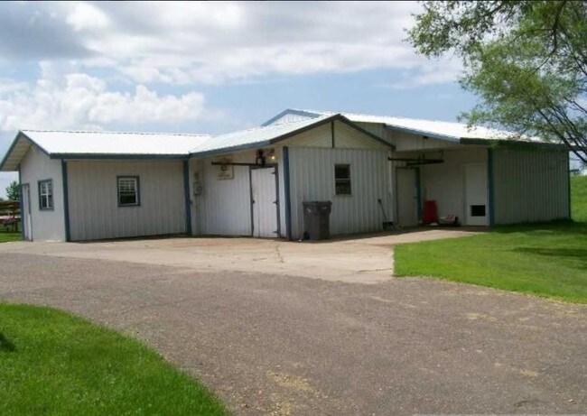
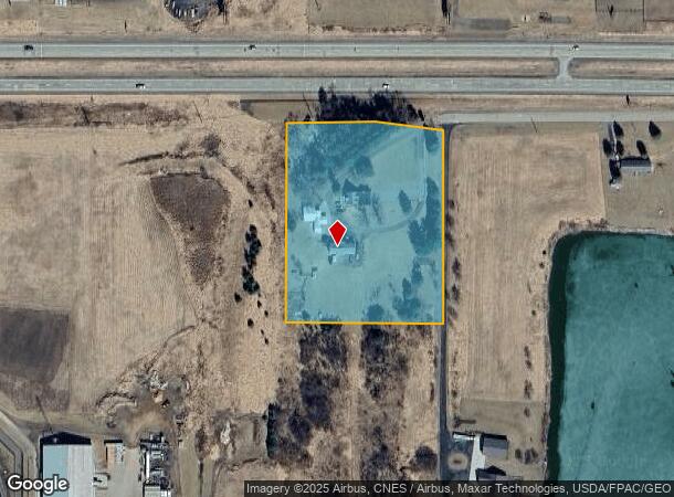
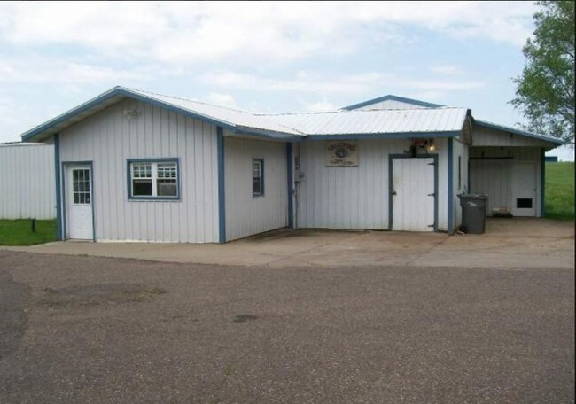
500 Sawmill Rd
Eau Claire, WI
NW SE LOT 1 OF CERT SUR MAP #4279 IN V19 P231 DOC #836164
22905-3542-74279001
Chippewa
Agriculturalland
Wisconsin
X
1
55019C0175D
4.51 AC
2024
Eau Claire/Menomonie
2024
Other Market Areas
010800
DEMOGRAPHICS near 500 Sawmill Rd
1 Mile
3 Mile
5 Mile
2024 Total Population
1,022
4,229
6,622
2029 Population
1,051
4,308
6,711
Pop Growth 2024-2029
+ 2.84%
+ 1.87%
+ 1.34%
Average Age
39
38
40
2024 Total Households
358
1,470
1,932
HH Growth 2024-2029
+ 3.35%
+ 2.18%
+ 1.71%
Median Household Inc
$47,083
$48,845
$53,048
Avg Household Size
2.50
2.60
2.60
2024 Avg HH Vehicles
2.00
2.00
2.00
Median Home Value
$133,695
$152,801
$159,619
Median Year Built
1960
1959
1959
Nearby Places
Map Layers
Map Styles
 Street
 Aerial
- Restaurants
- Banks
- Shops
- Fitness
- Groceries
Nearby Properties
Address
Land Use
TOTAL SIZE
Lot Size
Zoning
Address
Land Use
TOTAL SIZE
Lot Size
Zoning
22.35 AC
OUTSKIRTIN
Address
Land Use
TOTAL SIZE
Lot Size
Zoning
31.77 AC
OUTSKIRTIN
Address
Land Use
TOTAL SIZE
Lot Size
Zoning
27.48 AC
OUTSKIRTIN
Address
Land Use
TOTAL SIZE
Lot Size
Zoning
5.69 AC
Address
Land Use
TOTAL SIZE
Lot Size
Zoning
1.64 AC
Address
Land Use
TOTAL SIZE
Lot Size
Zoning
37.71 AC
Address
Land Use
TOTAL SIZE
Lot Size
Zoning
2.23 AC
Address
Land Use
TOTAL SIZE
Lot Size
Zoning
16,594 SF
3.26 AC
COMMERCIAL
Address
Land Use
TOTAL SIZE
Lot Size
Zoning
3.49 AC
Address
Land Use
TOTAL SIZE
Lot Size
Zoning
Address
Land Use
TOTAL SIZE
Lot Size
Zoning
3,888 SF
0.63 AC
COMMERCIAL
Address
Land Use
TOTAL SIZE
Lot Size
Zoning
4.12 AC
Address
Land Use
TOTAL SIZE
Lot Size
Zoning
4,140 SF
1.52 AC
COMMERCIAL
Address
Land Use
TOTAL SIZE
Lot Size
Zoning
1.05 AC
Address
Land Use
TOTAL SIZE
Lot Size
Zoning
5,314 SF
1.23 AC
COMMERCIAL
Address
Land Use
TOTAL SIZE
Lot Size
Zoning
Address
Land Use
TOTAL SIZE
Lot Size
Zoning
18,141 SF
0.92 AC
COMMERCIAL
Address
Land Use
TOTAL SIZE
Lot Size
Zoning
4.09 AC
Address
Land Use
TOTAL SIZE
Lot Size
Zoning
18,096 SF
3.67 AC
COMMERCIAL
Address
Land Use
TOTAL SIZE
Lot Size
Zoning
8,682 SF
0.70 AC
COMMERCIAL
Address
Land Use
TOTAL SIZE
Lot Size
Zoning
3,828 SF
0.30 AC
COMMERCIAL
Address
Land Use
TOTAL SIZE
Lot Size
Zoning
3,730 SF
0.52 AC
COMMERCIAL
Address
Land Use
TOTAL SIZE
Lot Size
Zoning
7,920 SF
0.51 AC
COMMERCIAL
Address
Land Use
TOTAL SIZE
Lot Size
Zoning
2.44 AC
Address
Land Use
TOTAL SIZE
Lot Size
Zoning
Address
Land Use
TOTAL SIZE
Lot Size
Zoning
9,180 SF
1.05 AC
COMMERCIAL
Address
Land Use
TOTAL SIZE
Lot Size
Zoning
Address
Land Use
TOTAL SIZE
Lot Size
Zoning
17.71 AC
Address
Land Use
TOTAL SIZE
Lot Size
Zoning
7.07 AC
OUTSKIRTIN
The World's #1 Commercial Real Estate Marketplace
Connect with us
© 2025 CoStar Group
The information above has been obtained from sources believed reliable. While we do not doubt its accuracy we have not verified it and make no guarantee, warranty or representation about it. It is your responsibility to independently confirm its accuracy and completeness. Any projections, opinions, assumptions, or estimates used are for example only and do not represent the current or future performance of the property. The value of this transaction to you depends on tax and other factors which should be evaluated by your tax, financial, and legal advisors. You and your advisors should conduct a careful, independent investigation of the property to determine to your satisfaction the suitability of the property for your needs.