Property Record
500 State Highway 183, Fort Worth, TX 76108
NEARBY LISTINGS FOR SALE OR LEASE
Property Detail
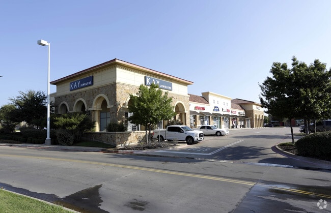
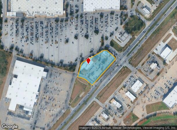
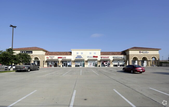
500 State Highway 183
Dallas-Fort Worth-Arlington, TX
Shoppes Of Hawks Creek,
41194659
SHOPPES OF HAWKS CREEK, THE BLOCK 1 LOT 3
Commercialnec
Tarrant
X
Texas
48439C0170L
3
2024
2.03 AC
2025
West Fort Worth
114207
Dallas/Ft Worth
21,861 SF
DEMOGRAPHICS near 500 State Highway 183
1 Mile
3 Mile
5 Mile
2024 Total Population
3,903
85,486
219,074
2029 Population
4,161
90,728
232,227
Pop Growth 2024-2029
+ 6.61%
+ 6.13%
+ 6.00%
Average Age
42
38
38
2024 Total Households
1,774
34,482
89,339
HH Growth 2024-2029
+ 6.76%
+ 6.31%
+ 6.25%
Median Household Inc
$65,574
$48,793
$60,292
Avg Household Size
2.10
2.40
2.40
2024 Avg HH Vehicles
2.00
2.00
2.00
Median Home Value
$473,809
$253,589
$257,592
Median Year Built
1990
1971
1979
Nearby Places
Map Layers
Map Styles
 Street
 Aerial
- Restaurants
- Banks
- Shops
- Fitness
- Groceries
PUBLIC TRANSPORTATION
COMMUTER RAIL
DRIVE
WALK
Distance
14 min
8.5 mi
Fort Worth Intermodal Transportation Center (ITC) (Trinity Railway Express - Dallas Area Rapid Transit (DART))
DRIVE
WALK
Distance
Fort Worth Intermodal Transportation Center (ITC) (Trinity Railway Express - Dallas Area Rapid Transit (DART))
14 min
8.5 mi
AIRPORT
Dallas-Fort Worth International
DRIVE
WALK
Distance
Dallas-Fort Worth International
44 min
33.0 mi
Dallas Love Field
DRIVE
WALK
Distance
Dallas Love Field
55 min
41.6 mi
SALE & LEASE HISTORY
LISTING DATE
SALE/LEASE

Sep 25, 2016
For Lease
Apr 13, 2018
For Lease
Nearby Properties
Address
Land Use
TOTAL SIZE
Lot Size
Zoning
Address
Land Use
TOTAL SIZE
Lot Size
Zoning
469,191 SF
4.20 AC
Address
Land Use
TOTAL SIZE
Lot Size
Zoning
378,038 SF
7.01 AC
Address
Land Use
TOTAL SIZE
Lot Size
Zoning
401,487 SF
6.16 AC
Address
Land Use
TOTAL SIZE
Lot Size
Zoning
314,284 SF
26.29 AC
Address
Land Use
TOTAL SIZE
Lot Size
Zoning
242,244 SF
27.01 AC
Address
Land Use
TOTAL SIZE
Lot Size
Zoning
424,333 SF
12.59 AC
Address
Land Use
TOTAL SIZE
Lot Size
Zoning
315,552 SF
14.84 AC
Address
Land Use
TOTAL SIZE
Lot Size
Zoning
271,065 SF
9.03 AC
Address
Land Use
TOTAL SIZE
Lot Size
Zoning
233,269 SF
8.81 AC
Address
Land Use
TOTAL SIZE
Lot Size
Zoning
152,640 SF
15.91 AC
Address
Land Use
TOTAL SIZE
Lot Size
Zoning
215,548 SF
7.79 AC
Address
Land Use
TOTAL SIZE
Lot Size
Zoning
357,676 SF
9.03 AC
Address
Land Use
TOTAL SIZE
Lot Size
Zoning
293,358 SF
6.95 AC
Address
Land Use
TOTAL SIZE
Lot Size
Zoning
136,717 SF
12.07 AC
Address
Land Use
TOTAL SIZE
Lot Size
Zoning
284,418 SF
15.86 AC
Address
Land Use
TOTAL SIZE
Lot Size
Zoning
238,580 SF
11.56 AC
Address
Land Use
TOTAL SIZE
Lot Size
Zoning
245,043 SF
13.10 AC
Address
Land Use
TOTAL SIZE
Lot Size
Zoning
118,265 SF
6.63 AC
Address
Land Use
TOTAL SIZE
Lot Size
Zoning
321,124 SF
13.20 AC
Address
Land Use
TOTAL SIZE
Lot Size
Zoning
203,179 SF
11.57 AC
Address
Land Use
TOTAL SIZE
Lot Size
Zoning
230,766 SF
9.24 AC
Address
Land Use
TOTAL SIZE
Lot Size
Zoning
177,726 SF
8.15 AC
Address
Land Use
TOTAL SIZE
Lot Size
Zoning
125,493 SF
16.55 AC
Address
Land Use
TOTAL SIZE
Lot Size
Zoning
152,132 SF
26.16 AC
Address
Land Use
TOTAL SIZE
Lot Size
Zoning
103,270 SF
13.01 AC
Address
Land Use
TOTAL SIZE
Lot Size
Zoning
161,746 SF
9.43 AC
Address
Land Use
TOTAL SIZE
Lot Size
Zoning
80,471 SF
3.51 AC
Address
Land Use
TOTAL SIZE
Lot Size
Zoning
236,934 SF
51.75 AC
Address
Land Use
TOTAL SIZE
Lot Size
Zoning
385,440 SF
6.04 AC
Address
Land Use
TOTAL SIZE
Lot Size
Zoning
179,340 SF
1.02 AC
The World's #1 Commercial Real Estate Marketplace
Connect with us
© 2025 CoStar Group
The information above has been obtained from sources believed reliable. While we do not doubt its accuracy we have not verified it and make no guarantee, warranty or representation about it. It is your responsibility to independently confirm its accuracy and completeness. Any projections, opinions, assumptions, or estimates used are for example only and do not represent the current or future performance of the property. The value of this transaction to you depends on tax and other factors which should be evaluated by your tax, financial, and legal advisors. You and your advisors should conduct a careful, independent investigation of the property to determine to your satisfaction the suitability of the property for your needs.