Property Record
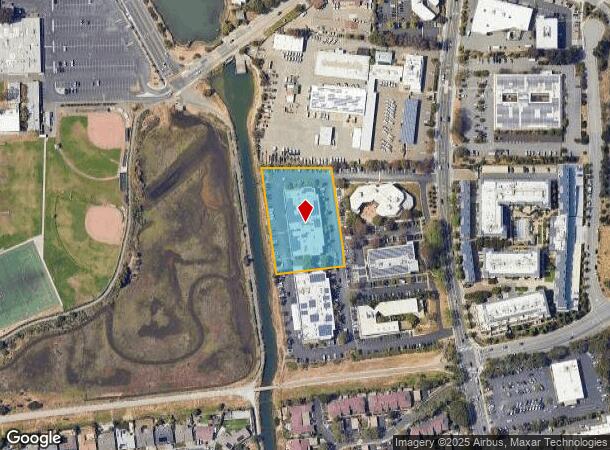
500 Tamal Vista Blvd, Corte Madera, CA 94925
NEARBY LISTINGS FOR SALE OR LEASE
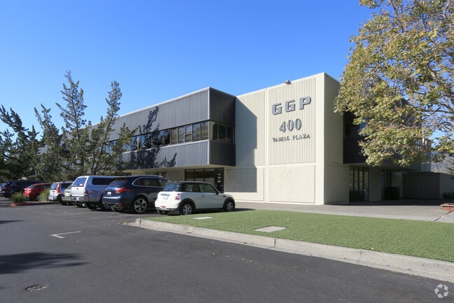
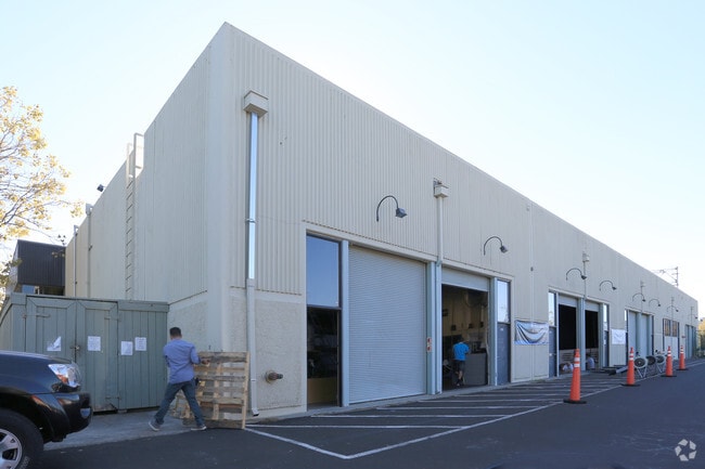
Property Detail
500 Tamal Vista Blvd
San Rafael, CA
Tamal Plaza 02 Amd
024-011-71
MAP 17 PG 27 LOT 5
Commercialnec
Marin
AE
California
06041C0467F
5
2025
1.57 AC
2025
Corte Madera/Mill Valley
121100
North Bay/Santa Rosa
29,712 SF
DEMOGRAPHICS near 500 Tamal Vista Blvd
1 Mile
3 Mile
5 Mile
2024 Total Population
11,988
80,892
138,748
2029 Population
11,696
78,621
134,809
Pop Growth 2024-2029
(2.44%)
(2.81%)
(2.84%)
Average Age
46
43
44
2024 Total Households
5,260
31,750
55,745
HH Growth 2024-2029
(2.49%)
(2.77%)
(2.84%)
Median Household Inc
$133,152
$123,533
$133,392
Avg Household Size
2.20
2.40
2.40
2024 Avg HH Vehicles
2.00
2.00
2.00
Median Home Value
$1,108,581
$1,117,060
$1,114,405
Median Year Built
1966
1963
1964
Nearby Places
Map Layers
Map Styles
 Street
 Aerial
- Restaurants
- Banks
- Shops
- Fitness
- Groceries
PUBLIC TRANSPORTATION
COMMUTER RAIL
DRIVE
WALK
Distance
4 min
1.4 mi
DRIVE
WALK
Distance
7 min
3.4 mi
AIRPORT
San Francisco International
DRIVE
WALK
Distance
San Francisco International
47 min
28.4 mi
Metro Oakland International
DRIVE
WALK
Distance
Metro Oakland International
44 min
31.0 mi
SALE & LEASE HISTORY
LISTING DATE
SALE/LEASE

Sep 25, 2016
For Lease
Jun 26, 2020
For Lease
Dec 10, 2019
For Lease
Dec 02, 2024
For Lease
Apr 27, 2023
For Lease
Nearby Properties
Address
Land Use
TOTAL SIZE
Lot Size
Zoning
Address
Land Use
TOTAL SIZE
Lot Size
Zoning
271,212 SF
15.87 AC
Address
Land Use
TOTAL SIZE
Lot Size
Zoning
257,091 SF
14.21 AC
Address
Land Use
TOTAL SIZE
Lot Size
Zoning
217,791 SF
4.51 AC
Address
Land Use
TOTAL SIZE
Lot Size
Zoning
87,058 SF
1.33 AC
Address
Land Use
TOTAL SIZE
Lot Size
Zoning
Address
Land Use
TOTAL SIZE
Lot Size
Zoning
91,151 SF
3.15 AC
Address
Land Use
TOTAL SIZE
Lot Size
Zoning
180,000 SF
15.92 AC
Address
Land Use
TOTAL SIZE
Lot Size
Zoning
132,969 SF
9.09 AC
Address
Land Use
TOTAL SIZE
Lot Size
Zoning
119,185 SF
4.31 AC
Address
Land Use
TOTAL SIZE
Lot Size
Zoning
109,944 SF
5.73 AC
Address
Land Use
TOTAL SIZE
Lot Size
Zoning
147,502 SF
1.02 AC
Address
Land Use
TOTAL SIZE
Lot Size
Zoning
110,272 SF
10.69 AC
Address
Land Use
TOTAL SIZE
Lot Size
Zoning
218,521 SF
26.79 AC
Address
Land Use
TOTAL SIZE
Lot Size
Zoning
127,504 SF
8.49 AC
Address
Land Use
TOTAL SIZE
Lot Size
Zoning
12.57 AC
Address
Land Use
TOTAL SIZE
Lot Size
Zoning
91,158 SF
1.89 AC
Address
Land Use
TOTAL SIZE
Lot Size
Zoning
79,995 SF
3.15 AC
Address
Land Use
TOTAL SIZE
Lot Size
Zoning
119,061 SF
5.90 AC
Address
Land Use
TOTAL SIZE
Lot Size
Zoning
72,870 SF
3.51 AC
Address
Land Use
TOTAL SIZE
Lot Size
Zoning
94,745 SF
1.46 AC
Address
Land Use
TOTAL SIZE
Lot Size
Zoning
234,922 SF
6 AC
Address
Land Use
TOTAL SIZE
Lot Size
Zoning
81,894 SF
5.91 AC
Address
Land Use
TOTAL SIZE
Lot Size
Zoning
71,527 SF
1.86 AC
Address
Land Use
TOTAL SIZE
Lot Size
Zoning
84,245 SF
2.62 AC
Address
Land Use
TOTAL SIZE
Lot Size
Zoning
97,410 SF
5.97 AC
Address
Land Use
TOTAL SIZE
Lot Size
Zoning
11,830 SF
0.65 AC
Address
Land Use
TOTAL SIZE
Lot Size
Zoning
100,900 SF
4.32 AC
Address
Land Use
TOTAL SIZE
Lot Size
Zoning
138,861 SF
15.83 AC
Address
Land Use
TOTAL SIZE
Lot Size
Zoning
82,206 SF
3.67 AC
Address
Land Use
TOTAL SIZE
Lot Size
Zoning
87,840 SF
1.19 AC
The World's #1 Commercial Real Estate Marketplace
Connect with us
© 2026 CoStar Group
The information above has been obtained from sources believed reliable. While we do not doubt its accuracy we have not verified it and make no guarantee, warranty or representation about it. It is your responsibility to independently confirm its accuracy and completeness. Any projections, opinions, assumptions, or estimates used are for example only and do not represent the current or future performance of the property. The value of this transaction to you depends on tax and other factors which should be evaluated by your tax, financial, and legal advisors. You and your advisors should conduct a careful, independent investigation of the property to determine to your satisfaction the suitability of the property for your needs.