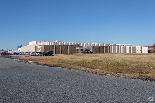
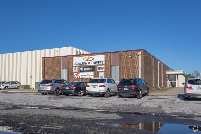
Property Record
500 Wilson Point Rd, Middle River, MD 21220


Property Detail
500 Wilson Point Rd
15-1800007545
PT LT 2 5.719 AC CHESAPEAKE PARK
Lightindustrial
Baltimore
MH-IM
Maryland
C and X Area of minimal flood hazard, usually depicted on FIRMs as above the 500-year flood level.
2
2024
5.71 AC
2025
Baltimore County East
451600
Baltimore
90,054 SF
Baltimore-Columbia-Towson, MD
NEARBY LISTINGS FOR SALE OR LEASE
DEMOGRAPHICS near 500 Wilson Point Rd
1 mile
3 mile
5 mile
2025 Total Population
7,568
82,046
144,648
2030 Population
7,618
82,585
145,437
Pop Growth 2025-2030
+ 0.66%
+ 0.66%
+ 0.55%
Average Age
38
39
40
2025 Total Households
2,722
32,335
56,421
HH Growth 2025-2030
+ 0.84%
+ 0.75%
+ 0.57%
Median Household Inc
$73,528
$70,377
$79,493
Avg Household Size
2.70
2.50
2.50
2025 Avg HH Vehicles
2.00
2.00
2.00
Median Home Value
$219,575
$282,420
$306,999
Median Year Built
1957
1975
1976
Nearby Places
Map Layers
Map Styles
 Street
 Aerial
Layers
 Traffic
 Biking
Places
Listings with unknown addresses are not visible on the map
- Restaurants
- Banks
- Shops
- Fitness
- Groceries
PUBLIC TRANSPORTATION
COMMUTER RAIL
Drive
Walk
Distance
4 min
1.3 mi
AIRPORT
Baltimore/Washington International Thurgood Marshall
Drive
Walk
Distance
Baltimore/Washington International Thurgood Marshall
40 min
23.9 mi
Freight Ports
Port of Baltimore
Drive
Walk
Distance
Port of Baltimore
28 min
12.5 mi
Nearby Properties
Address
Land Use
TOTAL SIZE
Lot Size
Zoning
Address
Land Use
TOTAL SIZE
Lot Size
Zoning
159,728 SF
0.02 AC
MH
Address
Land Use
TOTAL SIZE
Lot Size
Zoning
504,086 SF
7.48 AC
MH
Address
Land Use
TOTAL SIZE
Lot Size
Zoning
553,984 SF
7.42 AC
Address
Land Use
TOTAL SIZE
Lot Size
Zoning
83.12 AC
ML
Address
Land Use
TOTAL SIZE
Lot Size
Zoning
1,062,672 SF
70.27 AC
MHIM
Address
Land Use
TOTAL SIZE
Lot Size
Zoning
15.40 AC
DR16
Address
Land Use
TOTAL SIZE
Lot Size
Zoning
423,200 SF
22.60 AC
MH-1M
Address
Land Use
TOTAL SIZE
Lot Size
Zoning
14.19 AC
DR16
Address
Land Use
TOTAL SIZE
Lot Size
Zoning
14.28 AC
DR16
Address
Land Use
TOTAL SIZE
Lot Size
Zoning
21.83 AC
DR16
Address
Land Use
TOTAL SIZE
Lot Size
Zoning
253,081 SF
42.21 AC
DR5.5
Address
Land Use
TOTAL SIZE
Lot Size
Zoning
300,400 SF
31.60 AC
ML-IM
Address
Land Use
TOTAL SIZE
Lot Size
Zoning
135,931 SF
21.65 AC
DR5.5
Address
Land Use
TOTAL SIZE
Lot Size
Zoning
440,340 SF
128.19 AC
Address
Land Use
TOTAL SIZE
Lot Size
Zoning
23.40 AC
DR16
Address
Land Use
TOTAL SIZE
Lot Size
Zoning
97,878 SF
12.45 AC
DR5.5
Address
Land Use
TOTAL SIZE
Lot Size
Zoning
20.13 AC
DR16
Address
Land Use
TOTAL SIZE
Lot Size
Zoning
19 AC
DR16
Address
Land Use
TOTAL SIZE
Lot Size
Zoning
24.95 AC
DR16
Address
Land Use
TOTAL SIZE
Lot Size
Zoning
12.47 AC
DR16
Address
Land Use
TOTAL SIZE
Lot Size
Zoning
126,096 SF
14.68 AC
DR105
Address
Land Use
TOTAL SIZE
Lot Size
Zoning
10.48 AC
DR16
Address
Land Use
TOTAL SIZE
Lot Size
Zoning
11.69 AC
DR16
Address
Land Use
TOTAL SIZE
Lot Size
Zoning
81,466 SF
6.75 AC
BM
Address
Land Use
TOTAL SIZE
Lot Size
Zoning
10.53 AC
DR16
Address
Land Use
TOTAL SIZE
Lot Size
Zoning
130,797 SF
18.11 AC
DR105
Address
Land Use
TOTAL SIZE
Lot Size
Zoning
237,925 SF
28.28 AC
Address
Land Use
TOTAL SIZE
Lot Size
Zoning
18 AC
DR16
Address
Land Use
TOTAL SIZE
Lot Size
Zoning
294,750 SF
16.51 AC
ML-IM
Address
Land Use
TOTAL SIZE
Lot Size
Zoning
12.25 AC
DR16
The World's #1 Commercial Real Estate Marketplace
Connect with us
© 2026 CoStar Group
The information above has been obtained from sources believed reliable. While we do not doubt its accuracy we have not verified it and make no guarantee, warranty or representation about it. It is your responsibility to independently confirm its accuracy and completeness. Any projections, opinions, assumptions, or estimates used are for example only and do not represent the current or future performance of the property. The value of this transaction to you depends on tax and other factors which should be evaluated by your tax, financial, and legal advisors. You and your advisors should conduct a careful, independent investigation of the property to determine to your satisfaction the suitability of the property for your needs.