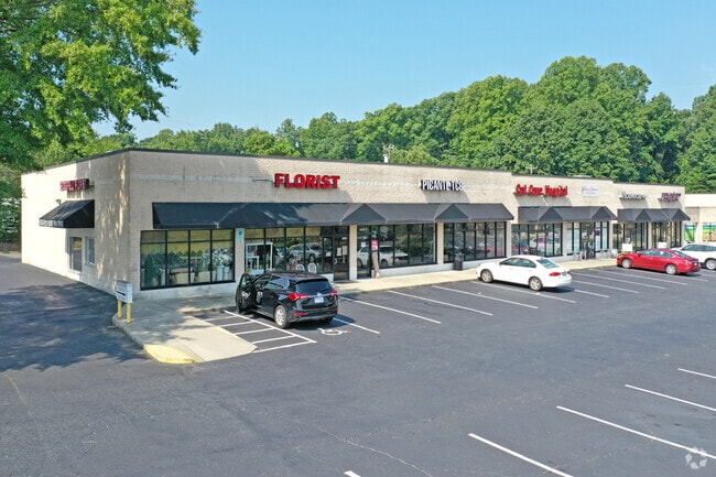
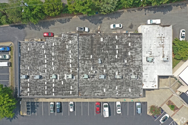
Property Record
5000 High Point Rd, Greensboro, NC 27407

Property Detail
5000 High Point Rd
0139970
3.84AC PT 1 PB92-19 HUNT VILLAGE PL:92-19
Storebuilding
GUILFORD
HB
North Carolina
B and X Area of moderate flood hazard, usually the area between the limits of the 100-year and 500-year floods.
3.84 AC
2024
Central Guilford County
2025
Greensboro/Winston-Salem
012617
Greensboro-High Point, NC
31,318 SF
NEARBY LISTINGS FOR SALE OR LEASE
DEMOGRAPHICS near 5000 High Point Rd
1 mile
3 mile
5 mile
2025 Total Population
5,512
56,610
148,284
2030 Population
5,665
58,181
152,637
Pop Growth 2025-2030
+ 2.78%
+ 2.78%
+ 2.94%
Average Age
41
38
38
2025 Total Households
2,206
24,023
63,199
HH Growth 2025-2030
+ 2.90%
+ 2.96%
+ 3.17%
Median Household Inc
$57,379
$63,226
$60,174
Avg Household Size
2.40
2.30
2.20
2025 Avg HH Vehicles
2.00
2.00
2.00
Median Home Value
$285,315
$243,620
$248,120
Median Year Built
1985
1987
1985
Nearby Places
Map Layers
Map Styles
 Street
 Aerial
Layers
 Traffic
 Biking
Places
Listings with unknown addresses are not visible on the map
- Restaurants
- Banks
- Shops
- Fitness
- Groceries
PUBLIC TRANSPORTATION
COMMUTER RAIL
Greensboro Station (Piedmont - North Carolina by Train (NC Train))
Drive
Walk
Distance
Greensboro Station (Piedmont - North Carolina by Train (NC Train))
12 min
6.4 mi
AIRPORT
Piedmont Triad International
Drive
Walk
Distance
Piedmont Triad International
16 min
8.0 mi
SALE & LEASE HISTORY
LISTING DATE
SALE/LEASE

Sep 25, 2016
For Lease
Nov 03, 2016
For Lease
Nearby Properties
Address
Land Use
TOTAL SIZE
Lot Size
Zoning
Address
Land Use
TOTAL SIZE
Lot Size
Zoning
892,800 SF
51.53 AC
HI
Address
Land Use
TOTAL SIZE
Lot Size
Zoning
1,307,155 SF
60.56 AC
C-H
Address
Land Use
TOTAL SIZE
Lot Size
Zoning
957,290 SF
18.71 AC
C-H
Address
Land Use
TOTAL SIZE
Lot Size
Zoning
412,635 SF
37.70 AC
RM-12
Address
Land Use
TOTAL SIZE
Lot Size
Zoning
275,782 SF
27.65 AC
RM-12
Address
Land Use
TOTAL SIZE
Lot Size
Zoning
341,210 SF
13.43 AC
PUD
Address
Land Use
TOTAL SIZE
Lot Size
Zoning
536,466 SF
46.90 AC
PUD
Address
Land Use
TOTAL SIZE
Lot Size
Zoning
279,853 SF
19.80 AC
RM-18
Address
Land Use
TOTAL SIZE
Lot Size
Zoning
138,843 SF
115.56 AC
CU-LI
Address
Land Use
TOTAL SIZE
Lot Size
Zoning
367,819 SF
32.88 AC
C-H
Address
Land Use
TOTAL SIZE
Lot Size
Zoning
312,732 SF
14.27 AC
RM-18
Address
Land Use
TOTAL SIZE
Lot Size
Zoning
228,994 SF
15.59 AC
PUD
Address
Land Use
TOTAL SIZE
Lot Size
Zoning
231,597 SF
8.46 AC
PD-R
Address
Land Use
TOTAL SIZE
Lot Size
Zoning
145,105 SF
20.12 AC
C-M
Address
Land Use
TOTAL SIZE
Lot Size
Zoning
234,173 SF
22.14 AC
RM-12
Address
Land Use
TOTAL SIZE
Lot Size
Zoning
395,043 SF
15.74 AC
PUD
Address
Land Use
TOTAL SIZE
Lot Size
Zoning
256,423 SF
20.64 AC
PUD
Address
Land Use
TOTAL SIZE
Lot Size
Zoning
336,176 SF
31.73 AC
C-H
Address
Land Use
TOTAL SIZE
Lot Size
Zoning
177,780 SF
11.80 AC
PUD
Address
Land Use
TOTAL SIZE
Lot Size
Zoning
136,130 SF
14.63 AC
C-H
Address
Land Use
TOTAL SIZE
Lot Size
Zoning
254,761 SF
13.05 AC
RM-26
Address
Land Use
TOTAL SIZE
Lot Size
Zoning
182,499 SF
6.74 AC
O
Address
Land Use
TOTAL SIZE
Lot Size
Zoning
293,851 SF
36.66 AC
PUD
Address
Land Use
TOTAL SIZE
Lot Size
Zoning
188,655 SF
13.16 AC
RM-18
Address
Land Use
TOTAL SIZE
Lot Size
Zoning
116,713 SF
4.53 AC
C-M
Address
Land Use
TOTAL SIZE
Lot Size
Zoning
193,705 SF
14.35 AC
PUD
Address
Land Use
TOTAL SIZE
Lot Size
Zoning
211,723 SF
20.24 AC
RM-18
Address
Land Use
TOTAL SIZE
Lot Size
Zoning
403,590 SF
72.06 AC
CIV
Address
Land Use
TOTAL SIZE
Lot Size
Zoning
48,532 SF
11.60 AC
HI
Address
Land Use
TOTAL SIZE
Lot Size
Zoning
132,905 SF
10.26 AC
RM-8
The World's #1 Commercial Real Estate Marketplace
Connect with us
© 2026 CoStar Group
The information above has been obtained from sources believed reliable. While we do not doubt its accuracy we have not verified it and make no guarantee, warranty or representation about it. It is your responsibility to independently confirm its accuracy and completeness. Any projections, opinions, assumptions, or estimates used are for example only and do not represent the current or future performance of the property. The value of this transaction to you depends on tax and other factors which should be evaluated by your tax, financial, and legal advisors. You and your advisors should conduct a careful, independent investigation of the property to determine to your satisfaction the suitability of the property for your needs.