Property Record
5000 Hillsdale Cir, El Dorado Hills, CA 95762


NEARBY LISTINGS FOR SALE OR LEASE
Property Detail
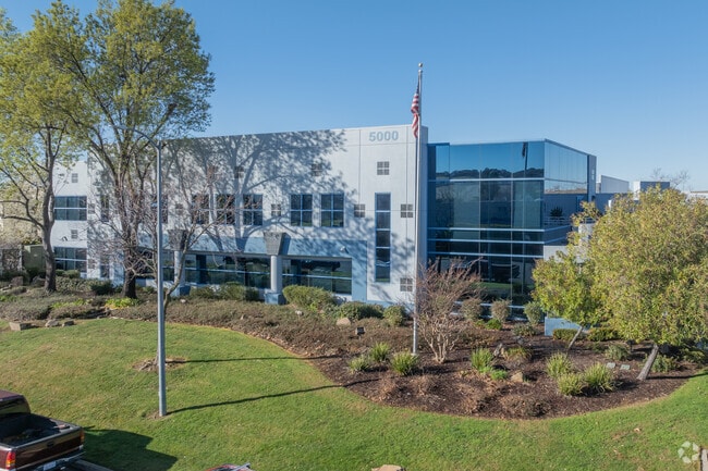
5000 Hillsdale Cir
117-084-006-000
PM 36/115/60
Lightindustrial
El Dorado
X
California
06067C0275J
2 AC
2024
Folsom/El Dorado
2025
Sacramento
030711
Sacramento--Roseville--Arden-Arcade, CA
38,256 SF
DEMOGRAPHICS near 5000 Hillsdale Cir
1 Mile
3 Mile
5 Mile
2024 Total Population
5,080
21,076
72,013
2029 Population
5,285
21,952
74,026
Pop Growth 2024-2029
+ 4.04%
+ 4.16%
+ 2.80%
Average Age
50
43
42
2024 Total Households
2,133
7,826
25,329
HH Growth 2024-2029
+ 4.41%
+ 4.24%
+ 2.80%
Median Household Inc
$120,736
$132,167
$146,710
Avg Household Size
2.40
2.70
2.80
2024 Avg HH Vehicles
2.00
2.00
2.00
Median Home Value
$738,801
$747,589
$757,978
Median Year Built
2010
2009
2003
Nearby Places
Map Layers
Map Styles
 Street
 Aerial
- Restaurants
- Banks
- Shops
- Fitness
- Groceries
PUBLIC TRANSPORTATION
AIRPORT
Sacramento International
DRIVE
WALK
Distance
Sacramento International
53 min
40.3 mi
Freight Ports
Port of Stockton
DRIVE
WALK
Distance
Port of Stockton
89 min
73.9 mi
SALE & LEASE HISTORY
LISTING DATE
SALE/LEASE

Sep 12, 2024
For Sale
Nearby Properties
Address
Land Use
TOTAL SIZE
Lot Size
Zoning
Address
Land Use
TOTAL SIZE
Lot Size
Zoning
Address
Land Use
TOTAL SIZE
Lot Size
Zoning
23.23 AC
SP-R-M (SP
Address
Land Use
TOTAL SIZE
Lot Size
Zoning
8.54 AC
SP-MHD (PD
Address
Land Use
TOTAL SIZE
Lot Size
Zoning
553,153 SF
33.17 AC
Address
Land Use
TOTAL SIZE
Lot Size
Zoning
6.29 AC
SP-C-2 (SP
Address
Land Use
TOTAL SIZE
Lot Size
Zoning
203,397 SF
11.58 AC
SP-R-4 (SP
Address
Land Use
TOTAL SIZE
Lot Size
Zoning
114,835 SF
19.73 AC
SP-C-2 (SP
Address
Land Use
TOTAL SIZE
Lot Size
Zoning
354,406 SF
23.94 AC
VVSP
Address
Land Use
TOTAL SIZE
Lot Size
Zoning
6.07 AC
SP-OS2 (SP
Address
Land Use
TOTAL SIZE
Lot Size
Zoning
Address
Land Use
TOTAL SIZE
Lot Size
Zoning
148,663 SF
18.60 AC
SP-C-2 (SP
Address
Land Use
TOTAL SIZE
Lot Size
Zoning
127,600 SF
8.24 AC
CG
Address
Land Use
TOTAL SIZE
Lot Size
Zoning
Address
Land Use
TOTAL SIZE
Lot Size
Zoning
85,799 SF
4.67 AC
Address
Land Use
TOTAL SIZE
Lot Size
Zoning
50.99 AC
SP-GC (PD)
Address
Land Use
TOTAL SIZE
Lot Size
Zoning
8.85 AC
SP-SFHD (P
Address
Land Use
TOTAL SIZE
Lot Size
Zoning
524,157 SF
12.03 AC
VVSP
Address
Land Use
TOTAL SIZE
Lot Size
Zoning
40,559 SF
4.20 AC
CG
Address
Land Use
TOTAL SIZE
Lot Size
Zoning
15,227 SF
9.57 AC
CG
Address
Land Use
TOTAL SIZE
Lot Size
Zoning
Address
Land Use
TOTAL SIZE
Lot Size
Zoning
Address
Land Use
TOTAL SIZE
Lot Size
Zoning
71,586 SF
1.40 AC
Address
Land Use
TOTAL SIZE
Lot Size
Zoning
39,790 SF
3.13 AC
CG
Address
Land Use
TOTAL SIZE
Lot Size
Zoning
Address
Land Use
TOTAL SIZE
Lot Size
Zoning
60,500 SF
1.37 AC
CG
Address
Land Use
TOTAL SIZE
Lot Size
Zoning
Address
Land Use
TOTAL SIZE
Lot Size
Zoning
59,018 SF
1.79 AC
CG
Address
Land Use
TOTAL SIZE
Lot Size
Zoning
29,850 SF
4.59 AC
RD
Address
Land Use
TOTAL SIZE
Lot Size
Zoning
31,952 SF
2.05 AC
CC
Address
Land Use
TOTAL SIZE
Lot Size
Zoning
123,390 SF
4.35 AC
RD
The World's #1 Commercial Real Estate Marketplace
Connect with us
© 2026 CoStar Group
The information above has been obtained from sources believed reliable. While we do not doubt its accuracy we have not verified it and make no guarantee, warranty or representation about it. It is your responsibility to independently confirm its accuracy and completeness. Any projections, opinions, assumptions, or estimates used are for example only and do not represent the current or future performance of the property. The value of this transaction to you depends on tax and other factors which should be evaluated by your tax, financial, and legal advisors. You and your advisors should conduct a careful, independent investigation of the property to determine to your satisfaction the suitability of the property for your needs.