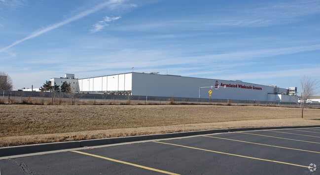
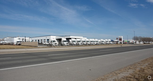
Property Record
5000 Kansas Ave, Kansas City, KS 66106
NEARBY LISTINGS FOR SALE OR LEASE
Property Detail
5000 Kansas Ave
Kansas City, MO-KS
Santa Fe Lands Plat
237327
SANTA FE LANDS PLAT, S18, T11, R25, ACRES 9.99, B6 L1
Shipyard
Wyandotte
X
Kansas
20209C0154E
1
2025
45.80 AC
2025
Turner
043700
Kansas City
1,032,141 SF
DEMOGRAPHICS near 5000 Kansas Ave
1 Mile
3 Mile
5 Mile
2024 Total Population
1,131
53,558
159,736
2029 Population
1,089
52,307
157,944
Pop Growth 2024-2029
(3.71%)
(2.34%)
(1.12%)
Average Age
36
35
37
2024 Total Households
386
18,152
60,212
HH Growth 2024-2029
(3.89%)
(2.39%)
(0.92%)
Median Household Inc
$55,256
$50,611
$54,088
Avg Household Size
2.80
2.80
2.50
2024 Avg HH Vehicles
2.00
2.00
2.00
Median Home Value
$169,642
$123,689
$148,469
Median Year Built
1956
1955
1960
Nearby Places
Map Layers
Map Styles
 Street
 Aerial
- Restaurants
- Banks
- Shops
- Fitness
- Groceries
PUBLIC TRANSPORTATION
COMMUTER RAIL
Kansas City (Lincoln Service Missouri River Runner - Amtrak, Missouri River Runner - Amtrak, Southwest Chief - Amtrak)
DRIVE
WALK
Distance
Kansas City (Lincoln Service Missouri River Runner - Amtrak, Missouri River Runner - Amtrak, Southwest Chief - Amtrak)
16 min
8.3 mi
AIRPORT
Kansas City International
DRIVE
WALK
Distance
Kansas City International
29 min
22.5 mi
Freight Ports
Tulsa Port Of Catoosa
DRIVE
WALK
Distance
Tulsa Port Of Catoosa
264 min
236.0 mi
Nearby Properties
Address
Land Use
TOTAL SIZE
Lot Size
Zoning
Address
Land Use
TOTAL SIZE
Lot Size
Zoning
872,064 SF
119.39 AC
Address
Land Use
TOTAL SIZE
Lot Size
Zoning
347,991 SF
51.92 AC
1KMC
Address
Land Use
TOTAL SIZE
Lot Size
Zoning
542,696 SF
28.12 AC
Address
Land Use
TOTAL SIZE
Lot Size
Zoning
249,363 SF
58.59 AC
Address
Land Use
TOTAL SIZE
Lot Size
Zoning
407,936 SF
37.46 AC
1
Address
Land Use
TOTAL SIZE
Lot Size
Zoning
396,532 SF
31.98 AC
Address
Land Use
TOTAL SIZE
Lot Size
Zoning
241,816 SF
20.03 AC
Address
Land Use
TOTAL SIZE
Lot Size
Zoning
122,217 SF
23.87 AC
KR2
Address
Land Use
TOTAL SIZE
Lot Size
Zoning
100,090 SF
48.47 AC
KR1
Address
Land Use
TOTAL SIZE
Lot Size
Zoning
21,635 SF
10.75 AC
KRP5
Address
Land Use
TOTAL SIZE
Lot Size
Zoning
24,920 SF
7.84 AC
KRP5
Address
Land Use
TOTAL SIZE
Lot Size
Zoning
383,232 SF
15.93 AC
LU1
Address
Land Use
TOTAL SIZE
Lot Size
Zoning
52,374 SF
2.88 AC
KRP5
Address
Land Use
TOTAL SIZE
Lot Size
Zoning
13,210 SF
7.80 AC
KRP5
Address
Land Use
TOTAL SIZE
Lot Size
Zoning
158,011 SF
26.66 AC
Address
Land Use
TOTAL SIZE
Lot Size
Zoning
111,880 SF
36.74 AC
KR1
Address
Land Use
TOTAL SIZE
Lot Size
Zoning
62,452 SF
14.89 AC
KR1
Address
Land Use
TOTAL SIZE
Lot Size
Zoning
132,724 SF
20.84 AC
KC1
Address
Land Use
TOTAL SIZE
Lot Size
Zoning
45,968 SF
2.58 AC
KR2
Address
Land Use
TOTAL SIZE
Lot Size
Zoning
56,700 SF
18.97 AC
KR1
Address
Land Use
TOTAL SIZE
Lot Size
Zoning
122,134 SF
3.67 AC
KRP5
Address
Land Use
TOTAL SIZE
Lot Size
Zoning
87,109 SF
6.95 AC
KR2B
Address
Land Use
TOTAL SIZE
Lot Size
Zoning
62,068 SF
17.75 AC
KR1
Address
Land Use
TOTAL SIZE
Lot Size
Zoning
10,132 SF
0.75 AC
KE9
Address
Land Use
TOTAL SIZE
Lot Size
Zoning
48,031 SF
9.67 AC
KR1B
Address
Land Use
TOTAL SIZE
Lot Size
Zoning
53,029 SF
6.50 AC
KR1B
Address
Land Use
TOTAL SIZE
Lot Size
Zoning
43,073 SF
2.15 AC
Address
Land Use
TOTAL SIZE
Lot Size
Zoning
41,904 SF
2.48 AC
Address
Land Use
TOTAL SIZE
Lot Size
Zoning
39,588 SF
16.33 AC
KR1
The World's #1 Commercial Real Estate Marketplace
Connect with us
© 2026 CoStar Group
The information above has been obtained from sources believed reliable. While we do not doubt its accuracy we have not verified it and make no guarantee, warranty or representation about it. It is your responsibility to independently confirm its accuracy and completeness. Any projections, opinions, assumptions, or estimates used are for example only and do not represent the current or future performance of the property. The value of this transaction to you depends on tax and other factors which should be evaluated by your tax, financial, and legal advisors. You and your advisors should conduct a careful, independent investigation of the property to determine to your satisfaction the suitability of the property for your needs.