Property Record
5000 Leetsdale Dr, Denver, CO 80246


NEARBY LISTINGS FOR SALE OR LEASE
Property Detail
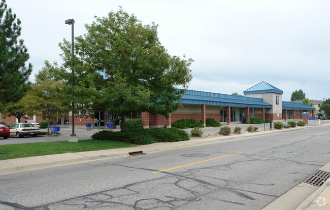
5000 Leetsdale Dr
6181-15-021
Jersey Sub
Storebuilding
JERSEY SUB BN & JANE K WHEELERS SUB OF BO JERSEY SUB B1 DIF RCP #94-00123641 RCD 8/5/94 EXC DIF RCP #96-00131972 RCD 9/23/96
X
Denver
0800460208H
Colorado
0
1.54 AC
2025
Colorado Bl/Cherry Ck
015300
Denver
20,680 SF
Denver-Aurora-Centennial, CO
DEMOGRAPHICS near 5000 Leetsdale Dr
1 mile
3 mile
5 mile
2024 Total Population
21,376
208,323
545,571
2029 Population
21,687
211,469
552,924
Pop Growth 2024-2029
+ 1.45%
+ 1.51%
+ 1.35%
Average Age
39
40
38
2024 Total Households
10,922
102,473
253,921
HH Growth 2024-2029
+ 1.47%
+ 1.43%
+ 1.38%
Median Household Inc
$81,059
$84,064
$77,207
Avg Household Size
1.90
2.00
2.10
2024 Avg HH Vehicles
2.00
2.00
1.00
Median Home Value
$813,151
$727,990
$622,156
Median Year Built
1977
1971
1973
Nearby Places
Map Layers
Map Styles
 Street
 Aerial
Transit
 Traffic
 Biking
Places
Listings with unknown addresses are not visible on the map
- Restaurants
- Banks
- Shops
- Fitness
- Groceries
PUBLIC TRANSPORTATION
COMMUTER RAIL
40Th & Colorado Station Track 1 (Union Station to Denver Airport Station - Regional Transportation District)
Drive
Walk
Distance
40Th & Colorado Station Track 1 (Union Station to Denver Airport Station - Regional Transportation District)
12 min
5.3 mi
Central Park Station Track 2 (Union Station to Denver Airport Station - Regional Transportation District)
Drive
Walk
Distance
Central Park Station Track 2 (Union Station to Denver Airport Station - Regional Transportation District)
16 min
6.9 mi
AIRPORT
Denver International
Drive
Walk
Distance
Denver International
34 min
23.2 mi
Freight Ports
Tulsa Port Of Catoosa
Drive
Walk
Distance
Tulsa Port Of Catoosa
731 min
705.9 mi
Nearby Properties
Address
Land Use
TOTAL SIZE
Lot Size
Zoning
Address
Land Use
TOTAL SIZE
Lot Size
Zoning
856,519 SF
10.04 AC
B-3
Address
Land Use
TOTAL SIZE
Lot Size
Zoning
551,531 SF
5.09 AC
C-MX
Address
Land Use
TOTAL SIZE
Lot Size
Zoning
451,860 SF
1 AC
C-MX
Address
Land Use
TOTAL SIZE
Lot Size
Zoning
377,735 SF
1.72 AC
G-RX
Address
Land Use
TOTAL SIZE
Lot Size
Zoning
422,426 SF
1.05 AC
C-RX
Address
Land Use
TOTAL SIZE
Lot Size
Zoning
1,137,044 SF
35.49 AC
CMP-EI
Address
Land Use
TOTAL SIZE
Lot Size
Zoning
124,658 SF
2.13 AC
CMP-EI
Address
Land Use
TOTAL SIZE
Lot Size
Zoning
252,992 SF
11.76 AC
B-3
Address
Land Use
TOTAL SIZE
Lot Size
Zoning
579,102 SF
7.47 AC
H-1-A
Address
Land Use
TOTAL SIZE
Lot Size
Zoning
550,760 SF
13.25 AC
CMP-EI
Address
Land Use
TOTAL SIZE
Lot Size
Zoning
152,415 SF
1.09 AC
C-CCN-12
Address
Land Use
TOTAL SIZE
Lot Size
Zoning
543,122 SF
13.43 AC
CMP-EI
Address
Land Use
TOTAL SIZE
Lot Size
Zoning
163,033 SF
5.94 AC
PUD
Address
Land Use
TOTAL SIZE
Lot Size
Zoning
197,212 SF
0.56 AC
C-CCN-5
Address
Land Use
TOTAL SIZE
Lot Size
Zoning
147,078 SF
6.17 AC
CMP-EI
Address
Land Use
TOTAL SIZE
Lot Size
Zoning
603,377 SF
9.25 AC
H-1-A
Address
Land Use
TOTAL SIZE
Lot Size
Zoning
97,530 SF
0.43 AC
C-CCN-7
Address
Land Use
TOTAL SIZE
Lot Size
Zoning
178,107 SF
2.28 AC
C-CCN-8
Address
Land Use
TOTAL SIZE
Lot Size
Zoning
174,244 SF
17.26 AC
E-SU-DX
Address
Land Use
TOTAL SIZE
Lot Size
Zoning
281,456 SF
36.55 AC
R-5
Address
Land Use
TOTAL SIZE
Lot Size
Zoning
185,689 SF
2.50 AC
C-CCN-8
Address
Land Use
TOTAL SIZE
Lot Size
Zoning
191,192 SF
10.16 AC
E-SU-D
Address
Land Use
TOTAL SIZE
Lot Size
Zoning
237,473 SF
1.63 AC
S-MX
Address
Land Use
TOTAL SIZE
Lot Size
Zoning
240,545 SF
2.35 AC
C-MX-20
Address
Land Use
TOTAL SIZE
Lot Size
Zoning
157,800 SF
2.12 AC
C-CCN-8
Address
Land Use
TOTAL SIZE
Lot Size
Zoning
169,311 SF
0.47 AC
C-CCN-8
Address
Land Use
TOTAL SIZE
Lot Size
Zoning
134,297 SF
1.54 AC
C-MX-5
Address
Land Use
TOTAL SIZE
Lot Size
Zoning
81,873 SF
0.32 AC
C-RX
Address
Land Use
TOTAL SIZE
Lot Size
Zoning
505,731 SF
2.46 AC
G-MU-20
Address
Land Use
TOTAL SIZE
Lot Size
Zoning
477,508 SF
79.66 AC
OS-A
The World's #1 Commercial Real Estate Marketplace
Connect with us
© 2026 CoStar Group
The information above has been obtained from sources believed reliable. While we do not doubt its accuracy we have not verified it and make no guarantee, warranty or representation about it. It is your responsibility to independently confirm its accuracy and completeness. Any projections, opinions, assumptions, or estimates used are for example only and do not represent the current or future performance of the property. The value of this transaction to you depends on tax and other factors which should be evaluated by your tax, financial, and legal advisors. You and your advisors should conduct a careful, independent investigation of the property to determine to your satisfaction the suitability of the property for your needs.