Property Record
5000 Montana Ave, El Paso, TX 79903


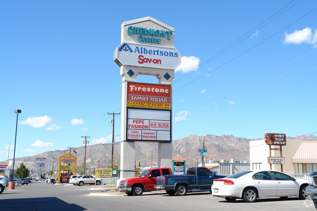
Property Detail
5000 Montana Ave
El Paso, TX
1 REMCON REPLAT PT OF 1 & 2 BEG 125.00 FT E OF NWC (IRREG ON ST - IRREG ON E- 501.56 FT ON S- IRREG ON W) (EXC 0.5306 AC IN NWC & NLY 0.0158 AC) & PT OF CLSD ST ADJ LOT 2 (5.3531 AC)
R375-999-0010-0100
EL PASO
Commercialnec
Texas
C1
2
2024
5.35 AC
2025
East
003300
El Paso
71,363 SF
NEARBY LISTINGS FOR SALE OR LEASE
DEMOGRAPHICS near 5000 Montana Ave
1 mile
3 mile
5 mile
2025 Total Population
13,327
83,983
180,377
2030 Population
13,258
84,873
182,528
Pop Growth 2025-2030
(0.52%)
+ 1.06%
+ 1.19%
Average Age
39
39
38
2025 Total Households
5,207
30,584
68,034
HH Growth 2025-2030
(0.54%)
+ 0.90%
+ 1.24%
Median Household Inc
$39,347
$34,887
$39,134
Avg Household Size
2.50
2.60
2.50
2025 Avg HH Vehicles
2.00
2.00
2.00
Median Home Value
$151,263
$144,713
$160,629
Median Year Built
1958
1956
1962
Nearby Places
Map Layers
Map Styles
 Street
 Aerial
Layers
 Traffic
 Biking
Places
Listings with unknown addresses are not visible on the map
- Restaurants
- Banks
- Shops
- Fitness
- Groceries
PUBLIC TRANSPORTATION
AIRPORT
El Paso International
Drive
Walk
Distance
El Paso International
21 min
9.9 mi
Freight Ports
Port of Corpus Christi
Drive
Walk
Distance
Port of Corpus Christi
677 min
691.5 mi
Nearby Properties
Address
Land Use
TOTAL SIZE
Lot Size
Zoning
Address
Land Use
TOTAL SIZE
Lot Size
Zoning
75,601 SF
495.64 AC
M3
Address
Land Use
TOTAL SIZE
Lot Size
Zoning
753,996 SF
23.50 AC
C4
Address
Land Use
TOTAL SIZE
Lot Size
Zoning
237,300 SF
4.99 AC
M1
Address
Land Use
TOTAL SIZE
Lot Size
Zoning
315,094 SF
2.22 AC
M1S
Address
Land Use
TOTAL SIZE
Lot Size
Zoning
561,866 SF
27.25 AC
C4
Address
Land Use
TOTAL SIZE
Lot Size
Zoning
230,968 SF
10.69 AC
C4
Address
Land Use
TOTAL SIZE
Lot Size
Zoning
1 SF
214 AC
M3
Address
Land Use
TOTAL SIZE
Lot Size
Zoning
343,190 SF
31.84 AC
C4
Address
Land Use
TOTAL SIZE
Lot Size
Zoning
107.76 AC
C4
Address
Land Use
TOTAL SIZE
Lot Size
Zoning
374,839 SF
33.29 AC
C3S
Address
Land Use
TOTAL SIZE
Lot Size
Zoning
683,161 SF
M1
Address
Land Use
TOTAL SIZE
Lot Size
Zoning
213,351 SF
12 AC
C3S
Address
Land Use
TOTAL SIZE
Lot Size
Zoning
271,746 SF
1.93 AC
C4
Address
Land Use
TOTAL SIZE
Lot Size
Zoning
190,770 SF
8.70 AC
C4S
Address
Land Use
TOTAL SIZE
Lot Size
Zoning
210,541 SF
2.45 AC
C3S
Address
Land Use
TOTAL SIZE
Lot Size
Zoning
74,907 SF
8.07 AC
C4
Address
Land Use
TOTAL SIZE
Lot Size
Zoning
142,532 SF
13.32 AC
C3S
Address
Land Use
TOTAL SIZE
Lot Size
Zoning
142,858 SF
0.17 AC
R3H
Address
Land Use
TOTAL SIZE
Lot Size
Zoning
97,809 SF
20.31 AC
C3S
Address
Land Use
TOTAL SIZE
Lot Size
Zoning
114,289 SF
3.03 AC
R5
Address
Land Use
TOTAL SIZE
Lot Size
Zoning
196,860 SF
10.15 AC
C4
Address
Land Use
TOTAL SIZE
Lot Size
Zoning
197,902 SF
30 AC
R4
Address
Land Use
TOTAL SIZE
Lot Size
Zoning
184,016 SF
14.17 AC
C4
Address
Land Use
TOTAL SIZE
Lot Size
Zoning
174,369 SF
6.47 AC
C4
Address
Land Use
TOTAL SIZE
Lot Size
Zoning
105,970 SF
7.45 AC
C4
Address
Land Use
TOTAL SIZE
Lot Size
Zoning
333,673 SF
15 AC
AO
Address
Land Use
TOTAL SIZE
Lot Size
Zoning
138,825 SF
23.17 AC
R3
Address
Land Use
TOTAL SIZE
Lot Size
Zoning
195,358 SF
13.53 AC
R5
Address
Land Use
TOTAL SIZE
Lot Size
Zoning
137,378 SF
10.05 AC
C3S
Address
Land Use
TOTAL SIZE
Lot Size
Zoning
83,251 SF
2.43 AC
M1
The World's #1 Commercial Real Estate Marketplace
Connect with us
© 2026 CoStar Group
The information above has been obtained from sources believed reliable. While we do not doubt its accuracy we have not verified it and make no guarantee, warranty or representation about it. It is your responsibility to independently confirm its accuracy and completeness. Any projections, opinions, assumptions, or estimates used are for example only and do not represent the current or future performance of the property. The value of this transaction to you depends on tax and other factors which should be evaluated by your tax, financial, and legal advisors. You and your advisors should conduct a careful, independent investigation of the property to determine to your satisfaction the suitability of the property for your needs.