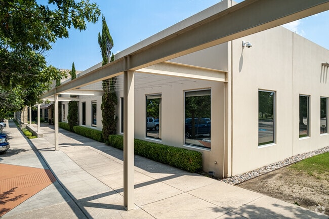
Property Record
5000 Plano Pky, Carrollton, TX 75010


Property Detail
5000 Plano Pky
Dallas-Fort Worth-Arlington, TX
AUSTIN RANCH SUB BLK 1 LOT 1R
R226118
Denton
Commercialnec
Texas
B and X Area of moderate flood hazard, usually the area between the limits of the 100-year and 500-year floods.
1r
2024
7.09 AC
2025
Upper Tollway/West Plano
021651
Dallas/Ft Worth
70,270 SF
NEARBY LISTINGS FOR SALE OR LEASE
DEMOGRAPHICS near 5000 Plano Pky
1 mile
3 mile
5 mile
2025 Total Population
13,125
116,976
323,385
2030 Population
14,829
131,288
361,914
Pop Growth 2025-2030
+ 12.98%
+ 12.23%
+ 11.91%
Average Age
39
39
39
2025 Total Households
6,267
48,321
137,848
HH Growth 2025-2030
+ 13.02%
+ 12.51%
+ 12.29%
Median Household Inc
$106,202
$114,151
$100,508
Avg Household Size
2.10
2.40
2.30
2025 Avg HH Vehicles
2.00
2.00
2.00
Median Home Value
$588,143
$543,016
$494,474
Median Year Built
2010
2002
1995
Nearby Places
Map Layers
Map Styles
 Street
 Aerial
Layers
 Traffic
 Biking
Places
Listings with unknown addresses are not visible on the map
- Restaurants
- Banks
- Shops
- Fitness
- Groceries
PUBLIC TRANSPORTATION
COMMUTER RAIL
Drive
Walk
Distance
13 min
7.3 mi
Trinity Mills Station (Green Line - Dallas Area Rapid Transit (DART))
Drive
Walk
Distance
Trinity Mills Station (Green Line - Dallas Area Rapid Transit (DART))
16 min
7.6 mi
AIRPORT
Dallas-Fort Worth International
Drive
Walk
Distance
Dallas-Fort Worth International
25 min
18.1 mi
Dallas Love Field
Drive
Walk
Distance
Dallas Love Field
31 min
20.1 mi
SALE & LEASE HISTORY
LISTING DATE
SALE/LEASE

Jan 19, 2021
For Lease
Aug 16, 2021
For Sale
Nearby Properties
Address
Land Use
TOTAL SIZE
Lot Size
Zoning
Address
Land Use
TOTAL SIZE
Lot Size
Zoning
4,575,402 SF
51.93 AC
Address
Land Use
TOTAL SIZE
Lot Size
Zoning
725,987 SF
34.18 AC
CE
Address
Land Use
TOTAL SIZE
Lot Size
Zoning
542,570 SF
75.67 AC
Address
Land Use
TOTAL SIZE
Lot Size
Zoning
719,177 SF
27.02 AC
O-2
Address
Land Use
TOTAL SIZE
Lot Size
Zoning
526,509 SF
135.02 AC
Address
Land Use
TOTAL SIZE
Lot Size
Zoning
518,210 SF
38.11 AC
CE
Address
Land Use
TOTAL SIZE
Lot Size
Zoning
526,369 SF
45.84 AC
Address
Land Use
TOTAL SIZE
Lot Size
Zoning
598,569 SF
86.50 AC
Address
Land Use
TOTAL SIZE
Lot Size
Zoning
615,249 SF
16.17 AC
COMM
Address
Land Use
TOTAL SIZE
Lot Size
Zoning
1,817,951 SF
82 AC
Address
Land Use
TOTAL SIZE
Lot Size
Zoning
537,274 SF
20.91 AC
Address
Land Use
TOTAL SIZE
Lot Size
Zoning
559,657 SF
30.49 AC
Address
Land Use
TOTAL SIZE
Lot Size
Zoning
554,780 SF
23.81 AC
Address
Land Use
TOTAL SIZE
Lot Size
Zoning
512,903 SF
18 AC
Address
Land Use
TOTAL SIZE
Lot Size
Zoning
500,844 SF
24.36 AC
2B
Address
Land Use
TOTAL SIZE
Lot Size
Zoning
460,403 SF
19.26 AC
Address
Land Use
TOTAL SIZE
Lot Size
Zoning
389,014 SF
20.91 AC
Address
Land Use
TOTAL SIZE
Lot Size
Zoning
479,145 SF
17.08 AC
Address
Land Use
TOTAL SIZE
Lot Size
Zoning
448,915 SF
20.37 AC
Address
Land Use
TOTAL SIZE
Lot Size
Zoning
452,164 SF
15.70 AC
2B
Address
Land Use
TOTAL SIZE
Lot Size
Zoning
376,139 SF
3.58 AC
Address
Land Use
TOTAL SIZE
Lot Size
Zoning
419,464 SF
22.05 AC
MF-3
Address
Land Use
TOTAL SIZE
Lot Size
Zoning
294,218 SF
20.54 AC
CE
Address
Land Use
TOTAL SIZE
Lot Size
Zoning
273,360 SF
12.89 AC
CE/CB
Address
Land Use
TOTAL SIZE
Lot Size
Zoning
462,888 SF
20.17 AC
Address
Land Use
TOTAL SIZE
Lot Size
Zoning
346,269 SF
15.14 AC
Address
Land Use
TOTAL SIZE
Lot Size
Zoning
434,639 SF
16.20 AC
Address
Land Use
TOTAL SIZE
Lot Size
Zoning
809,451 SF
94.32 AC
Address
Land Use
TOTAL SIZE
Lot Size
Zoning
462,429 SF
5.70 AC
Address
Land Use
TOTAL SIZE
Lot Size
Zoning
291,446 SF
16.18 AC
The World's #1 Commercial Real Estate Marketplace
Connect with us
© 2026 CoStar Group
The information above has been obtained from sources believed reliable. While we do not doubt its accuracy we have not verified it and make no guarantee, warranty or representation about it. It is your responsibility to independently confirm its accuracy and completeness. Any projections, opinions, assumptions, or estimates used are for example only and do not represent the current or future performance of the property. The value of this transaction to you depends on tax and other factors which should be evaluated by your tax, financial, and legal advisors. You and your advisors should conduct a careful, independent investigation of the property to determine to your satisfaction the suitability of the property for your needs.