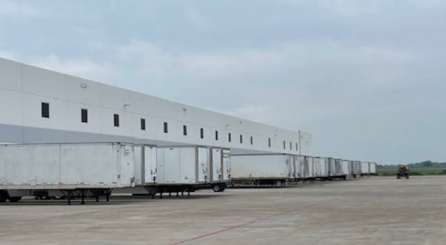
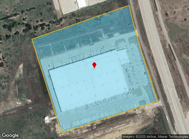
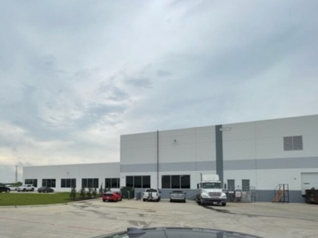
Property Record
5000 S Interstate Highway 45 Rd W, Corsicana, TX 75109
NEARBY LISTINGS FOR SALE OR LEASE
Property Detail
5000 S Interstate Highway 45 Rd W
Other Market Areas
Corsicana
Corsicana, TX
C0000 CORSICANA BLK 1410 LOT 11 26.724 ACRES
114518
Navarro
Industrialgeneral
Texas
2025
11
2025
26.72 AC
970701
Central Texas Area
DEMOGRAPHICS near 5000 S Interstate Highway 45 Rd W
1 Mile
3 Mile
5 Mile
2024 Total Population
11
1,639
23,559
2029 Population
13
1,810
26,133
Pop Growth 2024-2029
+ 18.18%
+ 10.43%
+ 10.93%
Average Age
44
42
37
2024 Total Households
5
582
8,076
HH Growth 2024-2029
0.00%
+ 10.31%
+ 10.72%
Median Household Inc
$137,500
$54,339
$44,394
Avg Household Size
2.40
2.80
2.70
2024 Avg HH Vehicles
2.00
2.00
2.00
Median Home Value
$199,999
$167,377
$119,964
Median Year Built
2002
1994
1978
Nearby Places
Map Layers
Map Styles
 Street
 Aerial
- Restaurants
- Banks
- Shops
- Fitness
- Groceries
SALE & LEASE HISTORY
LISTING DATE
SALE/LEASE

May 30, 2023
For Lease
Nearby Properties
Address
Land Use
TOTAL SIZE
Lot Size
Zoning
Address
Land Use
TOTAL SIZE
Lot Size
Zoning
33.62 AC
Address
Land Use
TOTAL SIZE
Lot Size
Zoning
14.46 AC
Address
Land Use
TOTAL SIZE
Lot Size
Zoning
10.59 AC
Address
Land Use
TOTAL SIZE
Lot Size
Zoning
46,285 SF
8.67 AC
Address
Land Use
TOTAL SIZE
Lot Size
Zoning
103,320 SF
11.88 AC
Address
Land Use
TOTAL SIZE
Lot Size
Zoning
56,852 SF
2.03 AC
Address
Land Use
TOTAL SIZE
Lot Size
Zoning
10,540 SF
10.96 AC
Address
Land Use
TOTAL SIZE
Lot Size
Zoning
70,697 SF
6.65 AC
Address
Land Use
TOTAL SIZE
Lot Size
Zoning
138.36 AC
Address
Land Use
TOTAL SIZE
Lot Size
Zoning
7,254 SF
4.59 AC
Address
Land Use
TOTAL SIZE
Lot Size
Zoning
51,724 SF
2 AC
Address
Land Use
TOTAL SIZE
Lot Size
Zoning
10,584 SF
1.30 AC
Address
Land Use
TOTAL SIZE
Lot Size
Zoning
20,013 SF
2.22 AC
Address
Land Use
TOTAL SIZE
Lot Size
Zoning
Address
Land Use
TOTAL SIZE
Lot Size
Zoning
9,200 SF
9.91 AC
Address
Land Use
TOTAL SIZE
Lot Size
Zoning
21,950 SF
10.01 AC
Address
Land Use
TOTAL SIZE
Lot Size
Zoning
52.43 AC
Address
Land Use
TOTAL SIZE
Lot Size
Zoning
43,860 SF
3.43 AC
Address
Land Use
TOTAL SIZE
Lot Size
Zoning
4,920 SF
1.74 AC
Address
Land Use
TOTAL SIZE
Lot Size
Zoning
7,248 SF
2.38 AC
Address
Land Use
TOTAL SIZE
Lot Size
Zoning
402.25 AC
Address
Land Use
TOTAL SIZE
Lot Size
Zoning
20,816 SF
1.95 AC
Address
Land Use
TOTAL SIZE
Lot Size
Zoning
4,305 SF
1.68 AC
Address
Land Use
TOTAL SIZE
Lot Size
Zoning
25,600 SF
3.78 AC
Address
Land Use
TOTAL SIZE
Lot Size
Zoning
3,742 SF
1.32 AC
Address
Land Use
TOTAL SIZE
Lot Size
Zoning
89,600 SF
10.78 AC
Address
Land Use
TOTAL SIZE
Lot Size
Zoning
3,407 SF
1.38 AC
Address
Land Use
TOTAL SIZE
Lot Size
Zoning
3,576 SF
3.08 AC
Address
Land Use
TOTAL SIZE
Lot Size
Zoning
11,600 SF
1.58 AC
The World's #1 Commercial Real Estate Marketplace
Connect with us
© 2025 CoStar Group
The information above has been obtained from sources believed reliable. While we do not doubt its accuracy we have not verified it and make no guarantee, warranty or representation about it. It is your responsibility to independently confirm its accuracy and completeness. Any projections, opinions, assumptions, or estimates used are for example only and do not represent the current or future performance of the property. The value of this transaction to you depends on tax and other factors which should be evaluated by your tax, financial, and legal advisors. You and your advisors should conduct a careful, independent investigation of the property to determine to your satisfaction the suitability of the property for your needs.